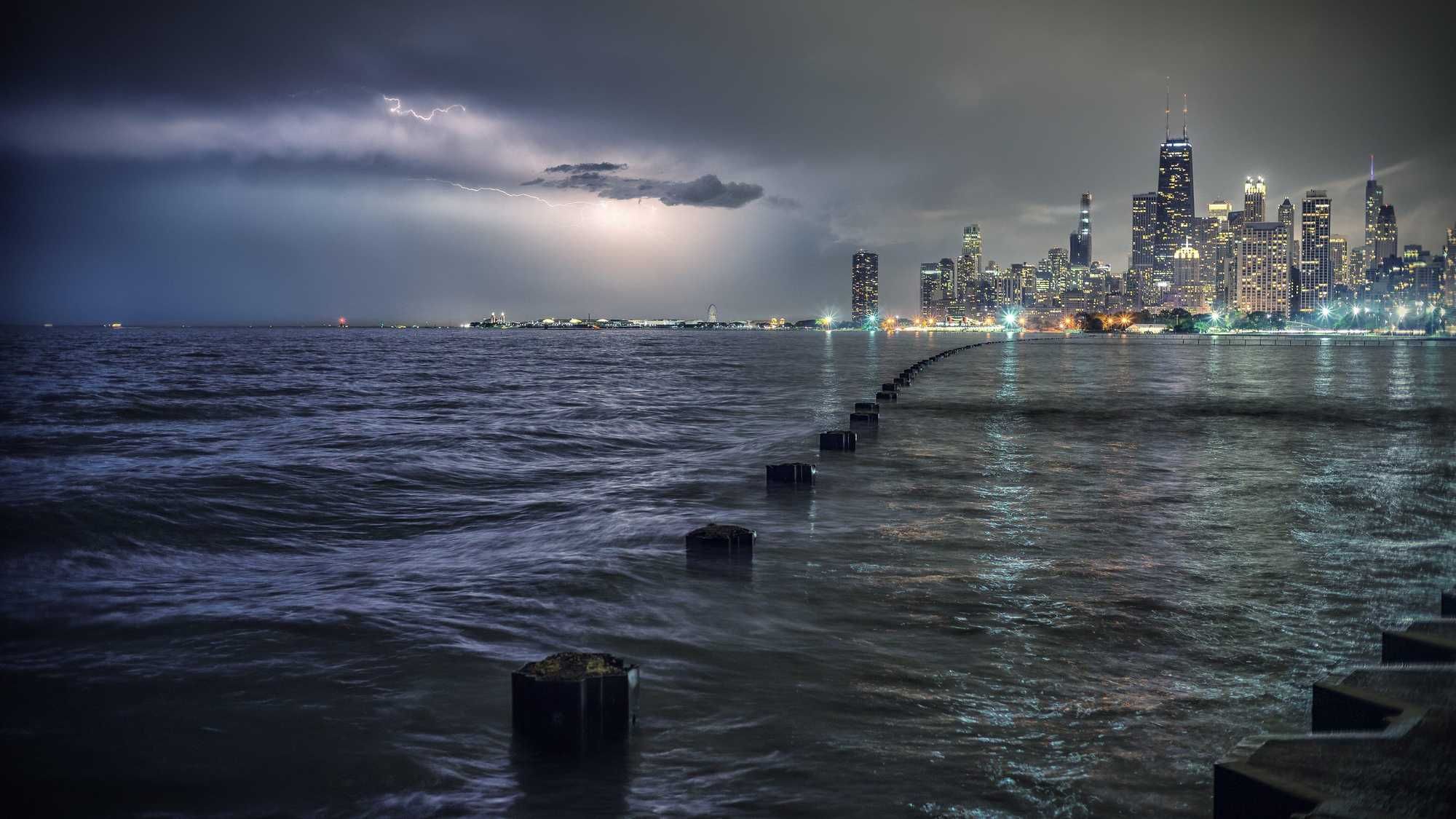
CHICAGO (WBBM NEWSRADIO) -- The National Weather Service issued a severe thunderstorm warning for much of the Chicago area, and a tornado watch was still in effect until 8 p.m. CST.
The severe thunderstorm warning was in effect until 6:15 p.m.
The main area of concern for a higher tornado threat is roughly west of a Streator to Aurora to Woodstock line, while a damaging wind threat exists across much of the area, the National Weather Service said.
"Stormy weather on the way. A tornado watch has just been issued. The watch runs until 8 p.m. this evening. Mostly cloudy, windy, and warm the rest of the afternoon. High of 76, breaking the record of 71," Accuweather meteorologist Bob Larson reports. "Windy with rain late today and early tonight. Any storm could be severe with damaging winds, hail, and even an isolated tornado. Then clearing late tonight."
The National Weather Service said a fast-moving line of storms will move across the Chicago area ahead of a powerful cold front later Tuesday afternoon and evening. Damaging wind gusts and a few tornadoes are possible. The weather service reminds people that any thunderstorm is capable of producing lightning and heavy downpours.
A fast-moving line of storms will move across the area ahead of a powerful cold front later this afternoon and evening. Damaging wind gusts and a few tornadoes are possible. Remember that any thunderstorm is capable of producing lightning and heavy downpours. #ilwx #inwx pic.twitter.com/73hNkpdODb
— NWS Chicago (@NWSChicago) November 10, 2020
The National Weather Service also issued a wind advisory for Cook, DuPage, Kane, McHenry, Lake, DeKalb, Winnebago, and Boone counties until 3 a.m. Wednesday.
Residents should expect south to southwest winds around 25 to 35 mph with gusts up to 45 mph expected. Occasional gusts up to 50 mph or more are possible. The National Weather Service said winds will shift to the west Tuesday evening. The strongest winds are expected through 9 p.m. Tuesday.
Gusty winds could blow around unsecured objects, including tents and holiday decorations. Tree limbs could be blown down and a few power outages may result, the National Weather Service said. Travel will be hazardous for high profile vehicles, especially on west to east roads.
Additionally, fast moving showers and thunderstorms in the late afternoon and early evening could produce brief gusts in excess of 50 mph.
The storms are part of a cold front that will end a record-breaking seven straight days of 70-degree November weather, blowing past the previous five-straight days of similar weather in 1953, the Sun-Times reported.
When the storms pass, Chicago residents could wake up Wednesday to a windchill in the 20s, according to the National Weather Service.
"Ahead of the cold front will be thunderstorms, some capable of producing very strong winds up to 60 mph," weather service meteorologist Todd Kluber said.
Those storms will move in quickly from the west into Chicago between 6 p.m. and 8 p.m., lasting about an hour or two in any spot, Kluber said. After the storms pass, gusts up to 45 mph will continue until midnight as temperatures keep dropping.
Tornadoes are possible among the storms throughout the entire metro area, but the risk is highest in the west and north suburbs — from Joliet past O'Hare Airport to Lake County, Kluber said.
Meanwhile, temperatures will plummet overnight, making Wednesday morning feel between 40 and 50 degrees cooler than Tuesday, Kluber said.
Accuweather meteorologist Joe Lundberg said Veteran's Day will be nice and sunny, but much cooler with a high only near 50. Sunshine for Thursday, with a high near 55. Friday will be a chillier day with sunshine and clouds with a high of 45, and then expect more rain Saturday with a high of 47. Milder Sunday with showers, and a high of 56.