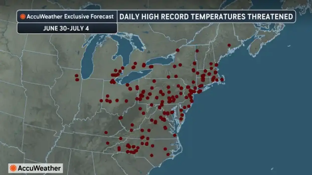
A dangerous dome of heat and humidity has prompted National Weather Service forecasters to issue a Heat Advisory for ALL of Western New York Tuesday, and an Extreme heat Watch for the region Wednesday through Friday.
"The heat is going to continue to be on the increase as we push through the next couple of days," NWS meteorologist John Rozbicki tells WBEN. "Today we'll see our highs get up into the upper 80's to low 90's, and then tomorrow we'll see them get a little bit higher, upper 80's in the Buffalo area, to low to mid 90's further inland."
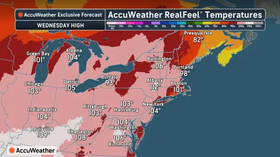
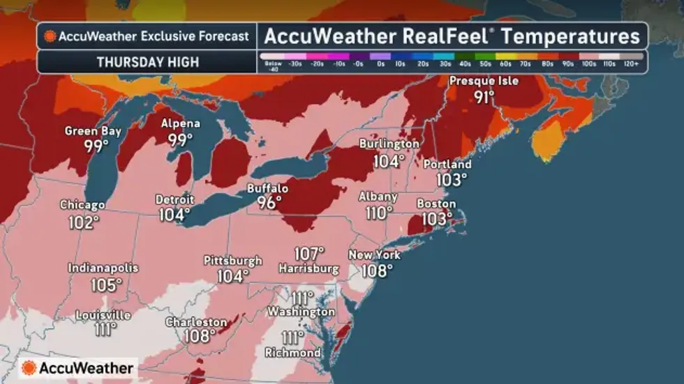
Combined with the increased humidity levels expected, heat indices are expected to reach the 95 to 100 degree range Tuesday, and as high as 105 Wednesday and Thursday. Those readings above 100 are expected to be limited to inland areas across Niagara, Orleans and Genesee counties. "The Buffalo area will probably be a little bit cooler, thanks to a southwest flow off of Lake Erie," Rozbicki says.
An Extreme Heat Watch, triggered by the possibility of the 105 heat index, is a rare occurrence for the WNY region.
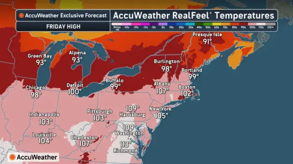
As hot as it's going to be this holiday week, we've felt worse, Rozbicki assures us.
"It's definitely been hotter than it will be this week...we've had prolonged heat in the mid to upper 90's," Rozbicki says. "It'll still be plenty hot and humid."
There's no real tangible relief after the sun sets, either.
"Our lows are not going to drop very much at night," Rozbicki warns. "We're going to be seeing lows in the mid 70's for the next few nights...it's going to be uncomfortable if you don;t have air conditioning."
Scattered strong to severe thunderstorms are possible Tuesday as a warm front crosses the region...and then again on Wednesday.
 AccuWeather.com
 AccuWeather.com
 AccuWeather.com