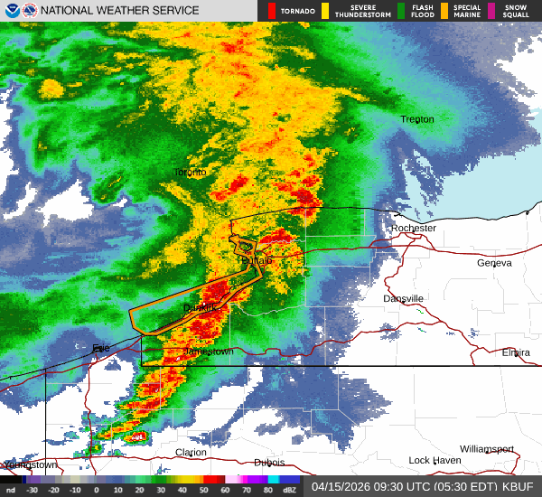
Rounds of potentially severe thunderstorms are crossing the Buffalo-Niagara region Wednesday, and the pattern is forecast to continue through Thursday across Western New York, National Weather Service forecasters say.
After the early morning wave of stormy weather, expect a period of mainly dry weather for a few hours, before another round of showers and thunderstorms will develop later this afternoon and evening. The best coverage of showers and thunderstorms will likely be late this afternoon through this evening south of the NYS Thruway, forecasters say.
"There will be another round of showers and storms moving in later this afternoon and this evening," NWS meteorologist Jon Hitchcock tells WBEN "That actually is the best chance for severe weather later today, so later this afternoon and this evening, especially south of Buffalo, there could be some isolated, damaging wind gusts, especially late afternoon and early evening."
With the storms moving through, winds may be very gusty at times, in the 40 to 50 mph range.
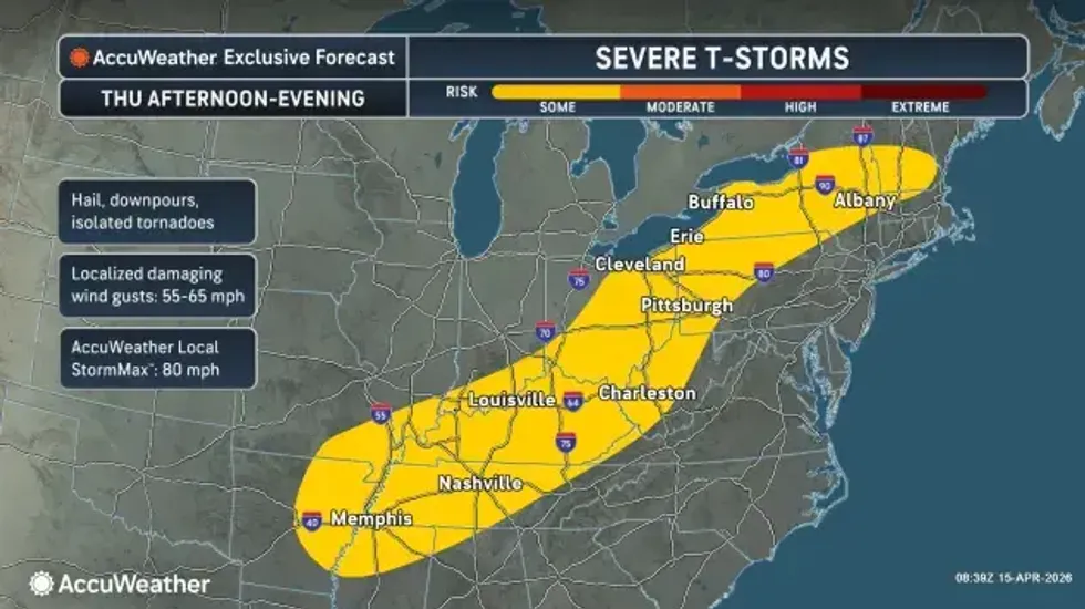
Thursday will be a 'rinse and repeat' day, Hitchcock tells us, with a couple rounds of showers and storms.
 AccuWeather.com
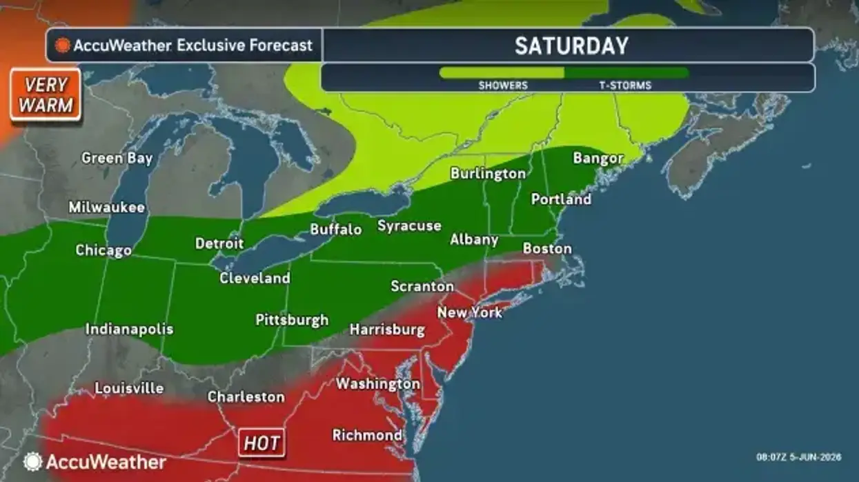
"Friday, some showers in the morning," Hitchcock notes, but adds, "It looks like we do finally dry out Friday afternoon, Friday night and Saturday morning, before another round of showers arrives later in the day Saturday."
The very warm pattern continues through Saturday before much colder air arrives by early next week.
Temperatures will soar Saturday into at least the mid to upper 70's, with 80's a possibility if clouds and showers hold off until late in the day.
A cold front late Saturday into early Sunday will deliver a much colder airmass and highs Monday will only be in the lower 40's at best, and may stay in the 30's if clouds persist most of the day.