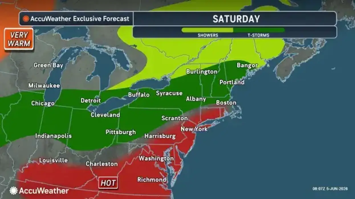
The streak of sunny and dry weather across the Buffalo-Niagara region comes to an end Saturday as a round of showers, storms, and even potentially severe weather moves through.
It will be short-lived, however, with a return to drier conditions Sunday and warmer conditions as the work week unfolds.
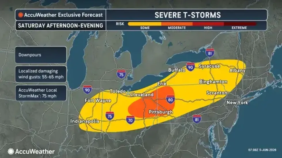
Showers and thunderstorms return Saturday with localized heavy downpours and an isolated severe weather risk, National Weather Service forecasters say.
After a round of showers and storms early in the day Saturday, there will be periods of dry conditions throughout the day.
The main severe weather risk will be roughly 2 p.m. to 7 p.m., mainly across the southern tier, and thunderstorms will also produce brief heavy downpours.
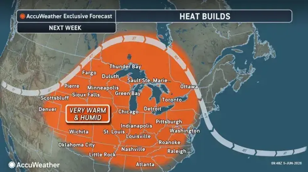
Mainly dry weather returns Sunday through early next week with warm temperatures, forecasters say.
A weather system overspreading the region will support dry weather and above average temperatures Sunday night through at least Tuesday.
"The jet stream pattern will shift quickly next week. Unlike previous episodes that sustained cooler weather for several days, this dip in the jet stream will move through in only 24-36 hours," AccuWeather Senior Long-Range Meteorologist Joe Lundberg said. "It will be followed by a pronounced northward bulge, allowing much warmer air to return."
 AccuWeather.com