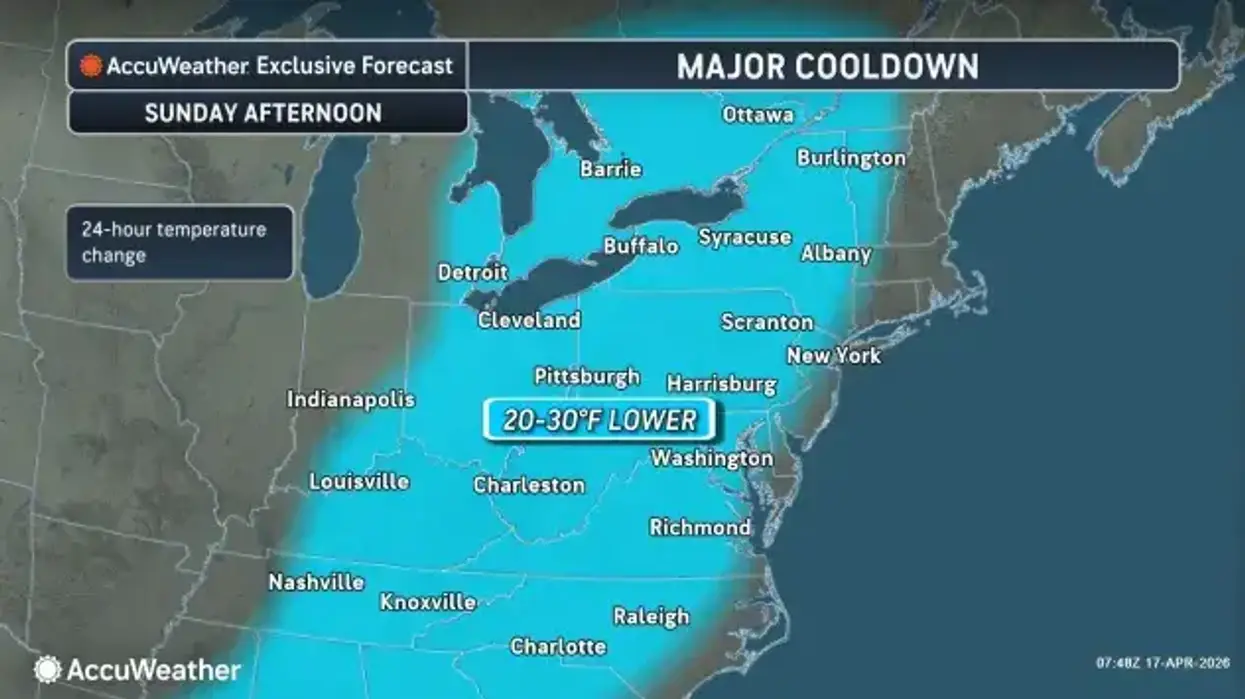
Just as Buffalo Sabres fan fever is off the charts and game one of the first round of the Stanley Cup Playoffs looms, Mother Nature is throwing ice on the region in the form of an extreme and unseasonable cooldown.
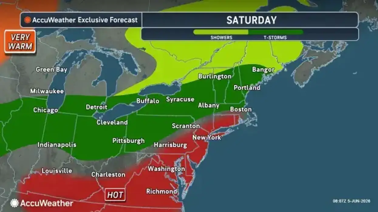
Forecasters say significantly colder weather will continue through Monday night with rain and/or snow showers. Showers Sunday could contain a few rumbles of thunder as well.
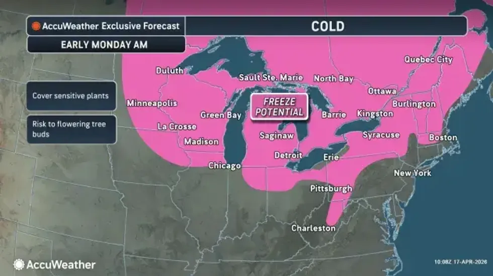
Daytime highs Sunday are forecast in the 40's, falling to the 30's to low 40's for Monday. Nighttime lows will be even colder, with widespread 20's and even teens at the higher elevations, especially Monday night.
"We're going to be seeing temperatures tumbling down through the 30's," National Weather Service meteorologist Phillip Pandolfo tells WBEN. "We're going to be seeing low temperatures actually in the upper 20's across the entire area," overnight into Monday, Pandolfo cautions.
It will be a chilly afternoon for Sabres fans at the pregame Party in the Plaza and for the watch party planned outdoors at Canalside adjacent to the arena.
Through early Sunday evening, conditions should favor plain rain, though some wet snow at times cannot be ruled out.
 AccuWeather.com
There is some improvement in the work week forecast with another day to day warming trend is expected throughout the week.
Beginning during the daytime Tuesday, temps will initially recover back to near seasonal averages with highs in the 50's to upper 40's. Temps will continue trending upwards, with well above average temps increasingly likely by late week.