


(Accwuweather/WBEN) It's a welcome shift for many.
Western New York is trading the heavy, swampy humidity for some showers and more typical summer heat.
"We got rid of the extreme heat and now we're looking at a pretty typical summer week ahead," said Meteorologist Jon Hitchcock at the National Weather Service.
Monday will be the most unsettled day of the week with scattered showers becoming more numerous into the afternoon with a few thunderstorms and locally heavy downpours.
Mainly dry weather returns for Tuesday, Wednesday and most of Thursday with temperatures in the upper 70's to mid 80's.
Scattered showers this morning become more numerous late morning through the afternoon. Some of the showers may be heavy and slow moving, producing locally heavy rainfall. Rain coverage will be VERY uneven, but there is a marginal risk of isolated flash flooding in a few spots pic.twitter.com/xZZhLCpQRD
— NWS Buffalo (@NWSBUFFALO) July 6, 2026
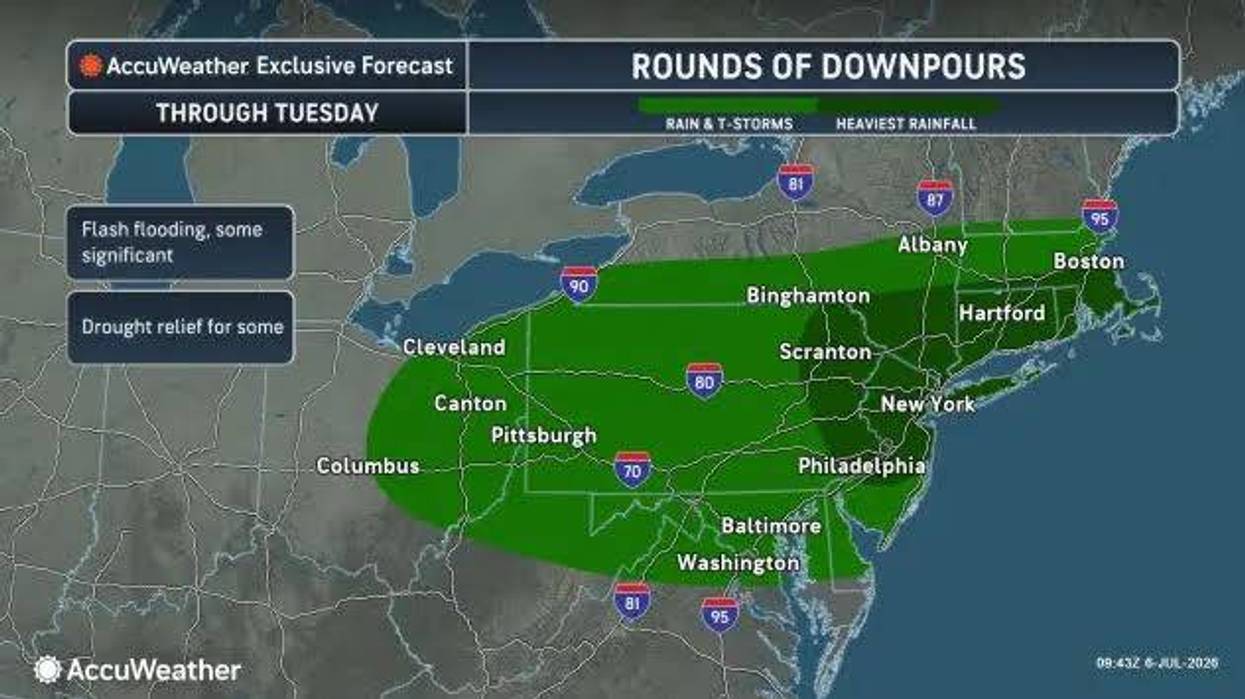
Drenching thunderstorms will be around to start the week for much of the Northeast, say AccuWeather meteorologists. Many of the storms can lead to disruptive and even dangerous localized flooding with one to three inches of rain per hour in some locations.
The slow-moving thunderstorms across parts of the Northeast and mid-Atlantic will produce numerous episodes of flash flooding into Tuesday morning. In areas where torrential downpours persist, significant flash flooding may occur," said AccuWeather Chief Meteorologist Jon Porter.
Baltimore, Philadelphia, Washington, D.C. and New York City are among metropolitan areas that can experience flash flooding. This includes the Interstate 70 and 80 corridors; driving through flooded roadways should always be avoided.
After Monday, the next disturbance for Western New York will be Thursday night into Friday that can bring a few showers and storms.
"We're looking at a pretty typical summer week ahead" - Jon Hitchcock
"We're looking at a pretty typical summer week ahead" - Jon Hitchcock