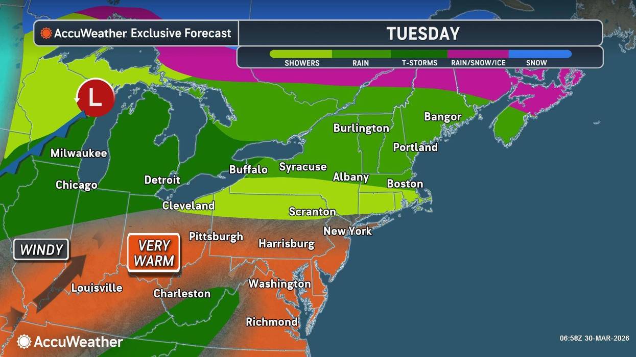
Rounds of rain are moving across the Buffalo-Niagara and Western New York region Tuesday, with the threat of potentially severe weather late in the day and into the evening hours.
The rain is also accompanied by a noticeable uptick in temperatures across the region.
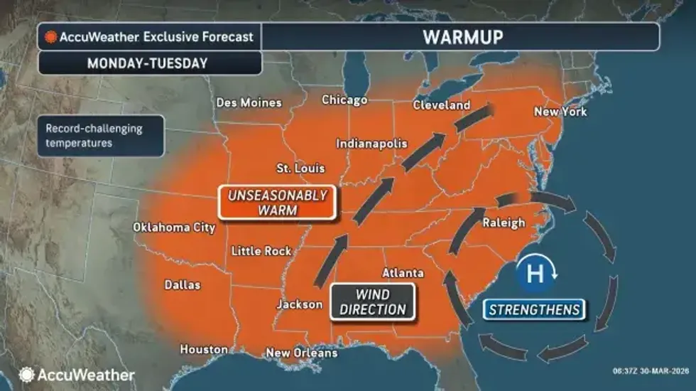
"We have a nice warmup the next few days," National Weather Service meteorologist Jon Hitchcock tells WBEN. "Today we'll be in the low to mid 60's, inland from Lake Erie...unfortunately there will be a southwest breeze off of Lake Erie today, so it will cost Buffalo a few degrees. It will be in the 50's for most of the metro area, even 40's right downtown by the waterfront."
 AccuWeather.com
Tuesday's temps will be similar, in the 60's inland, and cooler near downtown Buffalo, adjacent to Lake Erie.
"The warm days are going to win out over the cool days over the next few weeks," Hitchcock says.
The warmup comes with waves of rain that will impact the Western New York region.
"Quite a bit of rain coming tonight through tomorrow night," Hitchcock cautions. "We're looking at 1 to 2 inches total in several different rounds starting tonight and going through Wednesday morning."
A Flood Watch is posted for the WNY region Tuesday morning through Wednesday.
There will be a brief dry period Wednesday before more rain arrives for Thursday and Friday.
Severe weather is a possibility late Tuesday afternoon into the evening hours, Hitchcock tells WBEN.
"That'll be something to watch as we go through the day tomorrow."
A Severe Thunderstorm Watch is posted for all of WNY through 9 p.m.
FLOOD WATCH IN EFFECT FROM TUESDAY MORNING THROUGH WEDNESDAY
EVENING
* WHAT...Flooding caused by excessive rainfall is possible.
* WHERE...Portions of central and western New York, including the
following counties, in central New York, Northern Cayuga. In
western New York, Allegany, Cattaraugus, Chautauqua, Genesee,
Livingston, Monroe, Niagara, Northern Erie, Ontario, Orleans,
Southern Erie, Wayne and Wyoming.
* WHEN...From Tuesday morning through Wednesday evening.
* IMPACTS...Excessive runoff may result in flooding of rivers,
creeks, streams, and other low-lying and flood-prone locations.
* ADDITIONAL DETAILS...
- Multiple rounds of showers and embedded thunderstorms are
expected between tonight and Tuesday night which may result
in several inches of rainfall over a 2 to 3 day period.
Excess runoff from this rainfall may cause area waterways to
reach or exceed bankfull stage. General flooding away from
area waterways will also be possible during this timeframe,
especially in typical low-lying and poor drainage areas