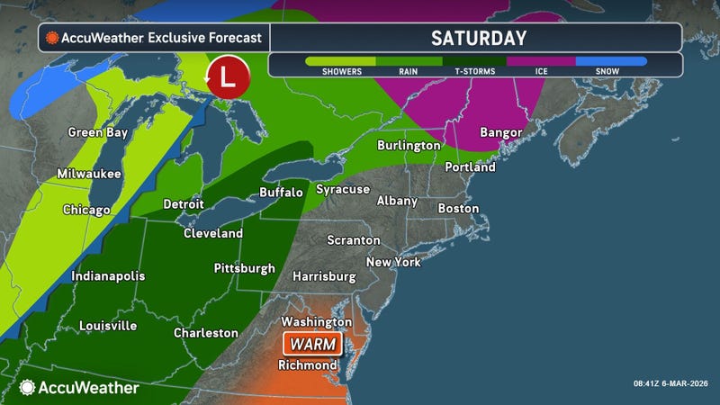

A multi-day heat wave that begins in earnest Saturday for Western New York will begin with a bang and go out the middle of next week with a return to much cooler temperatures.
'Ask Andy' meteorologist Andy Parker calls the unusually warm temperatures arriving Saturday as a 'snow eater' that will melt any remaining snow piles and lingering snow pack.
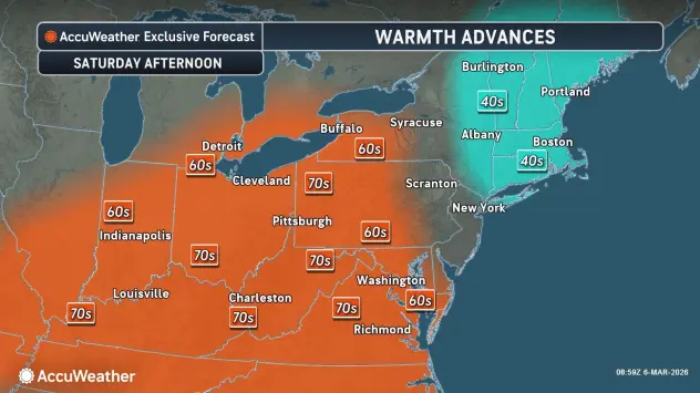
Temperatures Saturday will soar to the 60's, and near 70 in spots, Parker tells WBEN. "The average daytime high for the Buffalo area is around 40, so if you can get 65, 70, you are way, way up," he says.
The weather will turn windy and wet later Saturday, with gusty winds and then some storms that develop as a result.
"Those unnaturally warm temperatures and very soupy air is going to lead to some convection," Parker says. "We’ll get some thunder and lightning out of it with some gusty winds."
It's back to the 40's Sunday, with some sunshine and breezy conditions, before more warm air starts off the coming work week, when high temps will be in the 60's to near 70 again in spots.
But don't put away the winter coat just yet!
The weather will turn colder beginning later Wednesday, and remain that way for an extended period of time, Parker says.
"A rain system that comes through Wednesday will switch over to snow Thursday, and then we stay very cold, colder than normal…right through the 20’s of the month."
Parker says the ice cover on Lake Erie is slowly melting away, under 70% presently and likely under 50% following the extended warmup.