Buffalo, N.Y. (WBEN) - As promised, the entire Buffalo and Western New York region awakened Sunday to a blanket of new snow.
Widespread snow will rapidly taper off from west to east during the daytime Sunday. Some light lake effect snow will linger southeast of Lake Erie, with only minor additional accumulations.
Most of the area will then dry out tonight through Monday.
"We had a few inches here at the airport," National Weather Service meteorologist John Hitchcock tells WBEN. "Quite a bit more than that up in Niagara and Orleans counties. It looks like they fell within that 3 to 6 inch range, also southeast of Buffalo as well."
While the NWS did not have any official spotter data as of early Sunday morning, it appears the metro Buffalo area was on the lower end of the accumulations. "The immediate Buffalo area got the least, but most of WNY fell within that 3 to 6 inch range," Hitchcock noted.
The snow will taper off Sunday and no additional significant accumulation is expected. "The majority of this snow event is over."
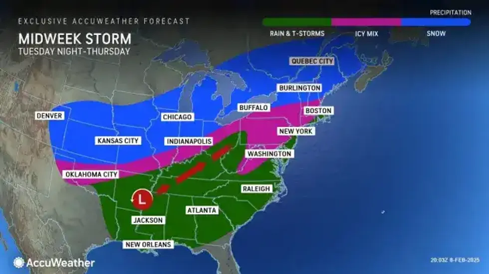
We get a break from active weather for the beginning of the work week, Hitchcock says, however there are some weather systems that will impact the region come midweek and later in the week.
 AccuWeather.com
There remains some uncertainty about the storm systems approaching late Wednesday and Thursday. "If it does go by to our south, we would stay all snow with significant accumulation possible," Hitchcock cautions. "If it does track north, over the top of us, we could see a snow changing to a wintry mix scenario
Forecasters are watching another system for next weekend that could produce similar impact on the WNY area.
"Two more widespread systems to watch."