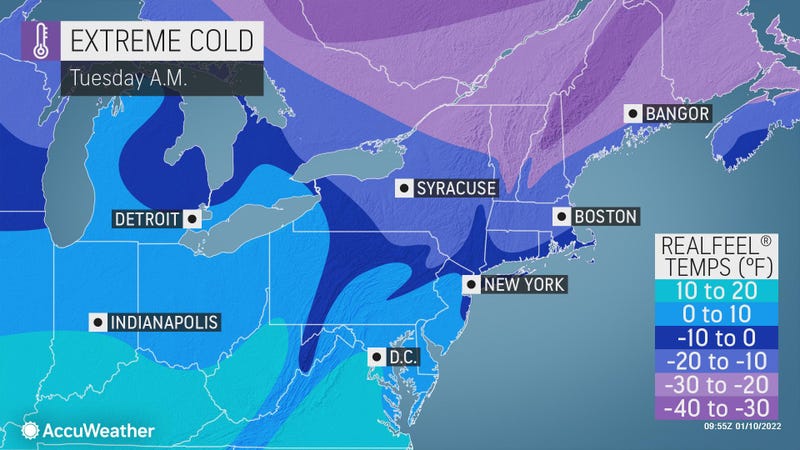

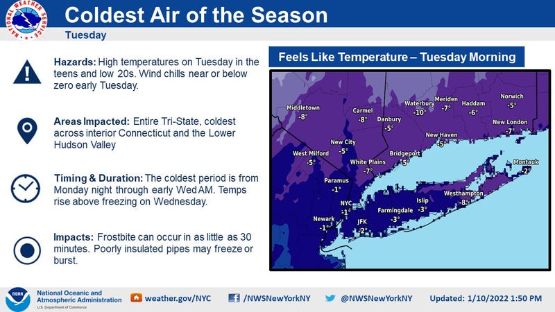
NEW YORK (1010 WINS) -- Frigid temps were enveloping the New York City area on Tuesday, with RealFeels plummeting to below zero in many spots.
The National Weather Service said the coldest air mass in nearly three years would settle over the region through Tuesday.
It was just 16 degrees in Central Park shortly before 8 a.m. with a RealFeel of -2 degrees. The RealFeel was also -2 to the north in Yonkers and to the east in Hempstead.
It will remain cold and blustery Tuesday despite plenty of sunshine, according to AccuWeather. A stray flurry is also possible on Long Island and in the Lower Hudson Valley.
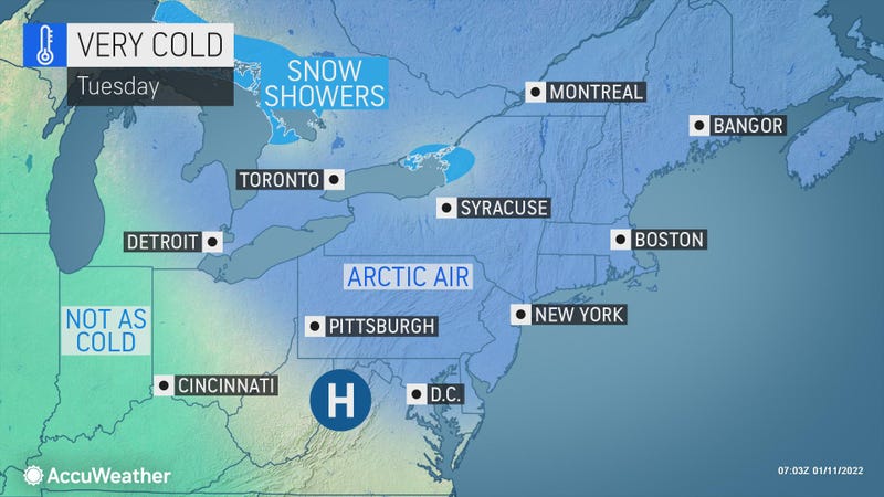
The high Tuesday will be 20, but RealFeels will stick to the single digits and teens.
The National Weather Service issued a weather statement warning the cold and wind could cause frostbite in a short period of time.
It’s partly cloudy and cold on Tuesday night but less windy. The low in the city will be 17, while it will be closer to 10 in the distant suburbs.
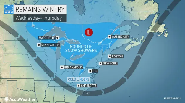
Wednesday will be partly sunny and not nearly as cold with a high of 39.
The high will hit 41 on Thursday, when a snow or rain shower can’t be ruled out later in the day.
The cold returns Friday. It will be windy and partly cloudy with possible flurries. The high will be 34.
Related

Related

Related
