
NEW YORK (1010 WINS/WCBS 880) – A major winter storm will pummel the New York City area with several inches of rain and 60 mph wind gusts Tuesday into Wednesday—as a second storm takes shape for this weekend and an Arctic blast looms for next week.
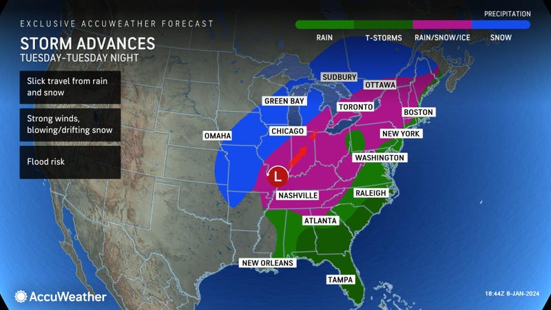
Tuesday's sprawling storm was impacting much of the eastern U.S., bringing up to a foot of snow to the Midwest and whipping up tornadoes in the South.
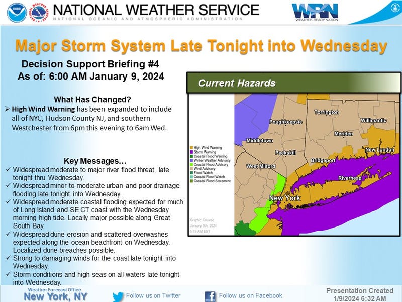
A High Wind Warning was issued for all of NYC and Long Island, as well as a swath of New Jersey, coastal Connecticut and Westchester. Most of the metro area, including all of NYC, is also under a Flood Watch.
NYC Emergency Management issued a travel advisory until Wednesday, while the MTA said its crews were preparing for downed trees on commuter rails and flooding in the subway.
Gov. Phil Murphy issued a state of emergency starting Tuesday evening for New Jersey, as did a number of localities, including Paterson and Hoboken. Murphy told WCBS 880 that he was in communication with dozens of local officials, and he urged New Jerseyans to "please, please, please take this seriously."
Gov. Kathy Hochul said she was mobilizing resources in the state, including some 8,800 utility workers and SWIFT water rescue teams. "Let me be clear, this will be an emergency, it will be serious, and we're urging all New Yorkers to exercise extreme caution," the governor told a news conference Monday.
The storm will move into the New York City area on Tuesday afternoon, with the worst conditions expected late Tuesday into early Wednesday, according to AccuWeather.
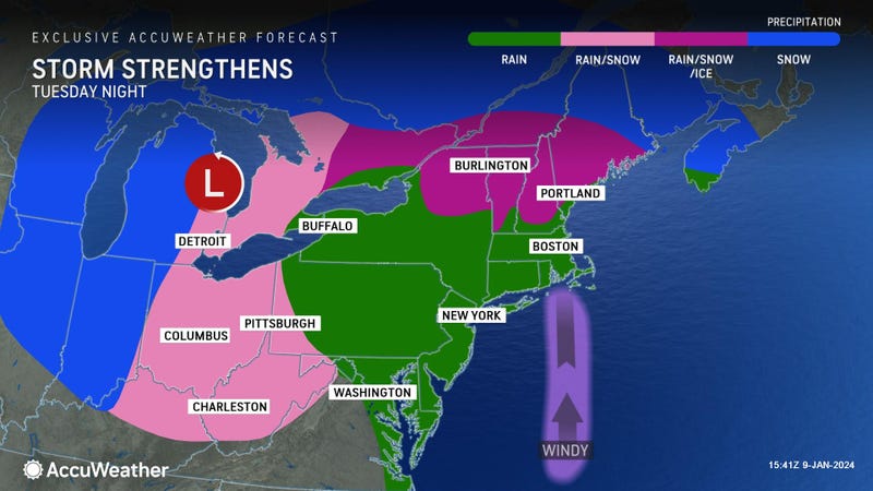
The rainmaker will grow more intense into Tuesday night, with sustained winds of 25-35 mph and gusts up to 50 mph in the city. Gusts of 60 mph are likely on Long Island. Downed trees and power lines could cause widespread outages, while floodwaters could impede travel or sweep away vehicles.
Flash flooding is an immediate threat Tuesday night, as temps warm to the 50s and cause additional snowmelt on top of the rain, but major long-term flooding is also a concern in the days ahead.
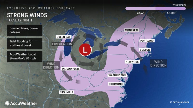
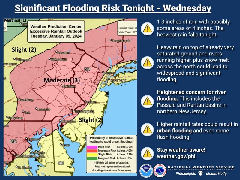
Forecasters have warned of life-threatening flooding as a general 2 to 3 inches of rain impacts an area already soaked by snowmelt and rain from last weekend's storm. Some spots could see 4 inches. Areas around the Passaic and Raritan rivers in New Jersey, as well as parts of the Hudson Valley and Connecticut, are of particular concern.
Stray showers and gusty winds will linger into Wednesday but begin to subside early on. Temps will drop from the 50s to the 40s throughout the day.
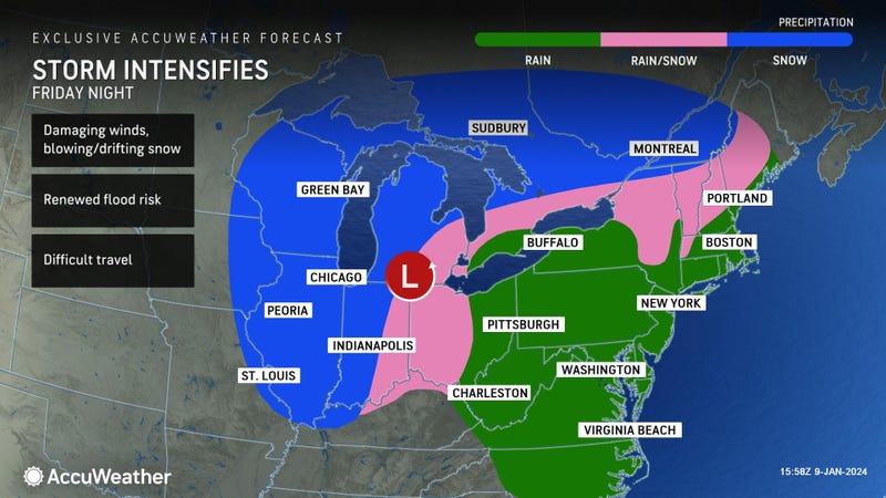
Thursday and Friday will be mostly sunny, with highs in the mid-40s, ahead of another storm with wind and heavy rain Friday night into early Saturday.
The start to the weekend will be windy and warm Saturday, with a high of 57, but it'll become sharply colder by Saturday night. The chilly temps will continue into next week as a polar vortex moves into the Lower 48 states.