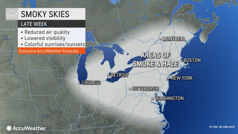

NEW YORK (1010 WINS/WCBS 880) – Canadian wildfire smoke is expected to worsen air quality in the New York area Thursday as stormy weather lingers and flight disruptions remain widespread at airports.
The smoke isn’t expected to reach the apocalyptic orange plumes seen in early June, when the city recorded its worst air on record, but it could pose health issues for vulnerable people and limit visibility.
An Air Quality Alert was issued for all five boroughs, Long Island, Westchester, the Hudson Valley and North Jersey until midnight Thursday night.
In a statement, the NYC Health Department warned, "While forecasting air quality is challenging and often unpredictable, we anticipate that conditions could deteriorate – getting worse on Thursday -- due to unprecedented wildfires in Canada."
Gov. Kathy Hochul and Mayor Eric Adams warned New Yorkers to prepare accordingly, including by staying inside if they can and wearing a tight-fitting mask, like a KN95 or N95, if they go outdoors.
“Due to incoming winds tonight and ongoing Canadian wildfires, New York City could experience worse air quality,” Adams tweeted. “We will keep New Yorkers informed on conditions outside and actions they can take to stay healthy.”
Hochul warned of unhealthy air and the potential for "near-surface smoke impacts" across the state as smoke moves in from the west.
"As we closely monitor the changing forecast, New Yorkers should be prepared for the potential return of smoke from the Canadian wildfires," the governor said.
"I encourage everyone to remain vigilant, especially if you are vulnerable to air pollution, stay up to date on the latest information and take steps to protect yourself."
Hochul said organizations that run outdoor activities or have outdoor workforces should plan for potential changes to activities.
People in vulnerable groups should avoid exertion outdoors and preferably stay indoors if they can, especially if the Air Quality Index tops 100. Wearing a face mask is also recommended while outside.
The worst of the air is expected Thursday, when the AQI could reach an "unhealthy" value of more than 150, known as a "code red." Just weeks ago on June 8, the AQI topped 400 in New York, which had the worst air of any city in the world at "hazardous" levels.
The air quality could be especially bad Thursday morning, according to AccuWeather.
The smoke threat comes amid an unsettled week for weather in the Tri-State. Thunderstorms with the potential to pack gusty winds and drenching downpours have been popping up daily since the weekend, especially in New Jersey.
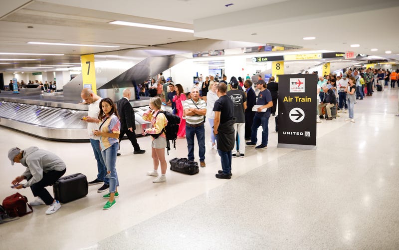
Flight cancellations and delays have been piling up at area airports for days, with hundreds of travelers sleeping in terminals or trying to find spots in booked hotels at the last minute.
Well over 700 flights were canceled at Newark, JFK and LaGuardia airports on Tuesday. The travel chaos continued Wednesday, with more than 400 flights already canceled, and hundreds more delayed, by the afternoon. On Tuesday, about 6,500 flights were delayed and 1,900 canceled on the East Coast.
The Federal Aviation Administration blamed storms in the Northeast, but United Airlines CEO Scott Kirby said the FAA was at fault for Newark delays because it reduced the arrival rates by 40% and the departure rates by 75%. An FAA spokesperson responded: "We will always collaborate with anyone seriously willing to join us to solve a problem."
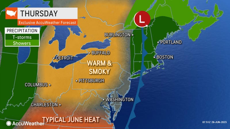
Stormy weather that has gripped the area for days moves out for a partly sunny and warm Thursday. Wildfire smoke and fog could reduce visibility at times. Highs will rise to the mid-80s.
The warmup continues Friday, when it will be sunny to start, followed by clouds. A late-day or nighttime thunderstorm can’t be ruled out. The high will be 86.
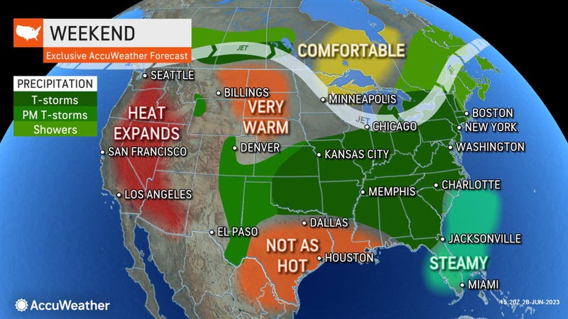
Active weather patterns return this weekend as the humidity rises. Thunderstorms are possible both Saturday and Sunday as highs near 80.
The chance of storms continues Monday and for the Fourth of July on Tuesday, but none of the days should see a washout.
Related

Related

Related
