


Federal help is on the way to 22 Minnesota counties affected by flooding over the past two weeks.
The announcement came Saturday from the office of Governor Walz.
It comes as some grasp with the reality of being under-insured, and with the threat of more rain hitting the region before the Fourth of July.
Here are the Minnesota counties that are part of the federal disaster declaration:
Blue Earth
Carver
Cass
Cook
Cottonwood
Faribault
Fillmore
Freeborn
Goodhue
Jackson
Lake
Le Sueur
Murray
Nobles
Pipestone
Rice
Rock
St. Louis
Steele
Wabasha
Waseca
Watonwan
In the southern part of Minnesota, flooded rivers, streams, and lakes are starting to recede.
It's going to take some time, with forecasters saying the water is falling back one to three inches every 12 hours.
 No concerts anytime soon on Raspberry IslandAudacy
In some places like Waterville, it's been tough to get flood insurance, and it might be tougher to acquire relief funds.
"The people that have permanent homes here are going to be the ones that might have a chance to get some funds," said Bob Goetzke, who lives in North Mankato but has a seasonal home in Waterville.
That residence had water up to its windows last week.
"I don't know how promising (it is) for some of the seasonal people," he said. "Some of these people can be looking at a total loss, it's really kind of a nightmare."
 A crane may be wondering why this part of Harriet Island in St. Paul is ankle-deep in water (yes, those are the bird's ankles)Audacy
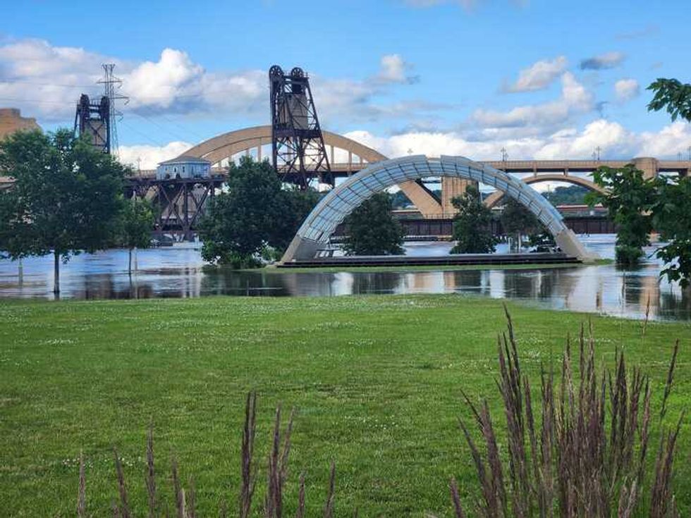
In the Twin Cities, the Minnesota and Mississippi rivers reached their highest points over the weekend.
The Mississippi at St. Paul crested Saturday at 20 feet.
Harriet Island and parts of Warner and Shepard roads, located adjacent to the river, remain flooded and closed to traffic with all planned activities either canceled or relocated.
The dangers of flooded waterways can be emphasized with one look at the elevated walkway that runs from St. Paul's historic west side onto Rasperry Island, a small spit of land directly underneath the Wabasha Street bridge.
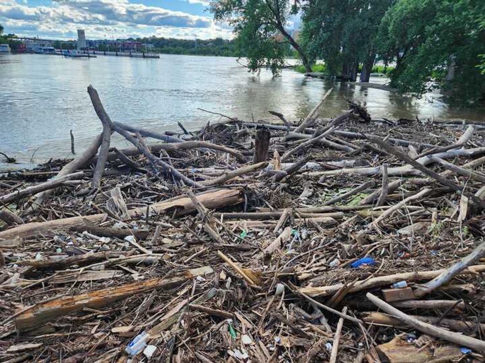 Debris caught up near Raspberry Island on the Mississippi River in St. PaulAudacy
With the rushing water only inches from that span, loads of debris washed downstream is piling up, a logjam that shows what is still coming downstream and creating danger for anyone thinking about swimming or boating while the water is high.


