The rumors are true. Snow lovers have an itch that a scratch won't reach - commuters feel a pang of dread, contemplating what the roads will be like Friday afternoon.
Pro-snow, anti-snow - everyone has an opinion. I am agnostic: it is what it is, and we are doing our best to set expectations.
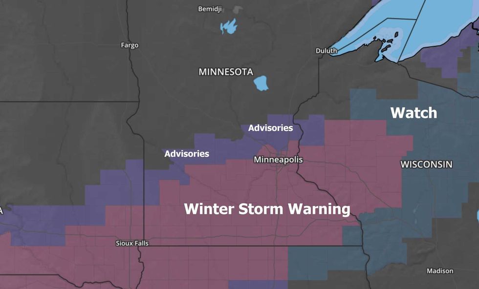 Winter Storm Watch and Warning now includes much of the Twin Cities Metro.(Map courtesy of AerisWeather)
A few headlines for this upcoming storm, the first significant snow of the winter season for the Twin Cities:
1). On our nuisance-plowable-crippling scale (which I conveniently borrowed from a college meteorology professor) this storm should fall neatly into the "plowable" category. As the term implies, enough to shovel and plow and gum up the drive home Friday afternoon. My best estimate: 4-8" (3-4" north suburbs with 5-8" for some southern suburbs).
2). A couple of important points: this will NOT be a blizzard. Winds are forecast to be relatively light tomorrow (blowing from the northeast at 10-20 mph). So I do not envision major issues with blowing and drifting. Also, temperatures at the height of the storm will be in the upper 20s, close enough to freezing to give salt/chemicals a better chance to melt snow and keep freeways wet and slushy.
That's more prayer than prediction, but this will not be the "cold storm" we had on Tuesday when temperatures in the teens resulted in icy roads even though most spots only picked up an inch or two.
3). Heaviest snow should fall Friday afternoon and the early nighttime hours, tapering to flurries late Friday night. This will be a relatively short-duration storm, a 6-10 hour "burst" of moderate snow piling up at the rate of an inch an hour at times.
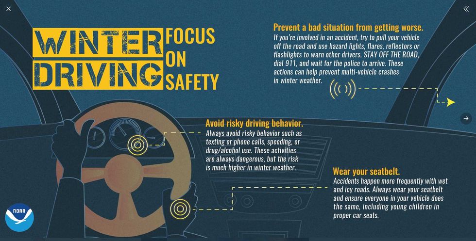 Safe Winter Driving Tips(Graphic courtesy of NOAA)
Timely Winter Driving Advice. I know - we all know how to drive on snow. But the first storm of the season is notoriously tricky as all of us try to remember to slow down, leave more room between vehicles and stopping, etc.
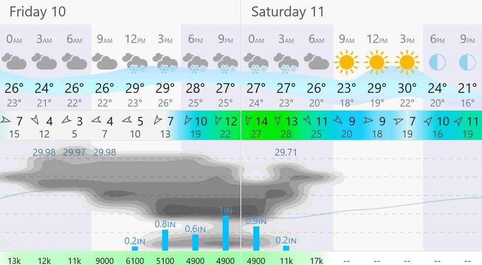 The Storm Timeline(Graphic courtesy of windy.com)
Storm Timeline. I expect the bulk of the snow to fall from midday Friday through midnight Friday night, with the heaviest amounts falling late afternoon and evening with air temperatures in the upper 20s.
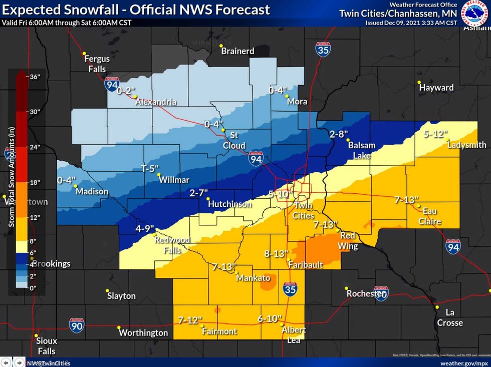 NOAA Snowfall Prediction(Graphic: Twin Cities National Weather Service)
National Weather Service Snowfall Prediction. North metro and central Minnesota will see less snow, with heavier amounts from the southern suburbs toward Faribault, Northfield and Red Wing. I think 4-8" is a good range for the immediate MSP metro, with a shot at 10" well south of MSP.
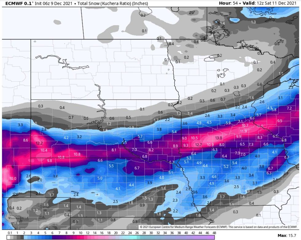 "European Model" showing 4-8" for much of the metro with some 10-11" amounts southern suburbs.(map credit: weatherbell.com)
European Solution. This is the 06Z numerical run of the "European Model" which is hardly perfect, but many times the superior weather model, showing 4-8" for much of the metro with some 10-11" amounts southern suburbs.
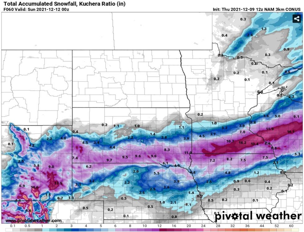
NAM Solution. NOAA's 3km high-resolution 12z NAM model shows 4-8", with the heaviest band of snow predicted well south of MSP. The axis of heaviest snow keeps shifting - as we get closer to the snow event the models will undoubtedly shift again. As always, your results may vary.
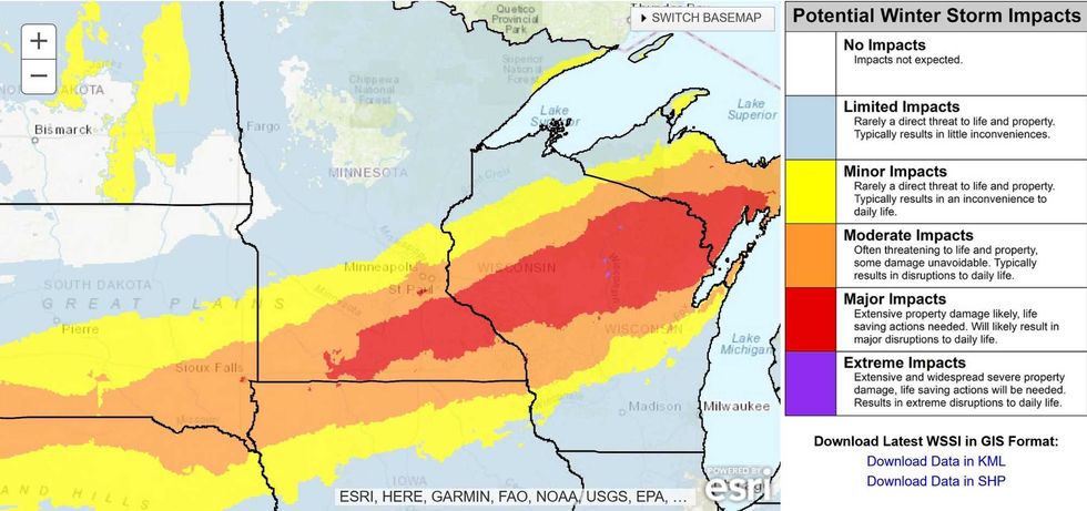 Winter Weather Severity Index(Map credit: NOAA)
Winter Storm Severity Index (WSSI): Moderate to Major Impacts. NOAA's WSSI Index has the immediate Twin Cities metro in "Moderate Impacts", but I suspect it could get pretty rough on the highways by late afternoon and evening on Friday.
So here we go, the first (real) snowstorm of the season. On some level I'm reassured it can still snow here in December. Next week's warming trend (a few days in the 40s, even topping 50F next Wednesday) will melt much of the snow, but I suspect we'll have a patchy-white Christmas this year.
No need to scramble for milk, eggs and toilet paper. This isn't the BIG ONE. But it will be enough (for most of us); a reminder that December is one of the snowiest months of the year in Minnesota. Let it snow.