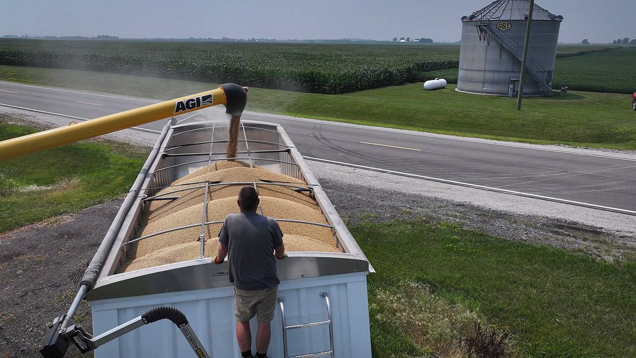
It's been a fairly quiet few weeks across Minnesota. Moderate temperatures, very little rain and pretty much average weather.
But WCCO Chief Meteorologist Paul Douglas, speaking to Vineeta Sawkar on the WCCO Morning News, does have a few weather headlines to break down. A major hurricane is causing significant damage in the Atlantic. Closer to home, fall-like weather is knocking on the door (finally). We also continue to battle drought conditions across portions of Minnesota.
Here are your weather highlights for Monday, September 19th, 2022.
Hurricane Fiona
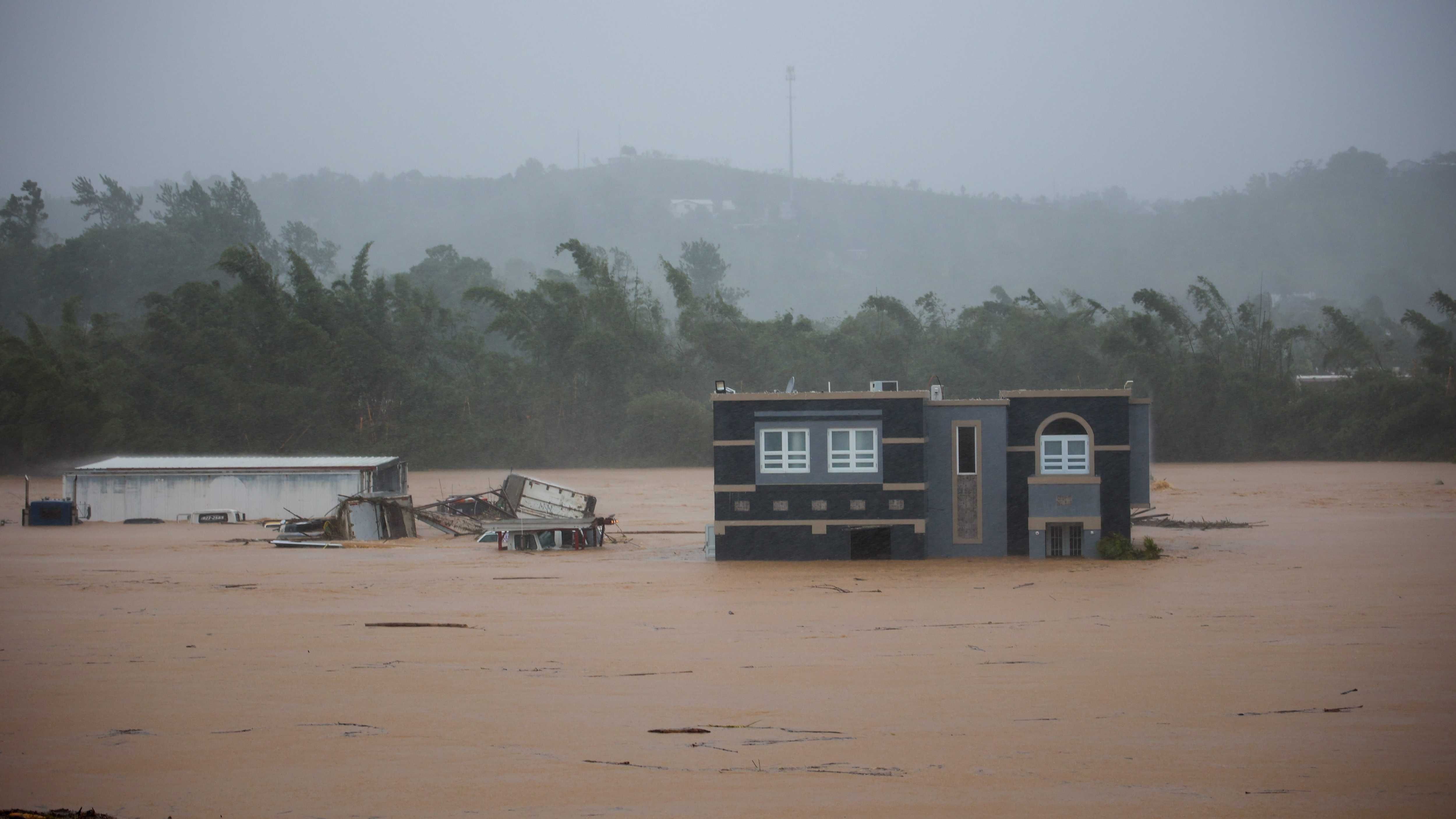
A horrible situation is again unfolding in Puerto Rico where up to one million people are without power. That's after a category one hurricane hit the island.
No deaths had been reported, but authorities in the U.S. territory said it was too early to know the full scope of damage from an expansive storm that was still forecast to unleash torrential rain across Puerto Rico on Monday.
“My understanding is that the grid is fragile to begin with,” explains Douglas. “I mean, every grid is fragile to some degree when it comes to extreme weather. Fiona was a Category One, winds up to 85, maybe 90 miles an hour and a couple of feet of rain. It moved very slowly, just like a giant meat grinder working its way from east to west across the island. That was what a category one can do. Imagine, had that been a category three, four or five?”
This hurricane hit Puerto Rico two days before the anniversary of 2017's devastating Hurricane Maria — from which the territory has yet to fully recover from. After slamming Puerto Rico and the Dominican Republic, Fiona is forecasted to turn northeast into the Turks and Caicos, then the Bahamas, before up the Eastern Seaboard heading but well off the coast.
It had been a pretty quiet hurricane season in the tropics so far this year, at least in the Atlantic. September and October do tend to create the most powerful storms however.
Long Range Forecasts
Paul Douglas is not a big fan of long range forecasts, as he made clear a week ago when discussing what sort of winter we might have in Minnesota.
Douglas says again, predicting what happens more than a few days out is not very accurate. Earlier this summer, the National Weather Service's Hurricane Center predicted a very active year in the Atlantic, but that has not panned out so far.
This is another example, says Douglas, of too many factors needing to come together and making it impossible to predict accurately.
“And again, it kind of goes to something that I've been saying for a long time, pleading with listeners long range forecast, you know, three-four-five months out are interesting," says Douglas. "But don't don't put too much stock in them, right? I mean back in June, NOAA, which does a great job, I'm not dissing NOAA, the national weather service, but they were predicting an above average season for hurricanes and everybody was, ‘oh my, here we go another year, like last year and the year before’. Hasn't turned out the way we had many of the ingredients but not all the ingredients. And if one thing is missing from the recipe, you will not get the, the outlook you thought, the result you thought.”
There is currently one more disturbance in the Atlantic that has only a 20% chance of development according to the Hurricane Center. In fact, no tropical cyclones formed in the basin during August. This is quite unusual and is the first time that has occurred since 1997, and is only the third time that has happened since 1950.
This Week’s Forecast
After some dense fog this morning, the sun should be out later on Monday.
“A light breeze should mellow into a beautiful Monday, highs near 80. Mid-eighties Tuesday but there could be a couple of thunderstorms. Not enough to really put a dent in the drought. Then Wednesday, a rush of northwest winds, cooler air.”
Paul says expect highs in the 60s the rest of the week but he does say it’s not ‘cold’ yet.
“I wouldn't call this a cold front,” says Douglas. “I'm sorry, sixties, that's a cool front. That's not a cold front. Ten degrees, okay, that's a cold front. But it will cool off into the 60s for highs later this week and much of next week.”
Drought
If we could only use a little bit of that rain that is overwhelming Puerto Rico. It's just too dry (still) in parts of Minnesota. At least in and around the metro area. Yes, northern parts of the state have seen decent rain. That is not the case in the rest of the state.
Douglas shared a video over the weekend of Minnehaha Falls in south Minneapolis. Normally one of the real natural highlights of the Twin Cities Metro Area, the falls right now are not even a trickle, something Douglas called Exhibit A of a severe drought.
Severe Drought Exhibit A: Minnehaha Falls is not falling pic.twitter.com/cfjXZzfP08
— Paul Douglas (@pdouglasweather) September 18, 2022
As you can see on the graphic below from the U.S. Drought Monitor, parts of the southern Metro are now in severe drought, with a large swath of the central part of Minnesota in either moderate drought or abnormally dry.
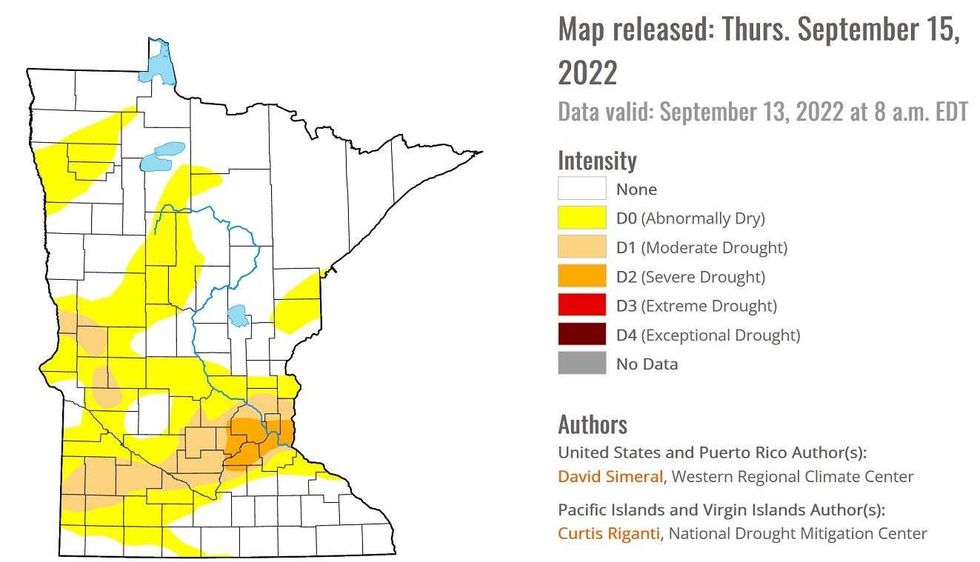 U.S. Drought Monitor for Thursday, September 15.(Photo Credit: U.S. Drought Monitor / National Weather Service)
The bad news is, there is no precipitation in the forecast whatsoever until at least Friday afternoon. Even with some significant rain on Friday, it is going to take quite a while to dig out of our dry spell and get the falls roaring again.