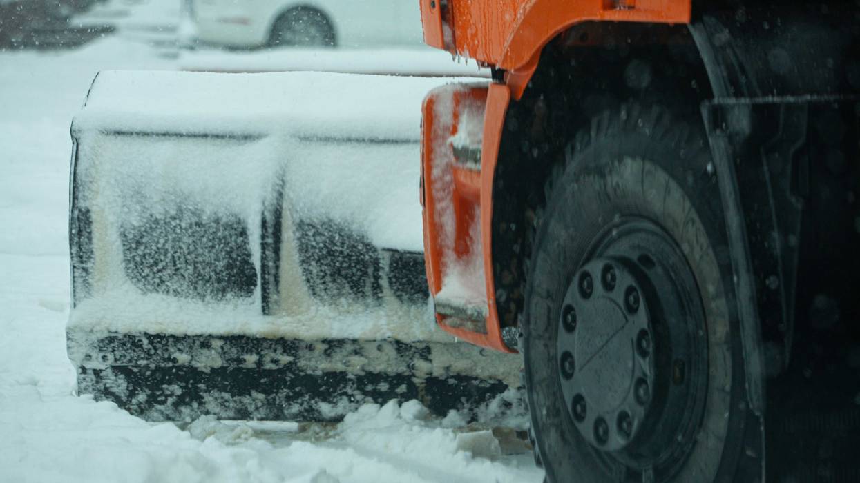
Minnesota's first real blast of winter weather is expected to arrive Tuesday afternoon and evening, with rain transitioning to snow and high wind gusts causing some pre-Thanksgiving Day travel headaches.
WCCO-TV Chief Meteorologist Chris Shaffer says the track of the storm shifted south in the overnight hours meaning 3-6 inches in the Twin Cities is not out of the question, with more snow the further north you go. The wind, especially later on Tuesday, will be a problem.
"The other complication is it's going to get very windy into the night tonight as well as during the day tomorrow," says Shaffer. "So again, this evening into the overnight hours, that's gonna be the tough go."
If you're one of those heading into work on Wednesday before Thanksgiving, prepare for a very snowy commute even if traffic levels are low, but Shaffer says there will be time for MnDOT to get the roads cleared.
"By the time you're heading off to work tomorrow, the highways will be cleared out," he told Vineeta Sawkar on the WCCO Morning News. "You'll be going 55 MPH down the highway tomorrow. So it's a tight window tonight. Get your stuff done early. If you're traveling, do it by day. Otherwise, wait till tomorrow and you'll be just fine."
WINTER STORM WARNING 6 PM TUESDAY TO 9 AM WEDNESDAY
* WHAT...Heavy snow and blowing snow expected. Total snow accumulations of 2 to 4 inches across southern Minnesota, to 4 to 7 inches across central Minnesota and northwest Wisconsin. Winds gusting as high as 45 mph.
* WHERE...Portions of central, east central, and south central Minnesota and northwest Wisconsin.
* WHEN...From 6 PM this evening to 9 AM Wednesday.
* IMPACTS...Travel could be very difficult. The hazardous conditions will impact the Tuesday evening and Wednesday morning commutes. Gusty winds could bring down tree branches.
FORECAST
TUESDAY: Rain changing to snow by evening. High: 46. NE 5-10 mph.
TUESDAY NIGHT: Winter Storm Warning. Wet snow. 3-6 inches possible in the metro, 5-10 inches possible north and 2-4 inches just south of the metro. Low: 27. NW wind 15-25 mph.
WEDNESDAY: Mostly cloudy and windy. High: 31. NW wind 10-20 mph.
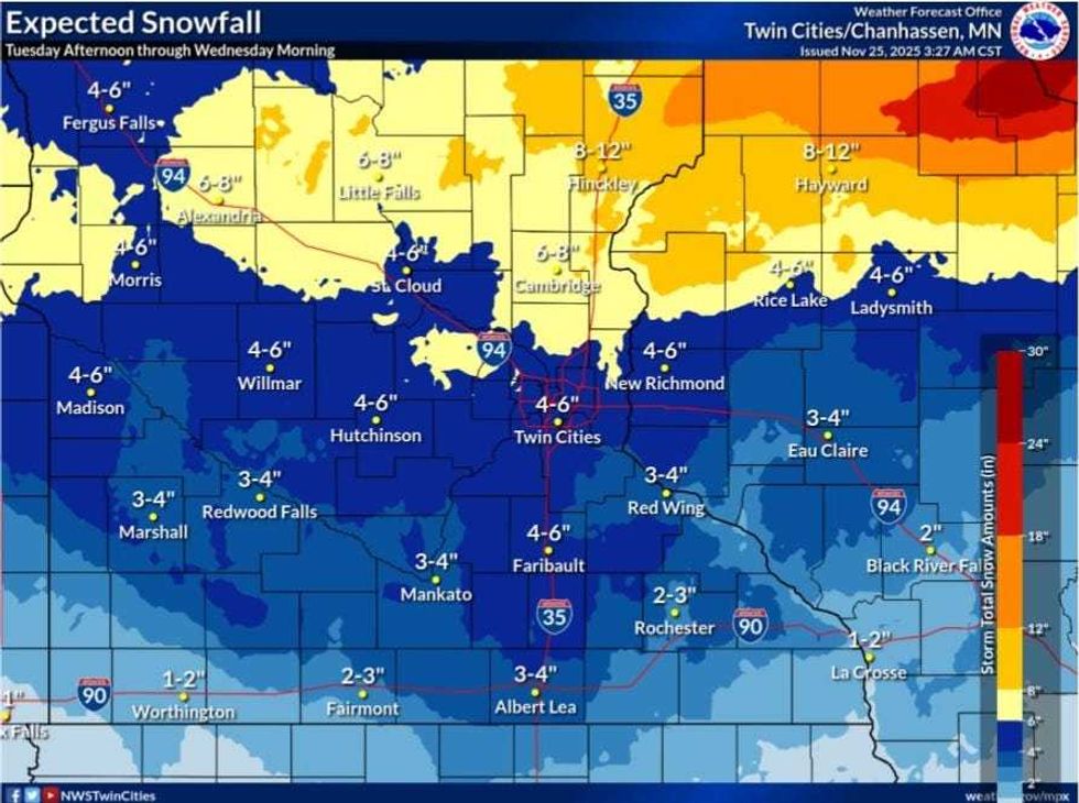 The predicted snowfall map shows 4-6 for the Twin Cities and much more in central Minnesota and western Wisconsin.(National Weather Service)
Winter Storm Warnings
Winter Storm Warnings go into effect Tuesday night in the Twin Cities where 4 to 6 inches of snow, lesser snowfall amounts are expected in southern Minnesota, with 3 to 4 inches likely in Mankato. Greater snowfall amounts are most likely in norther Minnesota, with the NWS Twin Cities map showing 6 to 8 inches in places like Alexandria and Little Falls, while Hinckley could be in the 8 to 12 inch range.
"Snow amounts are expected to be greatest in central Minnesota to northern Wisconsin, where the most likely location of a heavier band of snow will move through," according to the National Weather Service. "Gusty winds could make it difficult to measure snow, as blowing and drifting are likely while snow is falling."
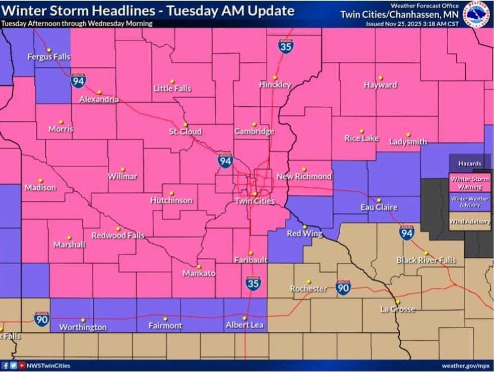 Most of 'CCO Land is under a Winter Storm Warning from 6pm Tuesday until 9am on Wednesday.(National Weather Service)
Timing
Rain is expected to transition to snow by late Tuesday afternoon, becoming all snow after 6-7 p.m.
The timing of the wind and snow could throw a wrench into pre-Thanksgiving Day travel plans.
"Kind of the advice we've been giving folks, especially if they have to go north of the Twin Cities, is you either leave Tuesday morning or you wait until Wednesday afternoon," said Mike Griesinger, a lead forecaster with the National Weather Service. "Really avoid Tuesday night through Wednesday morning for travel."
A cold, but calm weather day is on the Thanksgiving Day horizon, with high temps expected to land in the mid 20s. More snow could make its way back into the state Friday night into Saturday morning.