


Severe Storm Risk
March giveth, and March taketh away. A record-smashing 63 degrees yesterday in the Twin Cities (25 degrees warmer than average). Today? Soaking rains, slushy snow, high winds and a risk of severe storms - even an isolated tornado south and east of the Twin Cities.
Say what - tornadoes? Twisters in March are rare, but possible. In fact the earliest tornado sighting in the modern record was March 6, 2017, when 3 tornadoes touched down on Faribault, Freeborn and Sherburne counties. This is all happening much too fast.
 Potential for Hail and Damaging Winds.Credit: Praedictix
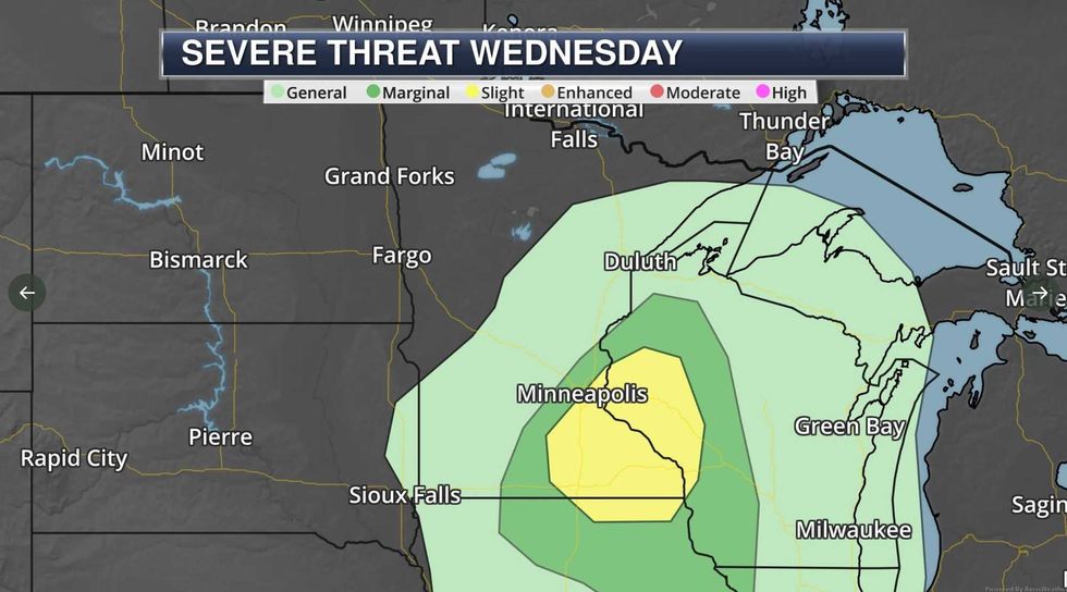
Potential for Hail and Damaging Winds
The odds of you (personally) seeing a tornado are remote, but there is a significant risk of severe, rotating thunderstorms capable of sparking large hail and isolated tornadoes, especially south and east of the Twin Cities this afternoon.
 Tornado PotentialCredit: Praedictix
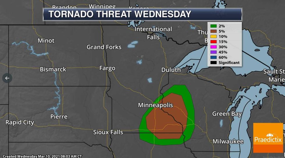
Tornado Potential
According to NOAA's Storm Prediction Center there is a 5% chance of a tornado within 25 miles of any location in the (brown) shaded area, from the Twin Cities to Mankato, Rochester and La Crosse. That's a fairly risk for any month, especially March.
Many of the ingredients are in place: the sun is breaking through over northern Iowa and southeastern Minnesota. We have strong instability and "wind shear" (winds changing speed and direction with altitude) that may support a few tornadic storms later today. There's a pretty good chance NOAA's Storm Prediction Center may issue a Severe Storm Watch or Tornado Watch later this afternoon. Stay alert and stay tuned to WCCO Radio for continuous updates.
 Snowfall Potential by midday Thursday.ECMWF (European) model guidance courtesy of weatherbell.com
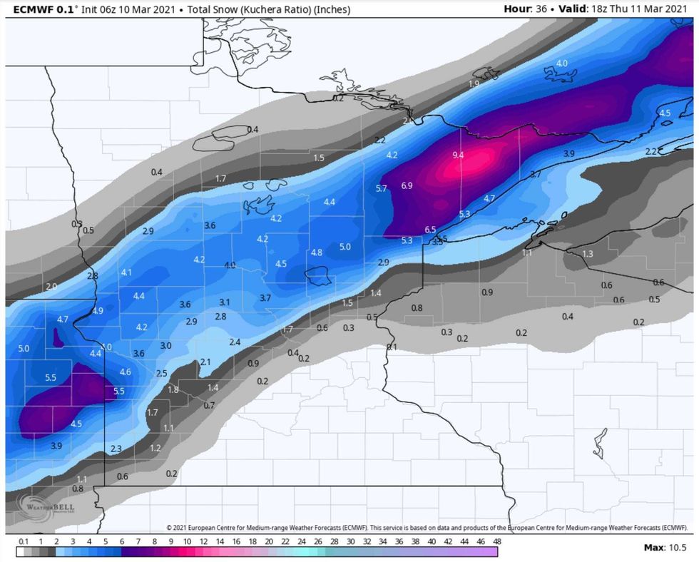
Snowfall Potential by midday Thursday
In the meantime, on the cold side of the storm a stripe of accumulating snow is still expected from near Alexandria to Brainerd and Duluth, possibly 2-5" (enough to shovel, scrape and plow). Again, not unusual for the 10th day of March in Minnesota, but a bit of a shock coming after yesterday's April-like warm front.
 Winter Weather ConcernsCredit: Praedictix
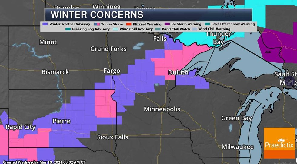
Old Man Winter Hanging On
Advisories and warnings are in effect, with the greatest potential for half a foot of slush near Duluth and the Lake Superior North Shore. For perspective: Denver, Colorado is expecting 1-2 FEET of snow, with up to 4 feet expected in some mountainous areas.
 Current Wind Advisories.Credit Praedictix.
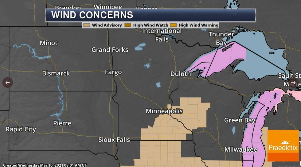
Current Wind Advisories
Winds will be gusty today, topping 40 mph at times, thus the Wind Advisory posted for much of southeastern Minnesota. All things considered, a good day to focus on work, school or spring housecleaning and try to ignore the weather outside your window.
 Temperature OutlookGFS temperature forecast courtesy of NOAA and weatherbell.com
Cooler Temperatures, But Still Above Average. GFS temperature forecast courtesy of NOAA and weatherbell.com.
More cold fronts are inevitable, but the frigid days of February are behind us, no more polar air brewing (in fact I think we're now done with subzero temperatures in the Twin Cities and most of central and southern Minnesota and western Wisconsin).
Long-range weather models show a few more 50s within a couple of weeks. In spite of a return to cooler weather, these temperatures are still consistently above average. The normal high now in the Twin Cities metro is 38 degrees. Yes, we've been spoiled, after a brutal February Mother Nature is finally showing signs of mellowing.
Personally, I'm keeping my driveway stakes in for the time being - I'm fairly convinced we'll see a few more slushy storms later in March and even into April. Pack away the parkas but keep a heavy jacket handy until further notice.
March springs are the very definition of fickle. Today's forecast of snow (and possible tornadoes) is a subtle, yet blunt reminder that a Minnesota spring is not for the faint of heart.
No kidding Paul.


