


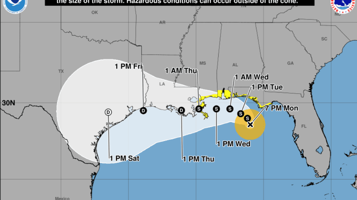

The low-pressure system off the United States Gulf Coast is now Tropical Storm Bertha.
The National Hurricane Center upgraded the system to tropical storm status with its 7 p.m. Monday update, and according to the NHC’s Tuesday 7 a.m. advisory, Bertha’s maximum sustained winds are 40 miles per hour.
The center of circulation is located about 100 miles south-southwest of Panama City, Florida, and is moving northwest at five miles per hour.
In Louisiana, tropical storm warnings are posted from the Jefferson/Plaquemines Parish Line to the Alabama/Florida State Line. A tropical storm watch is in effect for coastal Louisiana from Morgan City to the Jefferson/Plaquemines Parish Line.
The NHC’s latest forecast track moves the forecast track farther north. That track shows Bertha making landfall in either St. Bernard Parish or Plaquemines Parish last Wednesday or early Thursday.
However, the NHC’s forecasters admit that conditions along the Gulf Coast make it difficult for them to predict how Bertha will move. Furthermore, forecasters say the wind shear that Bertha will encounter as it pushes towards the coast could cause it to lose strength before the center of circulation ever makes landfall.
"The latest NHC track forecast is slightly north of the previous one for the first 24-36 hours, but then falls back to near the prior forecast track after that time, close to a blend of the most recent Google DeepMind ensemble mean (GDMI) and TVCN solutions," forecasters said in their Tuesday 4 a.m. forecast discussion. "It is worth noting that the track forecast beyond 48 hours assumes Bertha is able to maintain its status as a tropical cyclone, with several models suggesting Bertha could degenerate into a trough beyond this time period."