The rain has been a constant spring companion for much of Minnesota and it has helped alleviate a drought that had stretched over a couple of years. But there can be too much of a good thing.
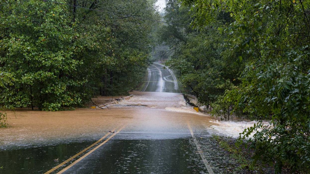
A flood watch was issued for much of the state, and now there are two flood warnings to contend with south and west of the Twin Cities.
Those warnings include the South Fork Crow River at Delano affecting Hennepin and Wright Counties, and the Minnesota River at Morton affecting Renville and Redwood Counties.
Recent heavy rain combined with forecast rainfall will lead to continued increases in area rivers such that these rivers will rise above flood stage later in the week according to the National Weather Service.
There's still uncertainty in where the heaviest rainfall will fall and that will impact where the largest river rises occur.
The current Flood Watch is posted until late Tuesday night but another wave of showers and storms arrives Thursday into Saturday.
WCCO Chief Meteorologist Paul Douglas says many of us will pick up another 2-4 inches by the weekend. He says a few spots may see over 6 inches and that could mean some significant flooding.
Flood Watch posted until late Tuesday night but another wave of showers and T-storms arrive Thursday into Saturday. Many of us will pick up another 2-4" by the weekend, a few spots may see over 6". Areas that normally flood probably will flood this week.https://t.co/5YlkiowOgw pic.twitter.com/1MIATPvetY
— Paul Douglas (@pdouglasweather) June 17, 2024
The weather service is warning motorists in these areas not to attempt to drive around barricades or drive cars through flooded areas. They're also urging caution when walking near riverbanks.
Douglas says when temperatures and humidity rebound on Tuesday, look out for more severe storms which could exacerbate the flooding due to heavy rains.
"When we get back into that tropical, 80 degree air mass with dew points in the 70s and sufficient wind shear, I think some of the storms late tomorrow, tomorrow night could certainly be severe," Douglas said.
This is all coming on the heels of a very rainy Saturday and Monday, sandwiched around a hot and humid Sunday.
"I think another inch, inch and a half Monday for most spots from this system coming through this morning, another inch or two late tomorrow, tomorrow night, then we get a little bit of a break Wednesday, Douglas explained. "Maybe a few hours of dry weather before the next round comes in Thursday through Saturday. There could be another inch or two."
FLOOD WARNING NOW IN EFFECT FROM TUESDAY EVENING UNTIL FURTHER NOTICE
* WHAT...Major flooding is forecast.
* WHERE...South Fork Crow River at Delano. Minnesota River at Morton affecting Renville and Redwood Counties. Minnesota River near Jordan affecting Sibley, Carver and Scott Counties. Minnesota River at Henderson MN19 affecting Sibley, Le Sueur and Scott Counties. Minnesota River at Savage affecting Dakota, Hennepin, Carver and Scott Counties.
* WHEN...From Tuesday evening until further notice.
FLOOD WATCH NOW IN EFFECT THROUGH LATE TUESDAY NIGHT
* WHAT...Flash flooding caused by excessive rainfall continues to be possible.
* WHERE...Portions of Minnesota, including the following areas: Anoka, Carver, Dakota, Hennepin, McLeod, Meeker, Ramsey, Renville, Scott, Sibley, Washington and Wright and west central Wisconsin, including the following area, St. Croix.
* WHEN...Through late Tuesday night.
* IMPACTS...Excessive runoff may result in flooding of rivers, creeks, streams, and other low-lying and flood-prone locations.