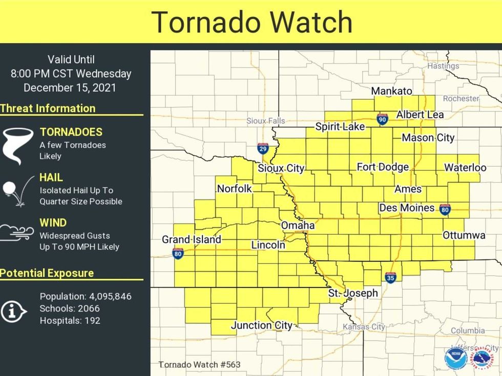
 Tornado Watch. NOAA has issued a Tornado Watch, valid for portions of southern Minnesota, until 8pm. Watches may be issued farther north, possibly including the MSP metro areaTwin Cities National Weather Service
And just like that, instant spring: 50s - even a few 60s over southern Minnesota this afternoon. Between the rain and the quick-thaw I've never seen snow melt so rapidly. Any sunshine will energize the atmosphere, and a small, compact storm approaching this evening will set off a squall line of strong to severe thunderstorms capable of wind damage, especially south and east of the Twin Cities.
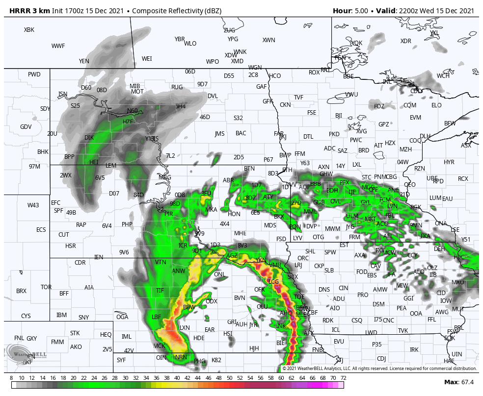 Future Radar. NOAA's 3km HRRR model brings a line of strong to severe T-storms into the metro area by 7 pm this eveningNOAA and weatherbell.com
How can this happen with snow on the ground. Potentially record warmth, coupled with high water levels (for December) and strong dynamics aloft (powerful, twisting winds called "wind shear" capable of causing T-storms to spin like a top). It's the spinning T-storms that Doppler radar picks up, and I suspect there will be severe storm and possibly even tornado warnings for parts of southern Minnesota and southwest Wisconsin by the evening hours. Surreal.
A few headlines and things to watch:
- These storms will move at 60-75 mph, which adds to the wind damage potential and leaves less time for warning. If a warning is issued head for cover immediately. You may not have the typical 10-13 minutes to get to the basement.
- Most of us will not experience severe weather, but the farther south you live from the Twin Cities the greater the odds of wind damage. Most of this will be straight-line wind damage with wind speeds as high as 100 mph, but a few isolated tornadoes can't be ruled out.
- This is historic. There has never been a reported tornado in Minnesota during the month of December. We aren't thinking about severe storms or certainly tornadoes 10 days before Christmas. Text or call a friend who may be in the path of these storms later today.
- Sustained winds may surpass 60 mph for a time tonight as much colder air pushes back into Minnesota. By daybreak temperatures will be in the mid-20s, so any wet roads and puddles will be icy. Expect a slow AM commute tomorrow morning.
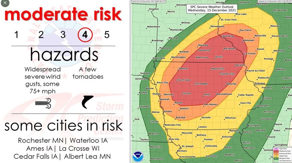 A Surreal Bullseye for Any Month - Especially December. NOAA SPC has a "moderate risk" of severe weather for much of southeastern Minnesota with a slight risk extending into the Twin Cities. A moderate risk usually means tornadoes and fairly extensive straight-line wind damage. I would think twice about evening plans.NOAA SPC
I'm warming up the Doppler radar and we'll be tracking storms on the air all afternoon and evening - I hope you can join us. Again, this is an historic outbreak of severe T-storms for Minnesota during what is allegedly meteorological winter. Be safe out there.