Here we go again. Another "snow event" is shaping up for Thursday and early Friday, and once again it should be enough to shovel and plow. Although with temperatures close to freezing I expect freeways and many other (darker, asphalt) roads and surfaces to stay wet and slushy. The sun is as high in the sky as it was in late September, and invisible infrared radiation can penetrate thick cloud cover and keep darker-colored roads wet this time of year.
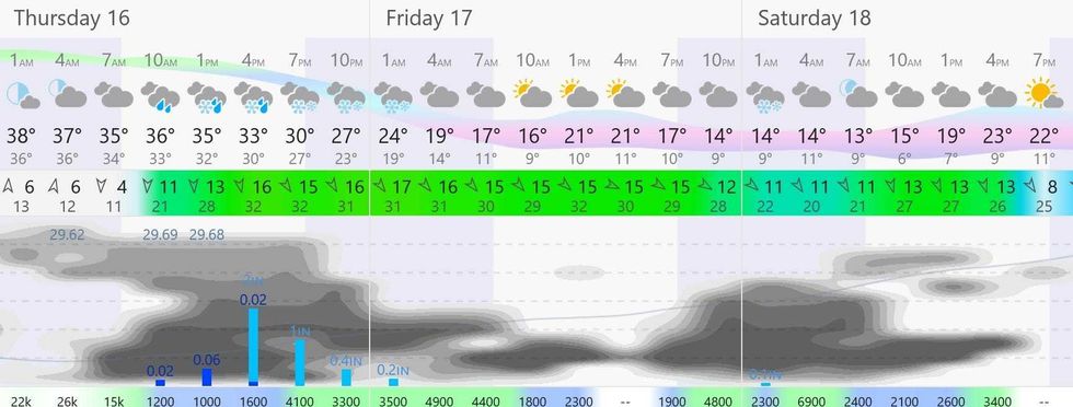 Meteogram shows the wind during the next three days, which will be high.(Image courtesy of windy.com)
Three Day Temperature and Wind Outlook
Today's storm starts as rain this morning, but as temperatures aloft cool off a changeover to wet snow is likely by afternoon. No big problems getting into work or school Thursday morning, but the drive home may be slushy and slow, with most of the accumulating coming after dark Thursday night, before tapering to flurries on Friday.
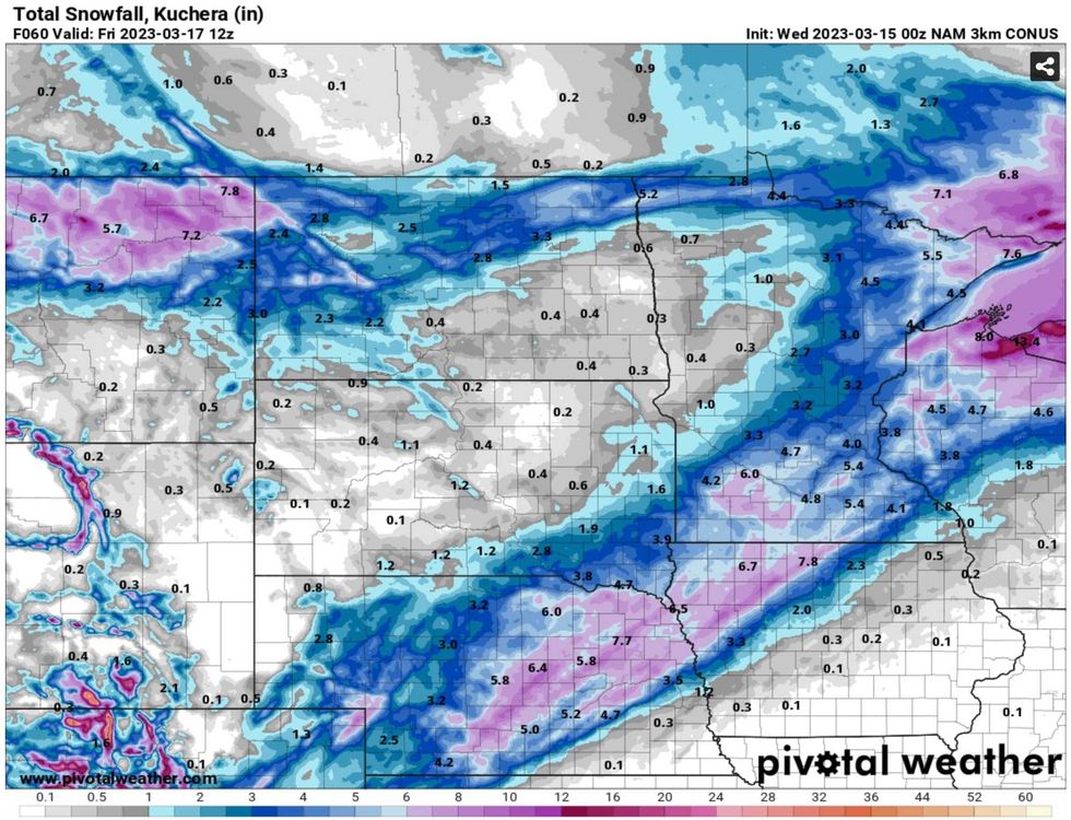 NOAA 3km NAM weather model(Image courtesy of pivotalweather.com)
NOAA Weather Model
NOAA's models generally agree with what the European model is predicting for Thursday's storm; something in the 3-5 or 3-6" range, mainly on lawns and fields.
Do not expect to wake up to 3-6" Friday morning on freeways and (asphalt) roads - there will be some slush accumulating on highways Thursday night, but not the full 3-6".
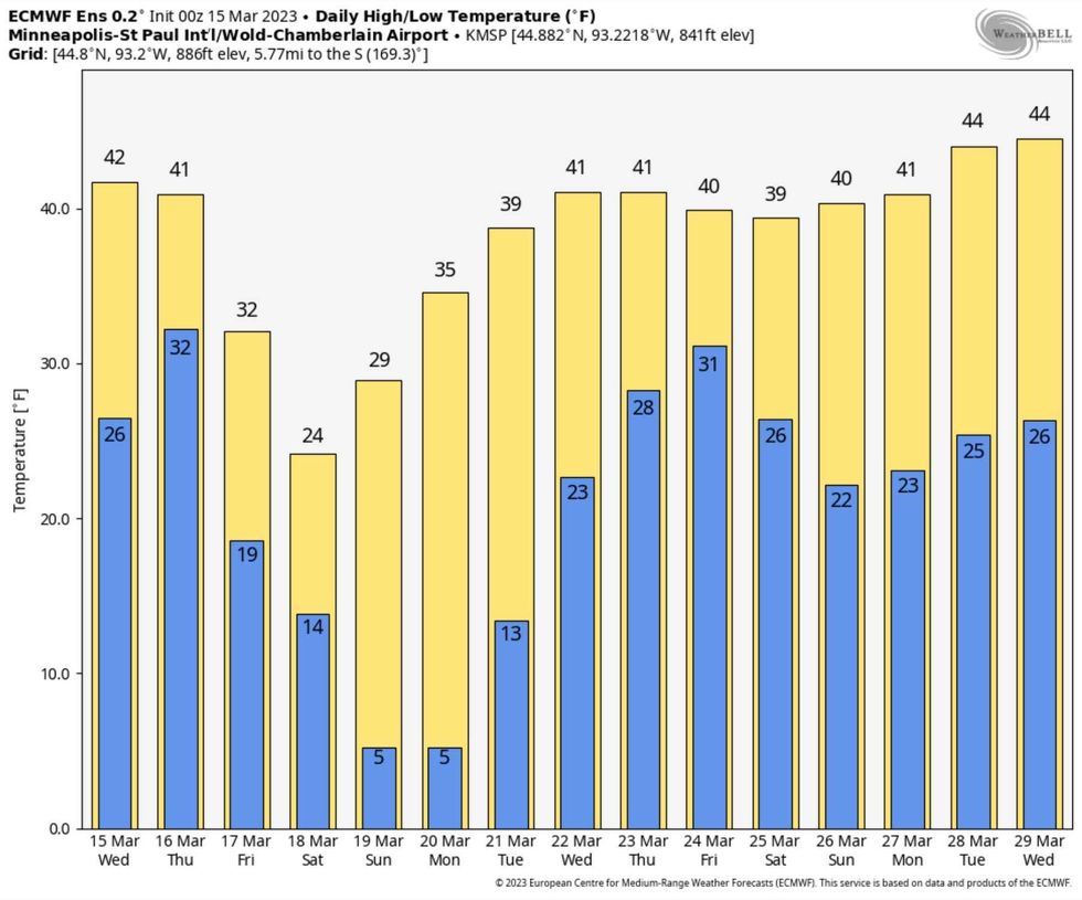 Twin Cities ECMWF Ensemble Temperature Outlook(Image courtesy of weatherbell.com)
Twin Cities Temperature Outlook
After the slush comes a (quick) pop of colder air. Friday may wind up being the chilliest St. Patty's Day in 30 years. The high back in 1993 was a brisk 19F. It won't be that cold this year, but you may need an extra layer or two if you plan on being out and about during the day Friday.
The average high now is close to 40F. and most of the weather models have us at or above 40F most of next week.
Hints of spring showing up on the maps. Small, subtle hints, which is probably a good thing considering all the water locked up in those snow banks and the ongoing risk of spring river flooding.
Keep in mind, if we get to 85" of snow at MSP this will be the 5th snowiest winter on record for the Twin Cities. By Friday afternoon we may be very close to that mark.