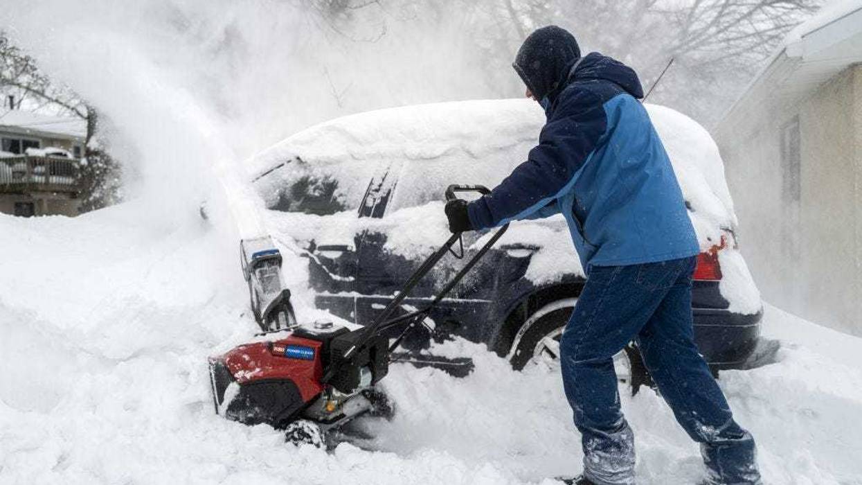
The snow has begun to fly across the Twin Cities. While this isn’t going to be a huge storm, it’s still going to be enough to cause a few headaches. And it is going to be followed up by another douse of the white stuff Saturday.
WCCO Chief Meteorologist Paul Douglas takes you through what to expect the rest of Thursday, over the weekend, plus looks at the total snow accumulation this winter and the unreal snow totals in the mountains of California.
Thursday Snow
Wednesday say about a half an inch to an inch and a half. It was that slushy, sloppy, classic March snow in Minnesota. Expect more of that says Douglas.
“I don't think this is going to be a powdery snowfall that you get when temperatures are in the teens or low twenties,” Douglas told Vineeta Sawkar on the WCCO Morning News. “This is going to be a heavier, wetter slush, or sloppier snowfall. And I think it'll peak this afternoon, this evening. Maybe an inch an hour in some spots.”
Douglas says this won’t be that big a deal due to the higher temps allowing roads to stay relatively clear.
“I think by midnight tonight we'll have another three to five, still kind of comfortable in that range,” predicts Douglas. “Most of it over by midnight. We get a little bit of a break tomorrow into Saturday morning.”
Snow This Weekend
The next system comes in Saturday afternoon and Saturday night before it tapers Sunday morning.
“Maybe another two to four inches over the weekend,” Douglas said. “Most of that coming really Saturday night. So you do the math. I think a lot of spots by midday Sunday will have an additional five, six, maybe seven inches of snow on top of the 75.3 inches that have already fallen.”
Total Winter Snowfall
We're almost two feet above average for an entire winter.
The normal snowfall in the Twin Cities according to the latest 30-year average is about 52 inches.
“We're over 75 and all we need is 3.1 inches for this to be a top 10 winter,” Douglas says. “Let's go for records. Let's go for bragging rights. Let's make our relatives in other more boring weather locales either faint or weep when they hear our weather stories. That's my goal.”
Douglas calls Minnesota the “Super Bowl of Weather”, so congrats to all you hearty Minnesotans.
“Only parts of Siberia see more extremes than we do,” Douglas told Sawkar Thursday. “We get about 30, 40 days a year where the weather is potentially life-threatening. We get supersized weather, an extra serving of extreme weather.
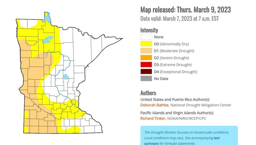 Last year, a lot of Central Minnesota was in the red, meaning extreme drought. The latest release from the U.S. Drought Monitor shows a lot of improvement.(U.S. Drought Monitor / NOAA)
This snow is a good thing too. The drought conditions we have dealt with over the last two years is largely taken care of due to the amount of moisture sitting on our yards. Douglas says there is potentially 4-5 inches of water in those snowbanks, enough to replenish waterways and hopefully soak into the ground once the freezing is done.
He does add, pray for a slow warmup. Anything that happens fast, 50 degree temps and rain, could potentially lead to catastrophic flooding across the region.
Forecast
Thursday: Snow with 3-5 inches, more to the south. High 34.
Friday: Flurries early then some brightening skies. High 33, low 26.
Saturday: More snow in the PM hours with 2-4 inches possible. High 30, low 26.
Sunday: A few more flurries but heavier snow north. High 33, low 28.
Monday: Sunny and windy. High 32, low 26 with winds out of the NW 15-25 mph.
Speaking of Supersized Weather
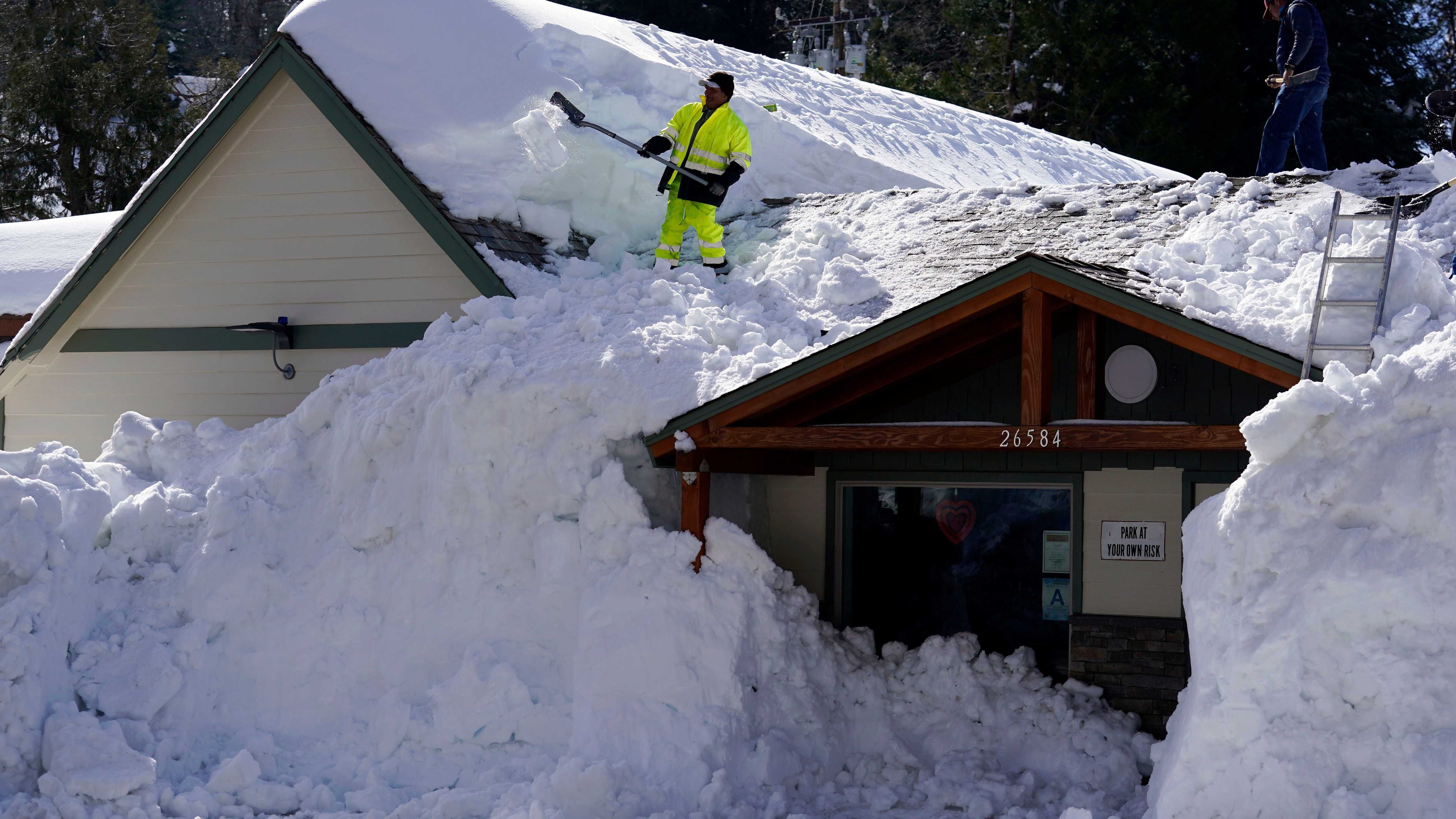
The mountains of California are getting pummeled. The amount of moisture and snow in the Sierras is astounding.
Say a prayer for folks in California, because they're going to get another 10 to 15 feet of snow in the mountains above 8,000 feet,” says Douglas. “People can't get out of their homes. They can't leave their cabins.
They're trapped by the snow. Rooftops are caving in just from the weight of all this snow.”
They are now pushing 50 feet of snow on the ground near the Donner Pass, where I-80 crosses the Sierra Nevada.
“I've never ever seen anything like this,” Douglas says. “And what's amazing is that this pattern is locked. It's just been a steady parade of these storms coming in off the Pacific. We get the storms gently used after they cross the Rockies, but they're getting the full brunt of this thing in California.
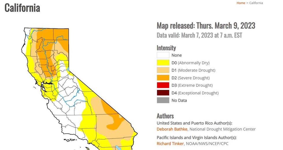 After being in extreme drought over much of the state, California has been hammered by rain and snow thanks to "Atmospheric Rivers" all winter which has eased drought and refilled reservoirs. Now the concern turns to what could be horrific flooding across the state.(U.S. Drought Monitor / NOAA)
That means the drought has eased for now in California, which has had literally years of dry weather.
“Reservoirs are brimming with water now,” said Douglas. “They're going to go from drought to possibly Biblical flooding here as all this snow starts to melt down in the coming weeks. So it's going to be a mess across much of the Western U.S.”