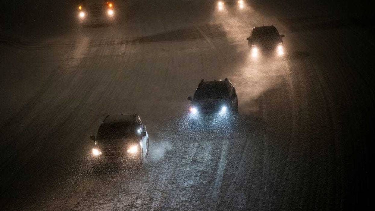
"It's going to be a pretty slow commute."
That's what you have to look forward to this afternoon according to WCCO Chief Meteorologist Chris Shaffer, because snow is on the way for our PM hours and it's going to be enough for headaches on the road.
"Eventually, moist air is going to arrive and it will overcome the dry air and it's gonna pop, almost like storms do in the summertime," Shaffer explained to Vineeta Sawkar on the WCCO Morning News Friday morning.
There is a Winter Weather Advisory in effect from 2:00 p.m. Friday afternoon through midnight for the extreme eastern part of Minnesota, southeastern Minnesota, and into western Wisconsin.
"Anywhere from one to three (inches), you'll see it blossom just west of the Twin Cities," Shaffer says. "That initial burst is going to lay down some accumulation on the roads, and that's the concern for the drive home. Flakes will still be falling while you're commuting home, so expect it to be slower and longer."
Expect more the farther east you go into Wisconsin and by the end of the snow late Friday?
"We'll see probably two to four inches," says Shaffer. "Better chance of two in the western suburbs, better chance of four in the eastern suburbs. And then if you're listing in Wisconsin, you have a better chance of three to five inches."
Happy Valentine's Day!
"For your Valentine plans, however you're celebrating, you're gonna need to leave early and you're gonna need to take it easy even coming home," says Shaffer.
The good news - after a very cold week - it'll be warmer with temperatures in the 20s on Friday. Enjoy it while you can because it's more bitter, bitter cold on the way.
"What you'll notice (Saturday) is the wind is going to pick up from the north," Shaffer explains. "So it's not gonna feel like 23 and maybe some scattered flurries passing by. But cold air cometh. 8 - that's the high on Sunday. We fall to 12 below Sunday night. It will feel like 32 below Monday morning and it's just going to be cold. We're talking about highs of 0, 3, 7 next week, and likely with the wind, feeling like 25 to 35 below. That's even here in the metro. So it's gonna be a pretty miserable feeling week next week, very dry."
The cold will be felt nationwide
This will be the 10th time this winter that the polar vortex — which keeps the coldest of Arctic air penned in at the top of the world — stretches like a rubber band to send some of that big chill south, said Judah Cohen, seasonal forecast director at the private firm Atmospheric and Environmental Research. In a normal winter, it happens maybe two or three times.
This winter, with record snow in New Orleans and drought and destructive wildfires in Southern California, has not been normal.
The latest projected cold outbreak should first hit the northern Rockies and northern Plains Saturday and then stick around all next week. The cold will likely concentrate east of the Rockies with only the far American west and central and southern Florida exempted, meteorologists said.
On Tuesday, expect the Lower 48 states to have an average low of 16.6 degrees Fahrenheit (minus 8.6 Celsius), and then plunge to 14 degrees (minus 10 Celsius) on Wednesday, calculated private meteorologist Ryan Maue, a former National Oceanic and Atmospheric Administration chief scientist.
Meteorologists expect strong winds to make the cold feel even worse. Every U.S. state but Hawaii, California and Florida have some or all parts forecast to have a good chance of windchills of 20 degrees or below sometime next week, the National Weather Service predicted.
Kansas, Nebraska, Missouri and Iowa will have “probably the most impressive” cold, with temperatures as much as 35 degrees (19 degrees Celsius) below what's normal for this time of year, said Zack Taylor, a meteorologist at the weather service's Weather Prediction Center. NOAA weather models predict Wednesday lows below zero in Oklahoma, Colorado, Nebraska, Missouri, Illinois, Iowa, Kansas, Wyoming, Montana, North Dakota, South Dakota, Minnesota, Wisconsin and Michigan.
The Associated Press contributed to this story.