DETROIT (WWJ) -- Plan ahead of you're going to be out and about. Snow moving into Metro Detroit on Saturday is expected to accumulate an inch or snow, making roads and freeways slick.
AccuWeather says this system would blow into the WWJ Newsradio 950 listening area the afternoon of Saturday (Feb. 8), threatening slippery travel conditions.
The snow was expected to start falling as early as 2 p.m., and continue until around 10 p.m.
"A period of light snow or flurries will be around this afternoon into tonight. Freezing drizzle could mix in, leading to slippery spots, but total snow accumulations will be light," said WWJ AccuWeather Meteorologist Bill Deger.
[Earlier, AccuWeather had been calling for 2-4 inches of snow on Saturday, but they're backing off on that.]
The high on Saturday will be around 32 degrees.
Sunday is looking breezy and cold, with clouds and a few peeks of sun, Lundberg said, with the high again around 32.
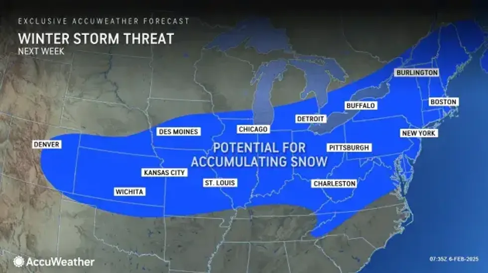
Looking ahead into next week, AccuWeather forecasters are keeping an eye on yet another winter storm that's expected develop across the Central and Eastern states. This one could also impact Southeast Michigan — the most likely day being Thursday (Feb. 13) — although it's too early to tell how much snow we may get.
 AccuWeather
A spot of good news if you're not a winter person: AccuWeather Meteorologist Brian Thompson said we're now officially past the coldest part of the season.
"And just the other day, back on Monday, we saw the average high temperature tick up a degree, from 32 to 33... We're making slow progress," Thompson said. "By the end of the month, average highs are near 40. So, some things to look forward to."
Get the detailed daily AccuWeather forecast HERE.
Stay with WWJ for weather updates, every 10 minutes on the 8s. Tell your smart speaker to "play WWJ nine-fifty" or download the FREE Audacy app to stream WWJ anytime. >>LISTEN LIVE