(WWJ) - Metro Detroiters have been spoiled with the warmest start to the winter season in nearly a decade, but meteorologists warm a blast of Arctic air bringing snow squalls and gusts of up to 50 mph will come howling into the region to start the work week.
While Michigan will dodge the second significant storm to strike the East Coast on Sunday into Sunday night, AccuWeather experts said the northern winds will start howling on Monday as it brings temperatures down into the 30s and increasing chances of snow showers.
"Winds across the Great Lakes on Monday as the storm exits could be strong enough to blow around holiday decorations," said AccuWeather Senior Meteorologist Adam Douty. "Because of that, homeowners may want to make sure outdoor decorations are secure."
Wind gusts ranging from 40 to 50 mph are possible from Sunday through Monday night, especially immediately downwind of the Great Lakes. In addition to yard decorations, the strong gusts could bring down tree limbs and cause power outages.
Another danger? Bursts of snow squalls -- the wintertime equivalent to sudden gust showers and thunderstorms we're familiar with in the summer months.
"The combination of the drop in temperature and some frozen precipitation can make travel tricky as early as the Monday evening commute in Michigan, including the Detroit metropolitan area," meteorologists added. "Roads and sidewalks will turn slippery, and visibility can drop due to windswept snow as temperatures tumble below freezing."
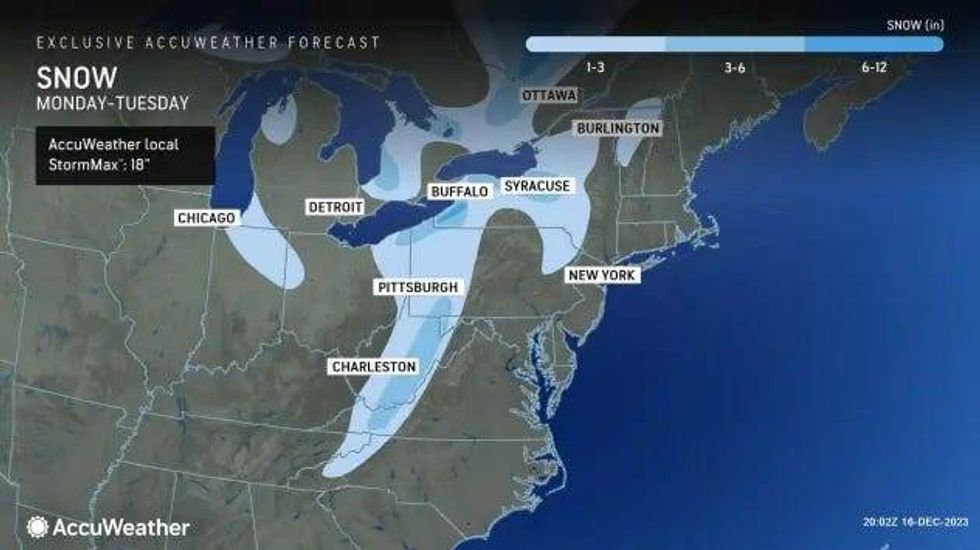
AccuWeather said while the snow squalls won't bring in any significant snow totals, there is still the potential for multiple heavy bursts throughout local area that could result in an inch or two of rapidly accumulating snow
 AccuWeather
Typical lake-effect snow belts in southwest Michigan could see several inches of accumulation if snowfall is consistent.
A Gale Watch is currently in effect for portions of Lake Michigan, Lake Superior and Lake Huron beginning Sunday night through Monday evening.
"Highest gusts up to 40 kts from the northwest and highest waves around 12 feet possible," the National Weather Service said. "Strong winds can cause hazardous highest waves which could capsize or damage vessels and reduce visibility."
Mariners are urged to consider altering plans to avoid possible hazardous conditions.
"Remain in port, seek safe harbor, alter course, and/or secure the vessel for severe wind and highest waves," the NWS warned.
The wintery weather will also bring in temperatures more suitable for the middle of December, but after the weekend's mild weather, it may come as a shock for some Michiganders.
 AccuWeather
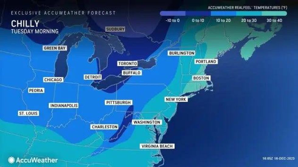
Tuesday will be a frigid start for Metro Detroit as temperatures are expected to dip into the low twenties and even into the teens -- with some places possibly flirting with single digits, AccuWeather added.
But there is some good news -- the wintery weather is expected to last for only 24 to 36 hours before quiet and mild conditions move back in.
"The cold will be short-lived, as temperatures return to or even above historical averages by the middle and end of the new week," said Douty.