


(WWJ) Authorities are advising the public to stay off, and away from the Clinton River for safety reasons, until further notice.
The means no fishing, no kayaking, and no walking on the trail nearby.
Due to recent weather and increased water flow, the Clinton River is currently unsafe for any recreational use, according to an alert shared by the Shelby Township Police Department on Thursday.
Officials say unstable riverbanks, strong currents, and hazardous debris have created "extremely dangerous conditions." These conditions significantly increase the risk of injury or accidental drowning — even for individuals with experience.
For your safety and the safety of first responders, please:
• Stay off and away from the river
• Do not walk, fish, or recreate near the water
• Keep children and pets well back from the river’s edge
• Call 911 immediately to report any emergency
Police added, "We appreciate your cooperation in helping keep our community safe. Stay alert, stay safe, and please share this message to help spread awareness."
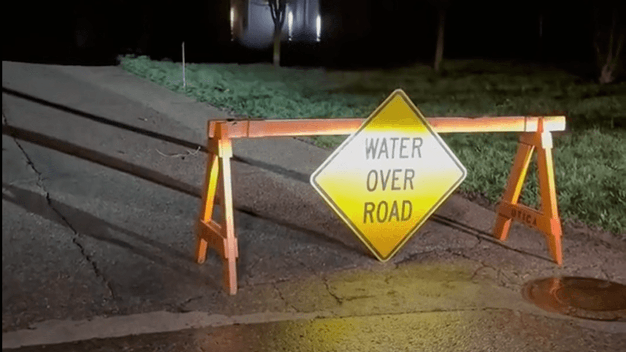
Video shot by WWJ's Charlie Langton Thursday morning showed water over the roadway in a Utica neighborhood, with significant river flooding.
The Clinton River flows roughly 83 miles from Oakland County to Lake St. Clair, draining a 760-square-mile watershed. As Michigan’s most populous drainage basin, it serves over 1.4 million people — popular for trout fishing in its upper tributaries, and boating near its mouth in Mount Clemens.
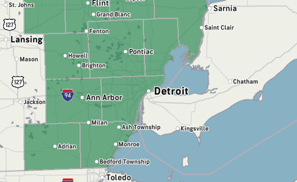
Flood watch area through Thursday night.
National Weather Service
This warning comes as areas across the state are experiencing a range of troubles with flooding.
With water levels already high, AccuWeather Meteorologist Joe Lundberg said any more rain the Metro Detroit-area gets on Thursday and into the weekend will exacerbate the problem.
All of Southeast Michigan, including Macomb, Wayne, Oakland, Genesee, Huron, Lapeer, Lenawee, Livingston, Midland, Monroe, Saginaw, Sanilac, Shiawassee, St. Clair, Tuscola, Washtenaw and Bay counties remain under a Flood Watch through Thursday night.
The National Weather Service said, although most locations were expected to see less than an inch of rain on Thursday, thunderstorms and heavy rain showers could produce localized accumulations of two inches or more on Thursday — with the soil is already drenched.
NWS warned that excessive runoff may result in flooding of rivers, creeks, streams, and other low-lying and flood-prone locations. Creeks and streams may rise out of their banks. Flooding may occur in poor drainage and urban areas. Low-water crossings may be flooded.
Gov. Gretchen Whitmer declared a state of emergency for Cheboygan Count, in northern lower Michigan, on Friday after meltwater from record spring snowfall and persistent rain threatened to overwhelm the dam.
The latest update from emergency officials show the water just five inches from the top of the complex despite efforts to divert as much water as possible from the area.
The state of emergency has since been extended to include 32 additional counties: Alcona, Allegan, Alpena, Antrim, Arenac, Barry, Benzie, Charlevoix, Clare, Crawford, Emmet, Grand Traverse, Gratiot, Iosco, Kalkaska, Lake, Leelanau, Manistee, Menominee, Missaukee, Montcalm, Montmorency, Newaygo, Oceana, Ogemaw, Oscoda, Osceola, Presque Isle, Roscommon, Saginaw, Shiawassee and Wexford counties.
AccuWeather says there could be a break in the rain on Friday, but more is expected over the weekend.
MORE: Severe storms continue to produce heavy rain, lightning and flooding across parts of US


