CALHOUN COUNTY (WWJ) - The National Weather Service has confirmed two tornadoes, one in Genesee County's Grand Blanc and one in Calhoun County's Marengo Township, after a rare bout of severe weather blasted the state Tuesday night.
Calhoun County Sheriff Steve Hinkley told WWJ's Beth Fisher that a tornado was witnessed by a weather spotter and a police officer in Lee Township at around 12:30 a.m. Wednesday, Feb. 28, just north of Marshall.
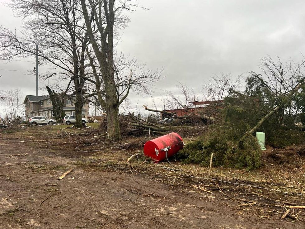
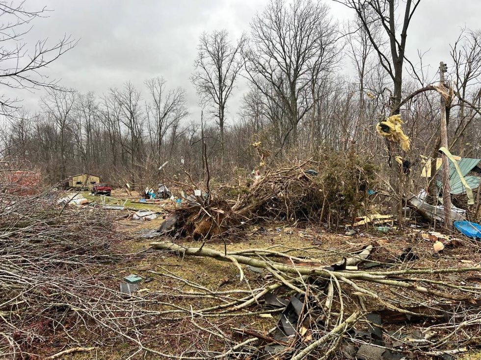
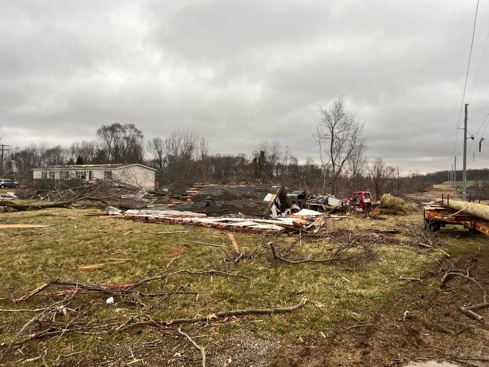
What later was confirmed to be an EF-1 tornado then began carving a path going northeast in almost a direct line with Duck Lake. Hinkley said the area of 17.5 and 24 Mile Road is where the heaviest damage was reported and where law enforcement are focusing their efforts.
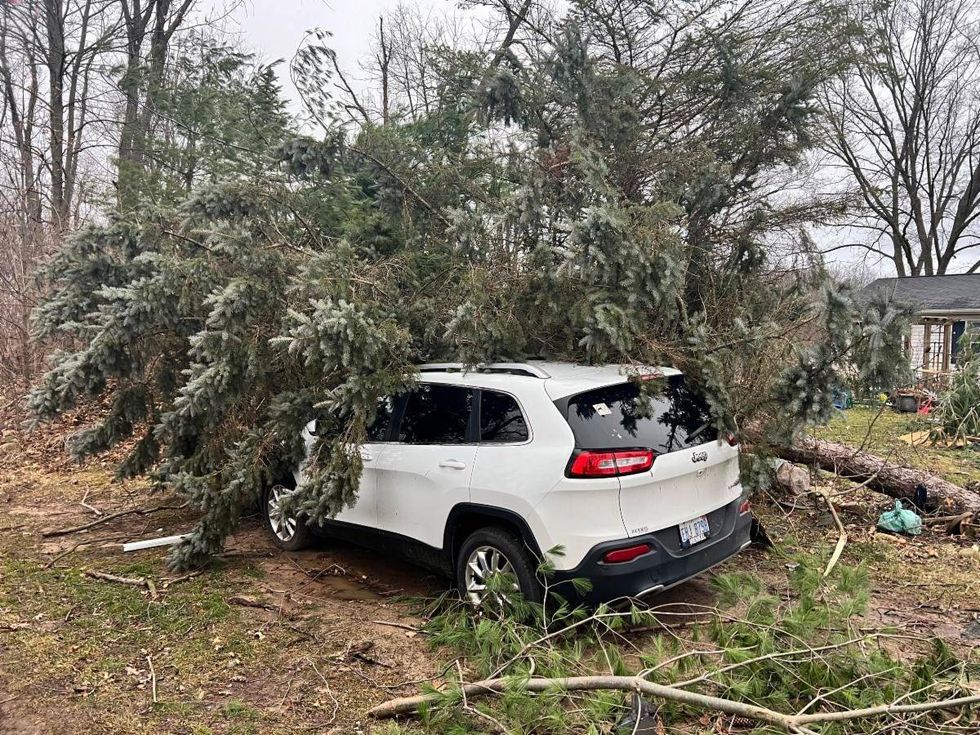
"[Officers] encountered multiple trees down, buildings, damaged barns, damaged power lines down," Hinkley added. "It was our road commission responded with heavy equipment and immediately able to clear a path for them so they could get into the scene more efficiently and they were able to go house to house and check."
The sheriff said there are no injuries reported at this point, but first responders are still working through the area at this time.
"We anticipate it's going to stay that way, but certainly we're still working through the process," Hinkley said. "It's a large area, but, we're feeling good being in a position of no injuries right now."
The sheriff said damage appears to be "significant" and strewn about a path five miles long, but deputies are unable to assess the destruction with drones due to high winds currently blowing into Southern Michigan.
"This has not been officially confirmed by the National Weather Service, we are going on information that was gathered from a spotter and a law enforcement officer and so we're waiting for the official word from them that this is a tornado," Hinkley added. "... yet again, the damage is incredible."
Law enforcement is teaming up with the Red Cross to help get affected residents what they need, but Hinkley said response is just beginning as the community picks up the pieces.
 Calhoun County Sheriff
 Calhoun County Sheriff
 Calhoun County Sheriff
 Calhoun County Sheriff
"We are just getting started to try to determine what the needs are and how we can accommodate those needs," he said. "So, you know, I hate to say it, but right now we just don't have enough information to know what direction we need to go, but I I assure you by probably noon or the end of the day, we'll have a comfortable feeling on what services we need to provide to people and how we can help them."
Hinkley strongly urged residents to stay clear of the hardest hit areas as work continues to help clear roadways and address downed powerline.
"The roads are being cleared pretty well by the road commission, but that doesn't mean that this area is safe in any way, shape or form," Hinkley warned. "...there are still power lines down along the road, service power lines to houses that are down on the ground... this isn't a safe area and if you do see or you approach a line, consider it live, period, and stay away from it."
The tornado in Calhoun County is one of two twisters people witnessed, with the other touching down in Genesee County. The Grand Blanc Police Department confirmed a tornado, later confirmed to an EF-2, began wreaking havoc at approximately 1:20 a.m. on February 28 in the area of Dort and Reid.
Officers responded to the scene with the department adding that police could see the twister from their patrol vehicles.
"The tornado path proceeded east from there through Grand Blanc City, Indian Hill Subdivision, the Commons, Kings Pointe Subdivision, through Perry and Belsay roads and then into Atlas Township," officials said of the storm.
For more information about the Grand Blanc Township storm, click here.
While the NWS has yet to officially gather data and assess storm damage to make an official designation and assign a category, meteorologist Cory Behnke with the National Weather Service's Detroit office did say that the Genesee County tornado did show up on radar.
"The National Weather Service office in Grand Rapids had issued a tornado warning, I believe for Calhoun County and Jackson County, preceding the storm," Behnke said. "I guess that developed and strengthened in Genesee County."