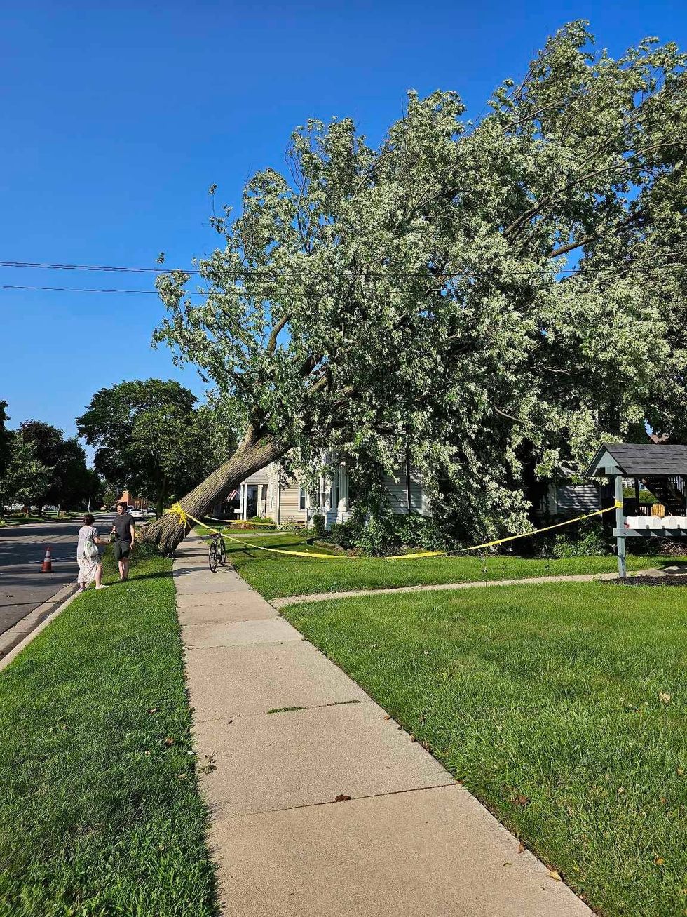
DETROIT (WWJ) - Southeast Michigan got hit by another round of severe weather on Thursday as high winds, heavy downpours and hail hit the area, leaving tens of thousands of people without power.
Cleanup efforts are now underway after the strong storms knocked down trees and flooded roads in some areas.
As the weather died down around 5 p.m. there was spotty flooding reported across the region, including on I-696, M-39, I-96 and I-75. Drivers were urged to use caution.
A particularly hard-hit area was on Pelham Street near the I-94 entrance and exit ramps near the Allen Park-Taylor border, where one man told WWJ's Jon Hewett his car stalled out as traffic in front of him slowed due to the flooding.
The Ann Arbor Art Fair was put on hold until about 5 p.m. as the area was put under a Severe Thunderstorm Warning, but it has since resumed.
More than 88,000 DTE Energy customers were without power as of 8:45 p.m. CHECK THE DTE OUTAGE MAP HERE. Elsewhere in the state, around 20,000 Consumers Energy customers were in the dark.
WWJ listeners have reported "baseball sized" hail causing damage in Davison -- east of Flint -- while Sterling Heights saw hail about a half inch.
A dialysis center on Dequindre across from Beaumont Hospital lost power and was running on a generator.
Plymouth saw high winds take down a tree one listener estimated to be 100 years old along S. Union Street.

Warren Mayor Jim Fouts tells WWJ high winds and hail caused several transformers to explode on the city's northwest side, leaving thousands of people without power. The Community Center was running on a generator, Fouts said.
Early Thursday morning NWS meteorologists in Detroit upgraded Southeast Michigan to an "Enhanced Risk" for severe thunderstorms, or a level 3 out of 5 as a cold front prepared to make its way across the area.
Experts said the storms were expected to start off as smaller, discrete cells -- which make for brief thundershowers -- before transitioning into a more powerful squall line.
A squall line is a group of storms arranged in a line, often accompanied by "squalls" of high wind and heavy rain, the NWS said.
But the biggest threat was the strong possibility for the formation of supercells, which are longer-living and highly-organized storms, and bowing structures, which occurs when strong winds reach the surface and spread horizontally.
And both are capable of producing tornadoes.
So far, there have been no confirmed reports of tornadoes in Michigan on Thursday.
Thursday's severe weather threat comes a week after an EF-1 tornado touched down near Colon in Southwest Michigan on July 12. The twister was on the ground for roughly 2.92 miles with a peak estimated wind speed of 90 MPH.
Not 48 hours later, another round of strong storms swept through Southeast Michigan, with a confirmed EF-0 tornado striking Sanilac County near Lexington on Friday, July 14.
According to NWS, the tornado reached maximum wind gusts of 85 mph and tracked for roughly 5 miles.
State officials with MIREADY advise the following actions to better prepare yourself and your family in the event of severe storms:
• Remove dead or rotting trees and branches that could fall on your home with strong winds.
• Postpone outdoor activities until the storm has passed.
• Secure outdoor objects that could be blown around, such as garbage cans and patio furniture.
• Close all windows and blinds.
• Charge cell phones and other wireless communication devices.
• Sign up to receive text or e-mail alerts from your local media, weather provider or the National Weather Service.
• Plan a way to monitor local weather and news while in shelter.
• Identify the safest shelter location in your home; it should be on the lowest level, away from windows and doors.
• Prepare for a power outage.
Stay tuned to the latest weather updates with WWJ Traffic and Weather on the :08s by listening LIVE.


