
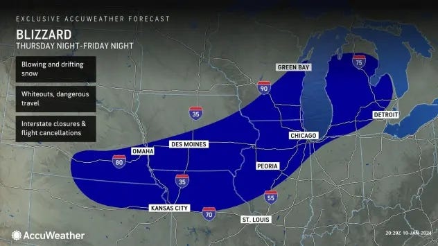
DETROIT (WWJ) - Weather experts are ringing alarm bells across Michigan as the state finds itself in the crosshairs of a major winter storm expected to rapidly intensify into a dangerous blizzard from Friday into Saturday.
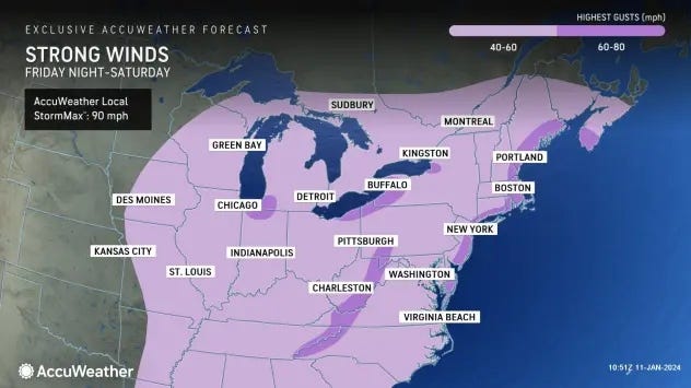
AccuWeather meteorologist Dean DeVore said the storm will thrash some areas with a foot or more of snow, frigid air and brutal winds from 40 to 60 mph that could create dangerous and life-threatening conditions for people and animals caught outside this weekend.
A Winter Storm Watch is currently in effect for Oakland, Washtenaw and St. Clair Counties. The majority of the state has since been upgraded to a Winter Storm Warning.
Wayne, Macomb, Monroe and Lenawee Counties are now the only counties in the state without a Watch or Warning, as of 4 p.m. Thursday.
The watch goes from now into Saturday afternoon.
The storm, which is now moving over the Plains, is forecasted to become stronger and colder as it undergoes bombogenesis, or rapid intensification, and emerges as a "bomb cyclone," AccuWeather experts warn.
It will thrash West and Lower Northern Michigan the hardest, but its affects will still be felt throughout Metro Detroit.
DeVore said warmer temperatures will mix in at first in Southeast Michigan with highs in the upper thirties when the storm arrives on Friday, but dangerous cold will take hold and cause any rain to switch over to snow.
According to AccuWeather, the worst of it is expected to hit the WWJ listening area during Friday's afternoon commute.
"We're putting numbers in, but you may not be able to measure it," DeVore said about possible snow totals around the Metro area. "It's gonna be blown around so much. It's going to be drifts."
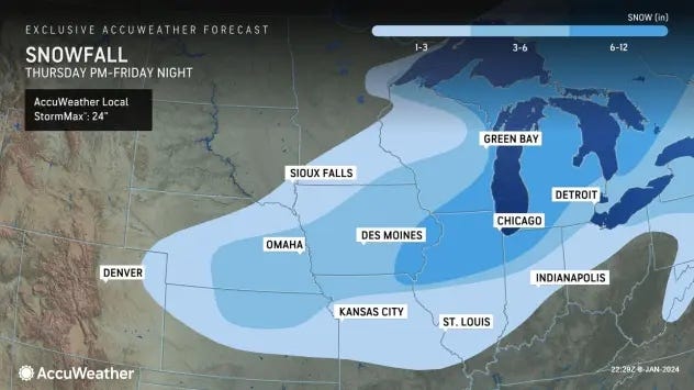
Those immediately in and around Detroit are forecasted to get three to six inches of snow with northern and western suburbs expected to see six to twelves inches of snow.
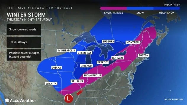
Travel in and around the area will be treacherous with conditions becoming life-threatening or near impossible the further north and west you go, AccuWeather stated.
The National Weather Service in Gaylord said they're expecting the heaviest snowfall from Friday evening into Saturday morning. Cities including Cadillac, Gladwin, Traverse City, Manistee, Oscoda, Gaylord, Grayling, Rogers City, Alpena and more have the potential to see at least 8" of snow with communities closer to Lake Huron -- including Alcona, Alpena, Black River, Glennie, Harrisville, Milo, and Lincoln -- have a high chance of seeing more than a foot of snow.
The heavy snow combined with forecasted wind gusts of over 50 mph will lead to possible whiteout conditions.
"Potential significant blowing and drifting snow and near-zero visibilities at times," the NWS Gaylord post said in a social media update.
The NWS post in Grand Rapids issued a similar message to residents on the coast of Lake Michigan from St. Joseph up to Muskegon and further inland to Mid-Michigan communities from Lansing to Kalamazoo and up to Big Rapids and Clare.
"Main concerns are wind gusts of 30-45 mph and heavy snow causing blowing and drifting snow, whiteout conditions, power outages, and hazardous travel conditions," NWS meteorologists said.
Back in Metro Detroit, DeVore said the storm will also usher in a rapid freeze up as temperatures keep falling Saturday through the 30s into the teens by Saturday night with snow showers and bitterly cold temperatures behind the storm.
According to AccuWeather, anyone who finds themselves outdoors during the storm would be at risk for hypothermia and frostbite as peak winds whip through.
The cold weather threat will continue to grip the state even after the storm moves out.
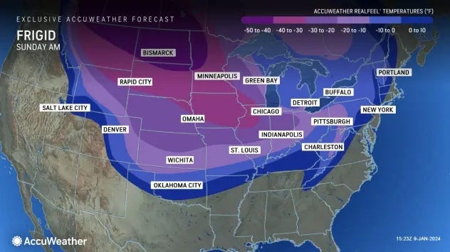
"Sunday, Monday, Tuesday, highs only in the low to mid-teens and Real Feels a lot of those times near or below zero," DeVore warned.
The frigid temperatures along with strong winds will lead to rapid ice build-up along the Great Lakes and freezing over wash and spray along shorelines. The Arctic blast is also predicted to produce bands of heavy lake-effect snow immediately after the storm.
A Storm Warning has been issued by the NWS for portions of Western, Central and Eastern Lake Superior beginning 1 p.m. Friday until 7 p.m. on Saturday, urgently warning sailors to remain at port, alter their course or secure their vessel for severe conditions as the storm moves through.
Forecasters say northeast winds will blow 35 to 45 knots with gusts up to 55 knots and waves 18 to 23 feet expected.
"Very strong winds will cause hazardous waves which could capsize or damage vessels and reduce visibility," the NWS warned.
Don't miss a thing! Stay with WWJ for traffic and weather updates, every 10 minutes on the 8s, listen anytime on the free Audacy app, or tell Alexa: "Play WWJ nine-fifty."