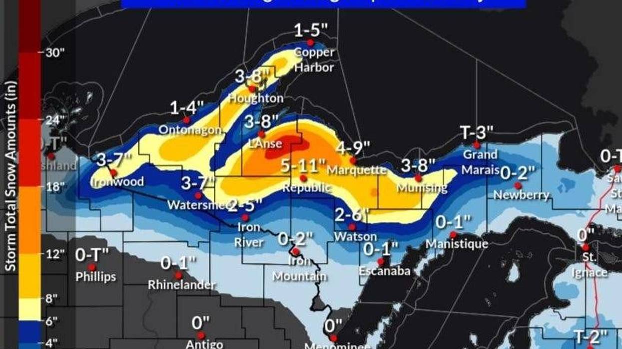
MARQUETTE (WWJ) - A record-setting May snowstorm is bringing historic snow totals to regions in the Upper Peninsula as winter refuses to relinquish its grip on Michigan.
Nation Weather Service forecaster Jonathon Voss out of Marquette told WWJ's Beth Fisher that the storm walloped the region and broke a decades-old record in the process.
"We set a record snowfall for the date of 19.8 inches which smashed the previous record of 5.4 inches in 2019 for the date," Voss said.
According to Voss, the storm appeared to bullseye western Marquette County over the last two days, which has caused dangerous travel conditions and widespread power outages.
"It's been a really dense snow," he explained. "[It's] very hard to move, you know, basically like wet concrete. [If you're] trying to move it or drive through that, it's been very hazardous if not impossible to drive through in some cases."
Winter Storm Warnings remain in effect for several counties in the U.P., until Tuesday afternoon, including Cooper Harbor, Houghton, Hancock, L'Anse, Gwinn, Marquette, Grand Marais and Munising.
The low-pressure system, which is associated with a weather pattern called a "Omega block," has brought sporadic power outages across the area as heavy snow toppled trees.
"Many of the power outages have been in Marquette County there... nearly 2,300 in Marquette County," he estimated.
Voss said the snow storm is renewing already present flooding concerns -- and the threat of snow isn't entirely over yet.
"It looks like even at the end of next week, there's a potential that there could be another storm system that... could bring us some more snow," Voss explained. "It's been pretty active pattern for us, from April to May."
The NWS has issued a Flood Watch from now through Friday morning for central and western Upper Michigan as a warm spell begins to melt the historic snowfall.
"Excessive runoff may result in flooding of rivers, creeks, streams, and other low-lying and flood-prone locations," forecasters warned. "Creeks and streams may rise out of their banks. Area creeks and streams are running high and could flood with more heavy rain."