(WWJ) - Experts warn treacherous travel conditions and whiteout bands of heavy flurries will begin Sunday and persist into the week as the first major lake-effect snow event of the season sets its sight on Michigan.
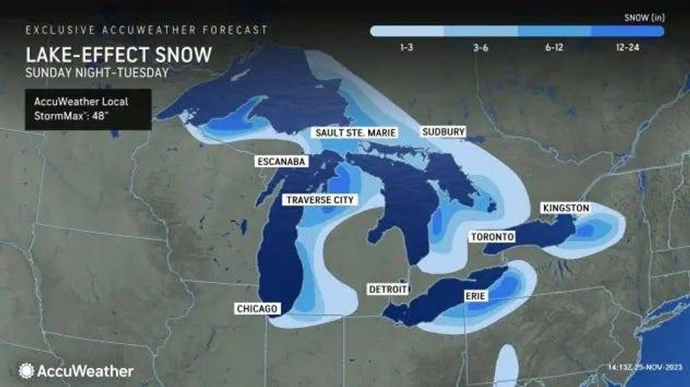
AccuWeather meteorologists say snowfall totals are likely to exceed one foot with heavier snow bands forecasted to strike northern and western Michigan while some areas in the Upper Peninsula could challenge or perhaps even exceed three feet of snow.
"Some of the most favored snow belts in the Upper Peninsula of Michigan, 'ski-country' south of Buffalo and the Tug Hill Plateau in northern New York are likely to challenge or perhaps even exceed 3 feet of snow, depending on the persistence of the heavy bands," AccuWeather Storm Warning Meteorologist Jake Sojda said.
The lake-effect snow is expected to start flying on Sunday after three storms merge together into one large storm over eastern Ontario and Quebec, Canada, AcuuWeather experts explained.
 AccuWeather
"As that large storm strengthens, winds will increase substantially, and Arctic air will be funneled across the open waters of the Great Lakes, leading to everything from flurries and snow showers to bands of heavy snow and snow squalls," meteorologists said. "In some cases, the lake effect may act like a thunderstorm in the winter and could produce thunder and lightning, creating a phenomenon known as thundersnow."
The major concern with lake-effect snow is the high probability of heavy snow bands and snow squalls which can lead to sudden, poor visibility on roadways.
Such intense conditions have been behind a number of massive pile-ups across the country, including the 150-vehicle crash that closed all lanes of I-96 in Ionia County, Mich. back in March.
Experts warned that whiteout conditions can occur "in a matter of seconds" for drivers traveling at highway speeds and create wet to snow-covered surfaces with little reaction time.
"Some roads may even close for a time due to the intensity of the lake-effect snow," Sojda added.
But experts said roadways aren't the only mode of travel that will be impacted.
The National Weather Service issued a Gale Watch in effect early Monday morning through Monday afternoon for mariners on the north half of Lake Huron.
Westerly winds of 25-30 knots with gusts up to 35 knots are expected in open water from Mackinac Bridge to Sturgeon Point from 4 a.m. to 4 p.m. on Nov. 27.
"Significant waves of 10 to 12 feet with potential maximum wave heights of 15 to 20 feet," the NWS said.
AccuWeather explained that a disturbance could expand the range of lake-effect snow beyond where its typically seen in West Michigan, bringing heavier bursts as far east as Detroit.
The NWS said accumulating snow from later Sunday night to Monday is possible is the Motor City and its surrounding suburbs. As of now, local forecasts predict anywhere from trace amounts in Downriver communities to up to 2 inches of snow for northern Metro Detroit.
By Tuesday evening, the lake-effect snow is likely to diminish, but winter will continue to make its presence known into the later part of the week.
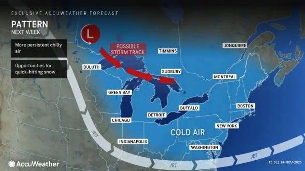
A system, called an Alberta clipper storm, is forecasted to drop in and bring a new round of lake-effect snow bands as well as "painfully low" temperatures and blustery winds more commonly seen in January or February.
 AccuWeather
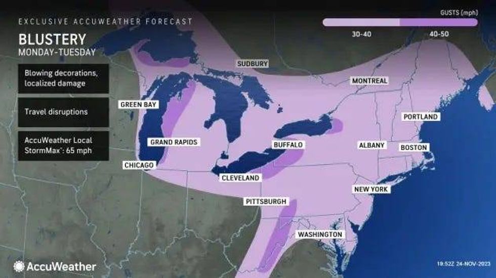
"The strong winds associated with the Arctic air outbreak and lake effect will create painfully low AccuWeather RealFeel® Temperatures, more typical of the middle of the winter. Frequent wind gusts will range between 30 and 50 mph near the Great Lakes," AccuWeather forecasters warned. "The AccuWeather Local StormMax™ Wind Gust is 65 mph. At this level, sporadic power outages could occur."
AccuWeather RealFeel® Temperatures predict temperatures could even dip to 20 degrees Fahrenheit lower than the actual temperature, which will dip well down into the 20s in some areas.
 AccuWeather
"The persistent winds will push lake waters toward the west- and northwest-facing shorelines, where overwash and even freezing spray are likely in some places," AccuWeather warned.
Stay tuned to WWJ Newsradio for the latest weather forecast and traffic updates on the :08s >>> LISTEN LIVE!