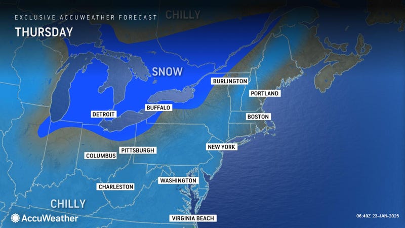
SOUTHELD (WWJ) -- It was a dicey morning commute on Thursday, as snow made roads slick — making many Metro Detroiters late for work.
Michigan State Police urged drivers to leave early and slow down, as crashes were piling up in Macomb, Oakland and Wayne Counties.
Northbound I-75, which was shut down at Northline Road for a jack knifed semi, has since reopened. At 10:30 a.m., WWJ Traffic Reporter Scott Ryan said it remained a slow go in Oakland and Livingston Counties, and there were several crashes causing backups on I-696, I-75 in Oakland County and on I-94.
The Macomb County Department of Roads crews were called in Wednesday night, with 60 trucks are working primary and state routes.
Craig Bryson with the Road Commission for Oakland County said the salt should work, once crews are able to get through traffic.
"These temperatures are certainly much better then they've been over the last couple of days; we're in the mid-to-upper teens," Bryson said. "It's not ideal, but it's far better than it was, The salt is working; especially the salt mixed with the brine. It does a good job in these temperatures.
"That, at this point in not the problem," he said. "The problem is getting through the rush hour traffic and getting things cleaned up."
According to the National Weather Service, some areas of Metro Detroit got up to three inches of snow overnight.
As of 9 a.m. Thursday, Lapeer had the most fresh snow, at 3 inches. Eastpointe, Shelby Township, and Howell all got 2 inches, while Ann Arbor only had about 1 inch of accumulation.
Other cities saw snowfall totals between an inch to an inch-and-a-half, NWS said.
AccuWeather Meteorologist Joe Lundberg said while the clouds were thinning out by late morning, there was least a little more snow on the way,.
He said the snow would continue to fall in parts of Metro Detroit into the early afternoon hours, before tapering off.
"This afternoon, I think it's a little more than flurries or maybe a heavier snow shower," Lundberg said. "The front should come through early in the afternoon. Temperatures will spike into the upper 20s with it.
"And then it will start to go the other way and skies will quickly clear this evening after any evening flurries depart... and then by (Friday) morning we're back down near 10."
Get the detailed daily AccuWeather forecast HERE.
Stay with WWJ for weather updates, every 10 minutes on the 8s. Tell your smart speaker to "play WWJ nine-fifty" or download the FREE Audacy app to stream WWJ anytime. >>LISTEN LIVE
