



DETROIT (WWJ) — Rare winter severe storms and tornadoes could be possible for much of Southern Michigan, including Metro Detroit, on Tuesday into Wednesday — but that's not all the weird weather residents will experience, experts warn.
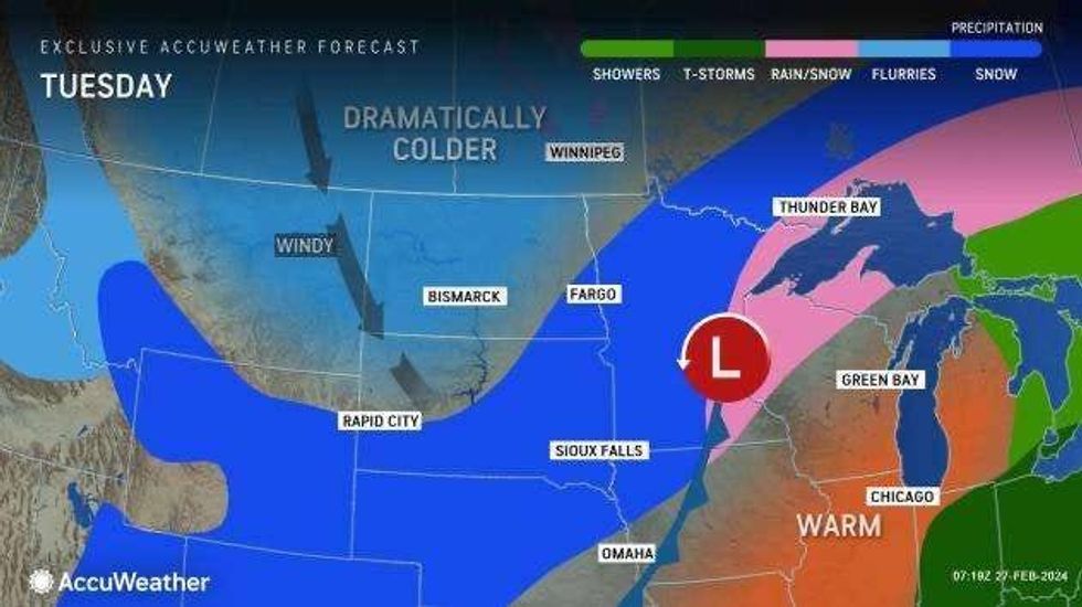
WWJ AccuWeather meteorologist Matt Benz said a powerful cold front will bring a shot of June-like warmth up into the Great Lakes region on Tuesday with temperatures forecasted to reach 67° and break the record of 63° set back in 1976.
But the warmth will come at a cost.
"Tracking some heavier thunderstorms into this evening and these mean business," Benz warned, "with flash flooding, damaging winds and hail —even an isolated tornado can't be ruled out here in Metro Detroit and actually across much of lower Michigan."
According to the National Weather Service's Detroit office, the severe weather threat will blow in at 45 mph between 8 p.m. Tuesday through 4 a.m. Wednesday.
 AccuWeather
"As that storm interacts with a strong jet stream, surging Gulf of Mexico moisture and an increasing temperature difference between unusual warmth and February cold, natural fireworks in the form of powerful thunderstorms will unfold," AccuWeather explained.
Meteorologists warned "all modes of severe weather are anticipated" with the storms, with the potential for multiple tornadoes the most serious concern.
While AccuWeather predicts large hail up to an inch in diameter, the NWS said 2" hail is also possible.
There's also a possibility for flash flooding across the area.
Localized damaging wind gusts between 55 and 65 mph are forecasted with an AccuWeather Local StormMax of 80 mph, which is 5 mph above hurricane force.
Storms will transition to linear mode with isolated damaging wind threat possible until the front passes.
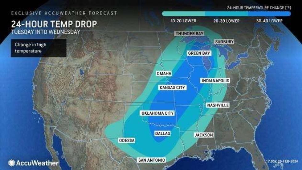
AccuWeather meteorologists said Metro Detroiters are also about to experience a weather whiplash with temperatures forecasted to plummet as much as 50 degrees in less than 24 hours.
"We'll start off in the 50s early [Wednesday], ending up in the upper twenties by the evening, any rain will become mixed with before ending as snow here later in the afternoon tomorrow," Benz said. "And there could be some slick spots as things rapidly freeze up."
 AccuWeather
In the meantime, Benz advised those in the path of the storms to stay weather aware and up-to-date on the latest forecast by signing up for alerts that will reach them in the event of severe weather in the middle of the night.
Stay tuned to WWJ Newsradio 950 for the latest traffic and weather updates every 10 minutes on the :08s. >>> LISTEN LIVE!