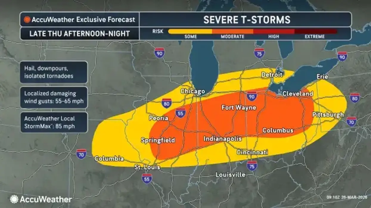
DETROIT (WWJ) -- After a calm start to Thursday in Metro Detroit, forecasters warned that storms are on the way, with some severe weather expected in our region.
AccuWeather said the risk for severe weather will arrive as a cold front pushed through, and temperatures drop.
Meteorologist Joe Lundberg said clouds will start to increase, and showers could start as early as 2 p.m. or 3 p.m. in Metro Detroit. But he said the stronger stuff is expected later, closer to 5 p.m. or 6 p.m. — with the worst of the bad weather continuing until around 9 p.m.
"And those thunderstorms have the potential of being severe," Lundberg said. "That includes the risk of hail, damaging winds, downpours, and yes, even an isolated tornado."
The southern half of southeast Michigan is at risk for severe weather on Today. #MIwx pic.twitter.com/spWCLDEHLW
— NWS Detroit (@NWSDetroit) March 26, 2026
The National Weather Service said the system has shifted a bit to the south, with areas near or below the state line at most risk for heavy downpours and flooding.
Keep your radio tuned to WWJ Newsradio 950 (AM 950) for the latest weather and traffic updates every 10 minutes on the :08s. >>> LISTEN LIVE HERE , or download the free Audacy app and follow WWJ. Tell Alexa: "Play WWJ nine-fifty."