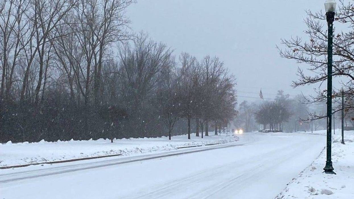
SOUTHFIELD (WWJ) -- Another blast of snow hit the Metro Detroit area overnight, continuing into Wednesday morning for a slow and slick commute.
To put it simply: The roads are horrible.
The National Weather Service has issued a Winter Weather Advisory, in effect through 1 p.m. Wednesday for all of Southeast Michigan — with peak snowfall intensity forecasted between 6 a.m. and 10 a.m.
About one to three inches of snow accumulation is expected, according to AccuWeather Meteorologist Brian Thompson, with the highest amounts between I-94 and I-69.
While drivers are reporting icy and treacherous driving conditions all across the WWJ listening area, police advise drivers to slow down and don't tailgate.
There have been multiple crashes reported, and commutes that are taking double or triple the usual time.
Steve Grunwald, with our sister station WYCD, called the newsroom to report problems on I-696 near Orchard Lake Rd.
"The road is solid ice," Grunwald said, in a mid-morning interview with WWJ. "Now, I didn't think it was icy, but I started to slide a little, and then I've watched three accidents so far that have happened because of these roads, and people driving too fast and not realizing that the snow has been packed down to solid ice."
Grunwald said he was traveling around 35 miles an hour with four wheel drive, which he said may even be a little too fast for the road conditions.
"But I have people passing me left and right, and I don't think they realize how dangerous it is out here. And you're really not gonna know unless you turb suddenly, or hit the brakes," he said.
We'll have updates throughout the day on WWJ Newsradio: That's
AM 950 on you radio. You can also listen anytime HERE or in the free Audacy app.
Much of southern lower Michigan is getting a fresh coating of snow. The National Weather Service has posted Winter Weather Advisories for counties south of a line from Midland to Ludington. Anywhere from two to six inches of snow is expected.
In Northern Michigan, some areas have already matched their snow totals for an entire year.
The NWS in Gaylord said snowfall totals in Sault Ste. Marie, which has measured 120 inches of snow, have already reached the normal amount for an entire winter season.
More than normal amounts are also reported in Alpena, Traverse City, Petoskey, West Branch and Houghton Lake.
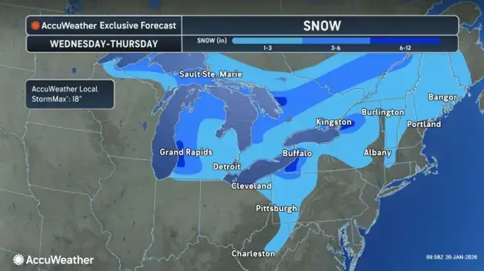 Snowfall map for MichiganAccuWeather
Looking ahead in Metro Detroit, AccuWeather is calling for frigid cold the next few days. After highs gets up into the low 30s Wednesday afternoon, it won't be that "warm" again for some time.
On Thursday, the high in Metro Detroit will be around 26 degrees, with a low of 7 degrees overnight. Friday will be even colder, with highs reaching only 11 degrees, with flurries and a bone-chilling low of -6.
On Saturday, AccuWeather is calling for highs only in the single digits in Metro Detroit, with a little snow possible.
The next chance for noteworthy snow will be on Sunday, AccuWeather says, with some parts of Metro Detroit could see a few inches of fresh accumulation. The high Saturday will be around 15 degrees, with a low of 7.
Get more forecasts details from AccuWeather at this link.