DETROIT (WWJ) - A rare February warm-up is bringing in record-setting heat that's already beat Flint's previous daytime high and tied records previously set in Detroit and Saginaw, officials said.
At 11 a.m. on Friday, Feb, 9, the National Weather Service in Detroit said the recorded temperature was 56° which has already tied the record high on this day in 1966 and in 2001.
"It's unbelievable to see temperatures at this time of the day, around 50 degrees," AccuWeather Senior Meteorologist Joe Lundberg told WWJ's Jonathan Carson. "I mean, that's our normal high at the end of March, not normal lows in early February, but that's what we're dealing with for another day."
In Flint, the highs are already pushing the mercury past 55° which shattered the previous record of 54° also set in 1966 and 2001.
A temperature of 53° recorded at 6 a.m. in Saginaw already tied the daily record set 99 years ago in 1925, experts said.
"Plenty of daytime left to surpass those records further," the NWS added.
Punxsutawney Phil's prediction of an early spring looks like it might hold true over Woody's, Michigan's official weather-predicting groundhog that said we're stuck with winter for the next six weeks, an unseasonably warm, spring-like pattern swooped across the state this week.
Experts say a strong area of high pressure is causing a "weather whiplash" as Michiganders go from nearly a month of dank, cloudy weather to abruptly sunny and dry conditions.
"A large, northward bulge in the jet stream has driven all of the Arctic air out of the country," said Lundberg, "There's just nothing to replace it, leading to this very warm pattern for February."
 AccuWeather
The warmth began last week and ushered in record-breaking temperatures 10-20 degrees above the historical average this time of year.
Lundberg said breezy, spring-like conditions with a shower or two in a few spots around the Metro Detroit possible as Friday goes on.
So far, forecasters say Detroit will see temperatures up to 61°.
Saturday will be cooler, but temperatures will still be above average with a brief shower and daytimes highs around 50°. Chillier still on Sunday, but still above normal at 41° with clouds and some sun.
But things won't be warm for long, meteorologists warned.
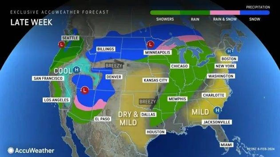
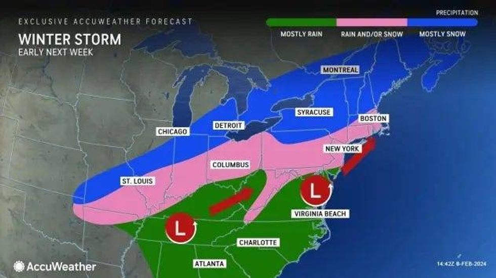
According to AccuWeather, a flip in the weather pattern has the potential to turn the unusual warmth on its head and as the spring-like weather fades, chances of a snowstorm over parts of the Midwest and Northeast continues to grow.
 AccuWeather
"While the January thaw and break from the stormy pattern extended into early February, there is going to be a change in the pattern with a potentially impactful storm coming swinging across the Midwest and Northeastern states from Monday to Tuesday," AccuWeather meteorologist DeVore said.
The system meteorologists are keeping an eye out for is expected to begin appearing over parts of the southern High Plains on Sunday and extend across portions of the lower Mississippi Valley to the Ohio Valley from Sunday night to Monday.
Snowfall is so far forecasted to be slight as the air may still be too warm for snow, resulting in more of a rain event.
But colder air will is expected to be drawn into the storm as it moves from the Central states to the East Coast -- although the timing and strength of the storm remains difficult to pinpoint.
 AccuWeather
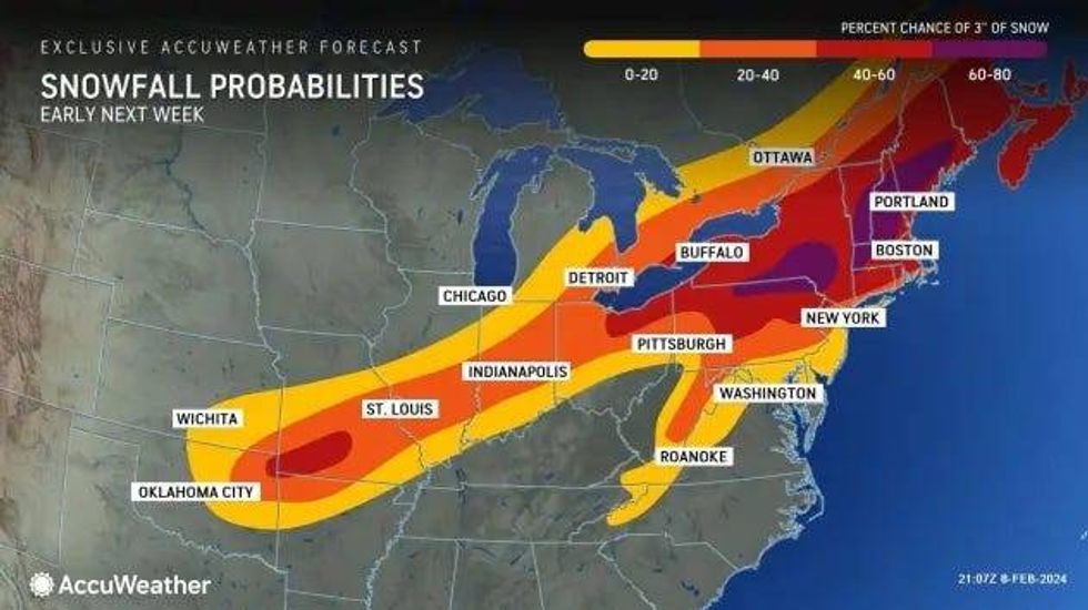
As more data is compiled in the coming days, AccuWeather will issue a forecast snow accumulation for locations expected to get hit.
This is a developing news story. Stay tuned to WWJ Newsradio 950 with traffic and weather together on the :08s for the latest details as they become available. >>> LISTEN LIVE!