METRO DETROIT (WWJ) - Southeast Michigan has had a relatively calm and quiet winter season so far as the region narrowly avoided two major storms, but now a third system stronger and colder than its predecessors is forecasted for a direct strike.
Metro Detroit residents are no doubt wary of the numerous winter weather alerts in the last week that saw big storms fail to produce much precipitation to match the "hype," but weather experts say we've been lucky so far -- and it appears our luck is running out.
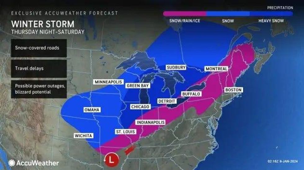
As Plains and portions of the Midwest dig themselves out of Tuesday's storm that only managed to dump rain on Metro Detroit as temperatures struggled to stay at or below freezing, AccuWeather said an "even nastier blast from winter" is looming from Thursday night to Saturday.
 AccuWeather
"The second storm of the week is likely to become stronger and much colder than the first storm, where a more widespread zone of blizzard conditions develops with plummeting temperatures that can cause wet and slushy areas to freeze," AccuWeather meteorologists warned.
Metro Detroit appears to be more directly in the storm's track, which will move a couple hundred miles further to the east, rather than at the cusp like the last couple of systems.
This shift would put more areas in the Midwest -- including Detroit -- at risk for more wintry aspects of the storm.
 AccuWeather
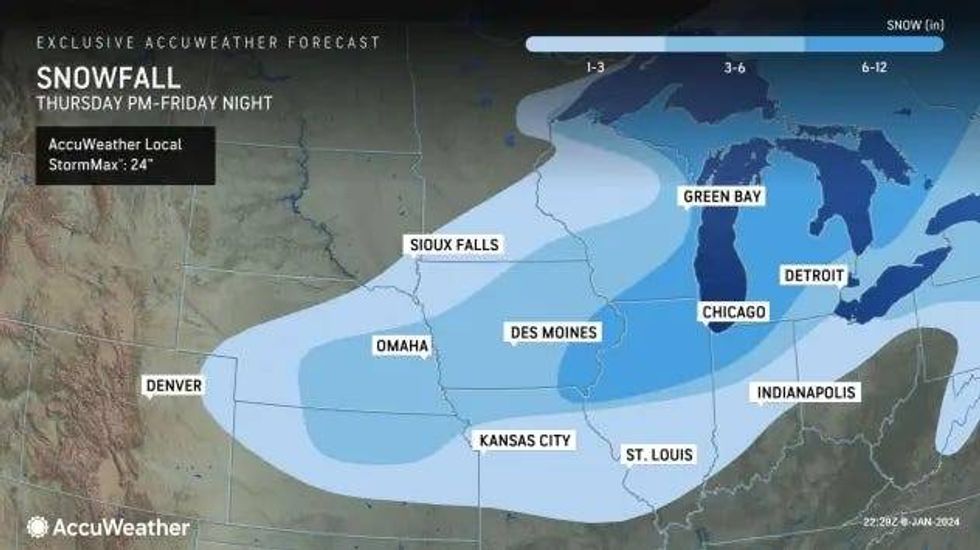
Two of the storm's greatest threats, a blast of arctic air and high winds, could even create blizzard conditions that would make travel dangerous, if not stop it entirely with whiteout conditions, large snow drifts, strong gusts and wind chills temps forecasted to clock in below zero.
"Blowing and drifting snow will be much more substantial and widespread during and following the second storm and could make the complete removal of snow nearly impossible," AccuWeather warned. "Some roads may become clogged with large drifts and stranded vehicles. Those who attempt to drive even short distances during the furious winter storm may be at risk of becoming stranded."
According to AccuWeather, anyone who finds themselves outdoors during the storm would be at risk for hypothermia and frostbite as peak winds are predicted to range between 40 and 60 mph, and push AccuWeather RealFeel® Temperatures well below zero Fahrenheit.
 AccuWeather
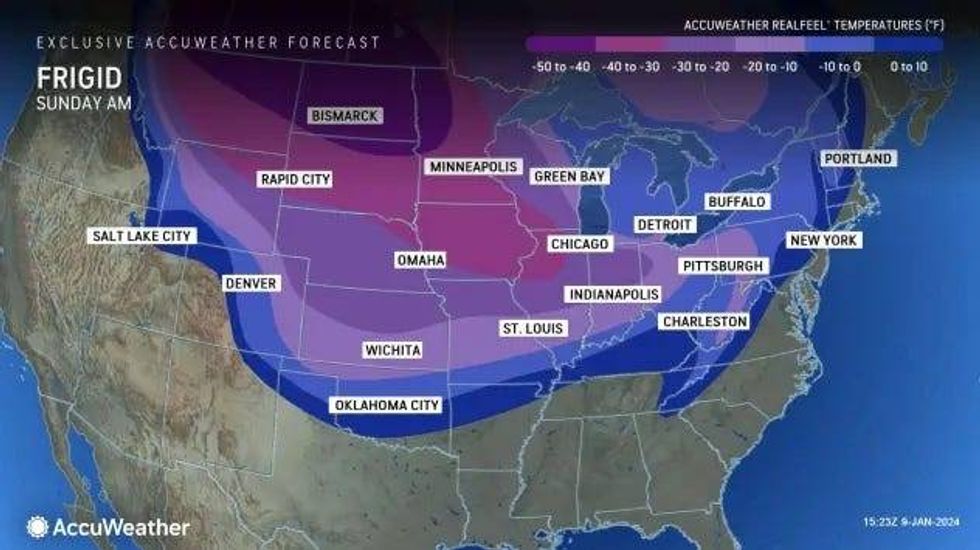
"Actual temperatures may struggle to climb past the single digits during the day and dip below zero at night in vast portions of the central and Plains and Upper Midwest this weekend as Arctic air blasts in," meteorologists said.
The frigid temperatures along with strong winds will lead to rapid ice build-up along the Great Lakes and freezing over wash and spray along shorelines. The Arctic blast is also predicted to produce bands of heavy lake-effect snow immediately after the storm.
"There is the potential for snow to be measured in feet where the snow bands persist," AccuWeather added.
Don't miss a thing! Stay with WWJ for traffic and weather updates, every 10 minutes on the 8s, listen anytime on the free Audacy app, or tell Alexa: "Play WWJ nine-fifty."