(WWJ) Winds are whipping across Metro Detroit and the state, leading to power outages for thousands of homes and businesses.
All of Southeast Michigan remains under a Wind Advisory (downgraded from a High Wind Warning) until 9 p.m. Monday, with powerful gusts of 50 miles per hour possible.
As of noon, DTE Energy was reporting around 9,700 outages (down from 14,000), while Consumers Energy was reporting 62,000 outages.
These numbers have been changing rapidly.
DTE Director of Electric Bill Hutchinson said Friday's ice storm and Sunday's rain had already weakened trees, making for more challenging conditions.
He said outage numbers were expected to rise.
"Coupled with today's forecasted winds approaching about 60 miles an hour, we expect additional limbs and trees to fall onto electric equipment," Hutchinson said. "Outage are almost sure to increase throughout the day and into the evening as conditions evolve."
Hutchinson said DTE called in 900 additional line workers from out-of-state to assist. He added high winds make electrical work dangerous, and crews may have to wait it out until the winds die down to complete some repairs.
As for restoration estimates, Hutchinson said residents can expect to be without power through Tuesday, and into Wednesday, depending on conditions.
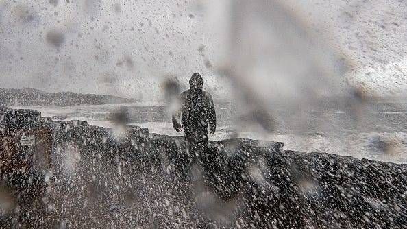
As for the forecast, AccuWeather says it'll be much colder in Metro Detroit on Monday with cloudy skies and snow showers that could accumulate about an inch or two, making the roads slippery. Highs will be in the 20s, but it will feel more like the single digits.

Snow squall warnings were issued for some area freeways, but have since expired. With numerous crashes reported — including a pileup during squalls on I-75 in Detroit — Michigan State Police reminded drivers to slow down, don't tailgate, and driver carefully in snowy conditions.
The National Weather Service warns that damaging winds will continue to blow down tree limbs and power lines. Travel will be difficult, especially for high profile vehicles, and blowing snow will worsen the travel conditions at times. Expect reduced visibility.
Looking ahead to Tuesday, AccuWeather says it'll be breezy and cold with light snow in the afternoon and evening. There won't be much accumulation, but there will be some slick spots.
For Wednesday, New Year's Eve, it'll be cold, only getting into the 20s, with a couple of snow showers possible once again.
Thursday, New Year's Day, will be breezy and very cold with a couple of flurries. The high is expected to reach only around 20 degrees.