


Warning: Consider Friday the calm before the storm for a large swath of the state.
Sure, it'll be rainy at times and cloudy. But starting in the evening, a stormfront threatens to march through the mid and northern regions of the state, bringing with it slick roads, possible power outages, and more. Northern areas of the state could get walloped with 4-9 inches of snow. Midland, Mount Pleasant, Kalkaska -- areas north of Flint -- will see the worst snow.
Locally, Accuweather says it will stay warm enough that metro Detroit will mostly experience rain.
But the warning that applies to mid and northern Michigan says travel tonight and tomorrow "could be difficult."
The warning for our neighbors to the north says rain will change to a heavy wet snow overnight and snow will continue through Saturday, tapering off Saturday night. "At its peak, snowfall rates could top an inch per hour. During the transition there could be a period of freezing rain or sleet."
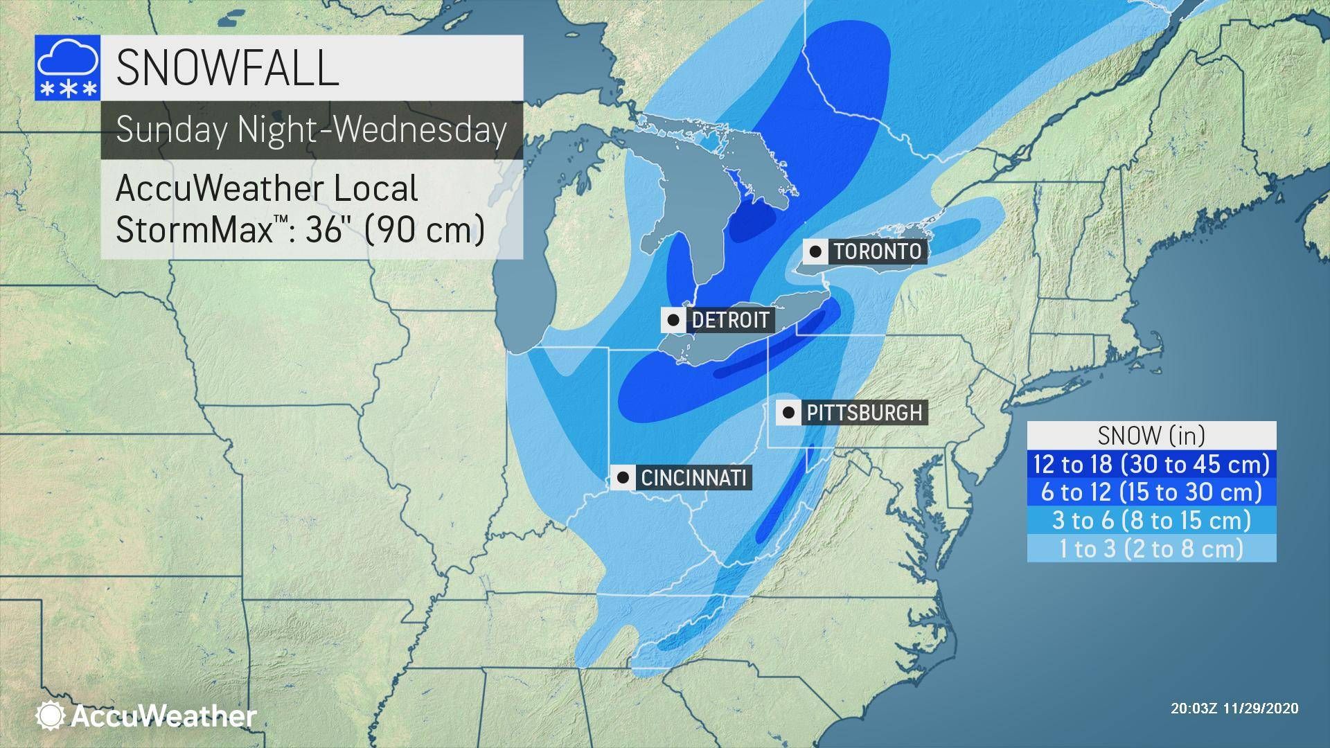

Northern Michigan is in for a real hit: The National Weather Service has issued Winter Storm Watches that include all of northeast Michigan. These begin Friday night and lasting until early Sunday. In that area, specifically Rogers City to Kalkaska, 6-12 inches of snow are forecast.
"Amounts more than 6 inches are expected to be common, but amounts on the high end (near 12 inches) will be isolated," WBKB reported. "Eastern Iosco County could end up with lower snowfall because any mixed precipitation will cut down on amounts. Also, less snowfall is expected farther north toward the Tip of the Mitt because they're farther away from the storm track."


