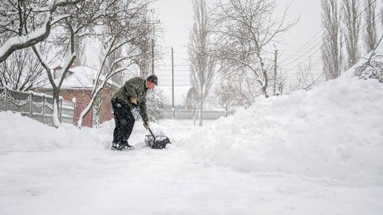
A major winter storm is expected to descend on the Midwest this week that could leave behind as much as two feet of snow when all is said and done, meteorologists say.
Winter weather alerts have been issued for 22 states from California to Maine as heavy snow and high winds impact a large portion of the country this week.
Warm air from the south is expected to meet cold air from Canada on Tuesday, creating a storm that forecasters say will last through the end of Thursday and spread from the West Coast to the Northeast.
"Heavy snow, sleet, and freezing rain is likely across the western and northern tier portions of the United States. Extreme impacts are likely, and historic snowfall is possible near Minneapolis, MN," said the National Weather Service's Weather Prediction Center. "Other weather hazards include high winds and an icy wintry mix from the Great Lakes to the Northeast."
The National Weather Service is reporting some areas might get as much as two feet of snow. The winter storm is expected to be extremely disrupting to travel, infrastructure, livestock and recreation in affected areas. Authorities are warning residents to prepare for dangerous conditions, road closures, power outages and snow days at schools.
"There is a high probability of snow totals over 8" from South Dakota eastward through southern Minnesota, northern Wisconsin, and the Upper Peninsula/northern Lower Peninsula of Michigan. Locally higher totals of 1-2 feet are possible, particularly across southern Minnesota," the NWS said.
"Heavier snow totals of 8-12" are also likely for higher elevations in the Interior Northeast including the Adirondacks and the Green and White Mountains, with lighter accumulations of around 2-4 inches at lower elevations across Upstate New York and central New England," the weather service added.
The combination of heavy snow rates of 1 to 2 inches per hour and strong wind gusts of 40 to 50 mph will create blizzard and whiteout conditions, making travel nearly impossible in parts of the West and Midwest, the NWS said.
Farther east, a wintery mix of heavy snow, sleet and freezing rain is expected to hit the Great Lakes and Northwest from late Wednesday into Friday. Treacherous travel conditions are likely, with scattered power outages possible. Ice accumulations around a quarter-inch or more are possible.
Record lows and dangerous wind chills are also expected to follow the storm system as very cold temperatures spread across the West Coast and Northern Plains.
"Many record-tying/breaking minimum high temperatures will be possible over the West, with highs in the 30s and 40s for the Pacific Northwest and in the 50s for California. Bitterly cold wind chills 20-30 degrees below zero are expected for the Northern Plains," the NWS said.
Meantime, portions of the East are expected to see abnormally warm temperatures for February. The NWS says highs on Wednesday will be 20-30 degrees above average for many locations across the Southern Plains, Midwest and Southeast.
"Many record-tying/breaking highs are possible particularly for the Ohio/Tennessee Valleys, where temperatures will be into the 70s, and closer to the Gulf Coast/Florida, where highs will be into the 80s," the NWS said.
As winter weather ramps up this week, be sure to follow your local forecast for updates on alerts and guidance as conditions change.