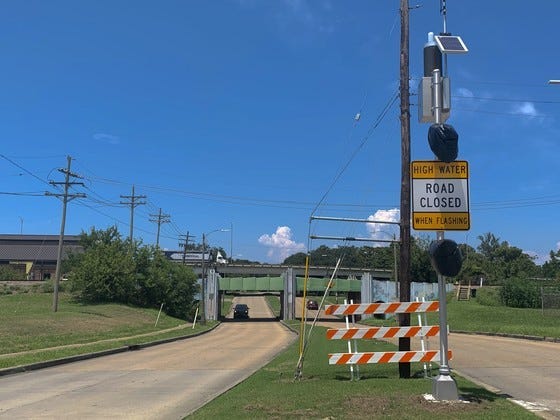
Mayor LaToya Cantrell has announced a long awaited flood controll warning system for New Orleans.
“Two years ago a perfect storm of infrastructure failures and torrential rains exposed stark flaws in our drainage system and our flood preparedness,” said Cantrell. “Since that time, we have worked relentlessly to address our critical needs, to invest in our infrastructure, and to make strategic, meaningful improvements."
A dozen weather weather reporting stations around the city will also report to emergency managers about flooding. This will enable the city to designate where drainage issues are taking place and direct city assets, like pumps to be activated quicker to respond to rising water.
The flood warning system was designed and installed by High Sierra Electronics, a company specializing in environmental monitoring systems. At a cost of $650-thousand, the system will be run by which was procured and project managed by NOHSEP--New Orleans Homeland Security and Emergency Preparedness.
These beacons and signs will replace NOPD's 'Operation Underpass' where temporary barricades are put up when rains start to fill these under crossings.
Road closure data from the flood warning system will also eventually be displayed publicly on the City’s real-time road hazard website, streetwise.nola.gov.
