


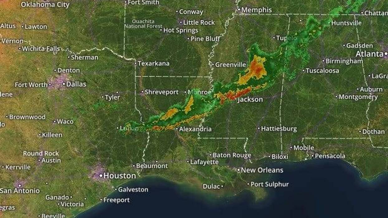
A cold front is forecast to bring some rain to the New Orleans area this afternoon and evening.>
"It we will be mostly cloudy, breezy, warm and humid with scattered showers and storms," WWL-TV Meteorologist Dave Nussbaum explained. "A few storms could be strong to possibly severe."
He says we will climb to about 80 degrees before the cold front hits that warm air, triggering storms from about 2:00pm until around 8:00pm.
"The cold front will move through tonight and we will see an end to the rain. It will be cooler with lows in the lower to mid 50s," according to Nussbaum.
He says the rest of the work week should be rain free.
"High pressure will build over us Tuesday and Wednesday with plenty of sun each day."
Nussbaum says the area of high pressure moves east of Louisiana Thursday and Friday.
"We will start to warm up. It will be partly cloudy with high temperatures in the mid 70s."
- Weekend Outlook: The next cold front will move toward us this weekend. Saturday will have a sun/cloud mix with spotty showers. It will be mild and humid with highs in the upper 70s. The cold front is expected to move through on Sunday with scattered showers and storms. However, the models are not in agreement as to how much rain we will receive. One model shows no rain while the other shows a lot of rain. I'll be watching the model trends this week. Both models agree that we will turn cooler with highs in the lower 70s.
Here is a look at the 7 Day Forecast for the New Orleans area: WWLTV #lawx pic.twitter.com/IFSMHigZBh
— Dave Nussbaum WWL-TV (@Dave_Nussbaum) March 25, 2019Here is Nussbaum's detailed forecast...
TODAY:Mostly cloudy, breezy, warm and humid with a 40% chance for scattered showers and storms. A few could be strong to severe. Highs around 80. Wind SW/W 6-12 mph.
TONIGHT:Becoming mostly clear and cooler. Lows north around 50 and south around 56. Wind N 8-15 mph.
TUESDAY:Plenty of sun, breezy and cooler. Highs around 70. Wind N 8-15 mph.
WEDNESDAY:Sunny and mild. Lows north around 45 and south around 52. Highs around 71.
THURSDAY:Partly cloudy and milder. Lows north around 47 and south around 53. Highs around 74.
FRIDAY:Patchy morning fog, then sun/cloud mix and mild. Lows north around 53 and south around 57. Highs around 76.
SATURDAY:Morning fog, then sun/cloud mix, breezy, warm and humid with a 30% chance for showers. Lows north around 57 and south around 61. Highs around 79.
SUNDAY:Mostly cloudy, breezy and cooler with a 40% chance for scattered showers and thunderstorms. Lows around 62. Highs around 72.


