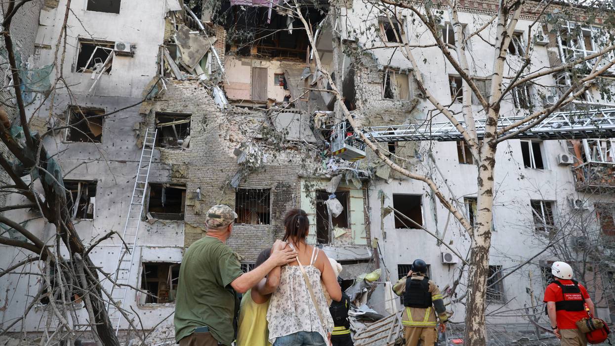
Hurricane Laura rapidly intensified from a Category 1 storm on Tuesday to a Category 4 storm by Wednesday; and at about 1:00am Thursday, the monster storm slammed into the Louisiana coastline near Cameron, LA. With winds bursting to 150 mph – Laura left a path of devastation in her wake. But as bad as the early assessment of damage appears to be - it could have been a lot worse.
Tuesday – the National Weather Service was describing the potential storm surge from Laura to be 20 ft. and “unsurvivable.” But instead of a 20 ft. storm surge – Laura’s storm surge appears to have been closer to 9 ft. Why such a discrepancy? And why the discrepancy in the predictions about Tropical Storm Marco a few days earlier?
Everyone should be thrilled that the storm surge from Laura did not live up to the predictions from the National Weather Service, and pointing out the differences between predictions and reality is not criticism – but it is fair to analyze what happened so we all can better interpret future storm forecasts.
One explanation for Laura’s storm surge being close to 9 ft. rather than 20 ft. may have come from the rapid intensification of the storm from Tuesday to Wednesday. The sudden strengthening of the storm may not have allowed the storm to build up the water under it as it churned toward the Louisiana coast.
Hurricanes that have days of intensity over the open waters can amass a much larger storm surge. We should assume that the lesson learned from Laura’s quick intensification will be factored in with future storm forecasting.
The projections of landfall and strength for Tropical Storm Marco at the beginning of this week were also inaccurate. Some people seemed disappointed that Marco fizzled out – but it was good that the storm did not live up to its predicted potential.
Marco was disrupted by wind shear and dry air and when I asked a meteorologist why the life of Marco as a storm was not more accurately predicted – she said that apparently the computer models did not appropriately factor in the impact that wind shear and dry air would have on the storm. I would assume that following the miscalculations about Marco – that information will now be put into the computers that will change that the impact of the factors of wind shear and dry air.
Storms are alive and are not obliged to follow even the most sophisticated weather technology. The National Weather Service releases information it believes is accurate – but active forces in the Earth’s atmosphere will often make specific predictions unreliable.
Marco could have been a devastating storm for the Greater New Orleans area; and as severe as Laura was – it could have been so much worse. I have no doubt that the extreme warnings from weather officials about the expected 20 ft. storm surge from Laura saved lives because some people heeded that warning that might have been dismissed if the prediction was for a much lower storm surge.
Hurricane Laura turned out to be a storm with extreme winds and many structures were destroyed – but it could have been much worse for the area overall.
It will be interesting to see if weather experts make changes based on the factors that impacted Marco and Laura – but weather predictions will always be predictions and are not guarantees.