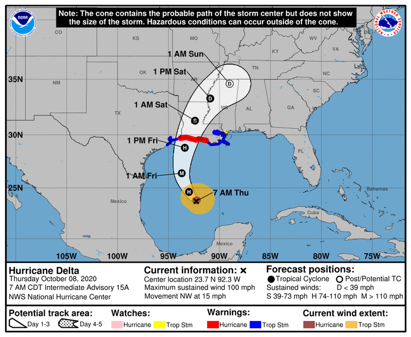

The National Hurricane Center says Hurricane Delta remains on a path to hit Southwest Louisiana exactly six weeks after Hurricane Laura devastated the same region.
"On the forecast track, the center of Delta will move over the central Gulf of Mexico today, and move inland within the hurricane warning area Friday afternoon
or Friday night," the Hurricane Center advised.
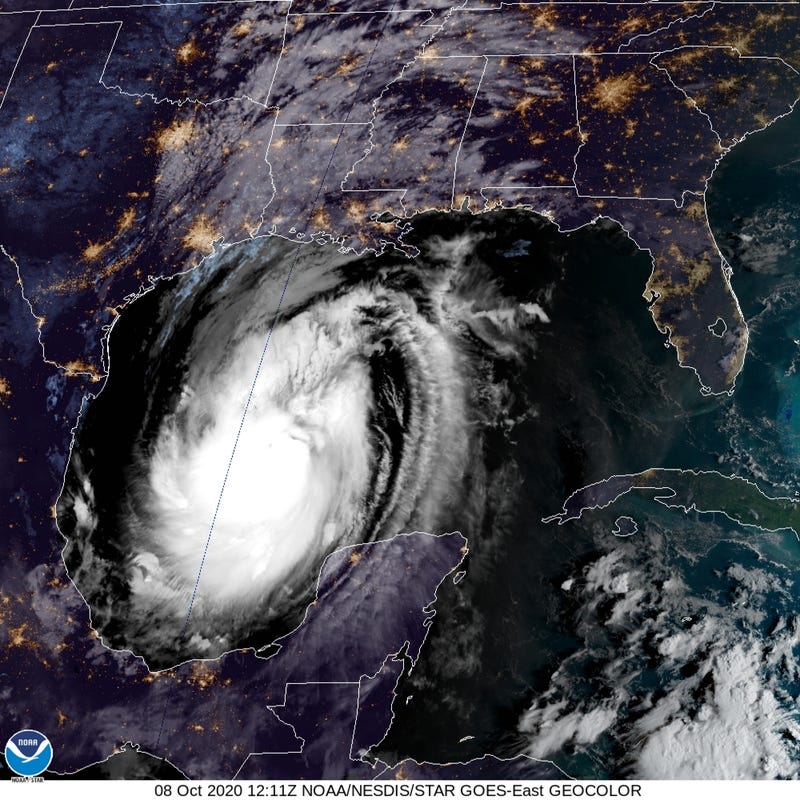
Winds have been picking up.
"Reports from the Hurricane Hunter aircraft indicate that maximum sustained winds are near 100 mph," the advisory said. "Strengthening is forecast, and Delta is expected to become a major hurricane again by tonight. Some weakening is forecast when Delta approaches the northern Gulf coast on Friday."
The forecast calls for Delta to have winds around 105 miles per hour at landfall. Laura had winds of 150 miles per hour.
In the New Orleans area, occasional wind gusts above 40mph are possible with passing rain, but no flooding from the rain. Storm surge remains an issue outside the levees.
Related

STORM SURGE: The water could reach the following heights above ground somewhere in the indicated areas if the peak surge occurs at the time of high tide...
Pecan Island, LA to Port Fourchon, LA including Vermilion Bay...7-11 ft
Cameron, LA to Pecan Island, LA...4-7 ft
Port Fourchon, LA to the Mouth of the Mississippi River4-6 ft
Mouth of the Mississippi River to Ocean Springs, MS...2-4 ft
Lake Borgne, Lake Pontchartrain, and Lake Maurepas...2-4 ft
High Island, TX to Cameron, LA including Calcasieu Lake...2-4 ft
Ocean Springs, MS to the AL/FL border including Mobile Bay...1-3 ft
Sabine Lake...1-3 ft
Port O'Connor, TX to High Island, TX including Galveston Bay...1-3 ft
RAINFALL: Friday through Saturday, Delta is expected to produce 5 to 10 inches of rain, with isolated maximum totals of 15 inches, for southwest into south central Louisiana. These rainfall amounts will lead to significant flash, urban, small stream flooding, along with minor to isolated moderate river flooding.
Southeast Louisiana and New Orleans are only expected to get one or two inches of rain.
WIND: Hurricane conditions are expected within the hurricane warning area from the Texas/Louisiana line to Morgan City by Friday afternoon or evening, with tropical storm conditions expected within this area by early Friday.