For the first time this season we have a category five hurricane in the Atlantic Basin. Iota's top sustained wind hit 160 miles per hour this morning in the Caribbean as the hurricane takes a path toward Nicaragua and Honduras.
Iota is the record setting 30th tropical cyclone of the 2020 season.
The National Hurricane on the forecast track, the core of Iota will make landfall within the hurricane warning area in northeastern Nicaragua tonight.
"Maximum sustained winds are near 160 mph with higher gusts. Iota is forecast to continue to be a catastrophic category 5 hurricane when it approaches Central America tonight."
That landfall is forecast very near where Hurricane Eta hit as a category four two weeks ago.
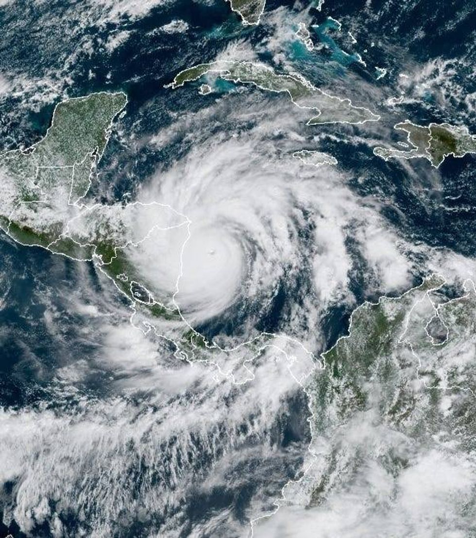
Iota's impacts are expected to be catastrophic.
STORM SURGE: A life-threatening storm surge will raise water levels by as much as 15 to 20 feet above normal tide levels in areas of onshore winds along the coast of Nicaragua and Honduras. Near the coast, the surge will be accompanied by large and destructive waves.
WIND: Catastrophic wind damage is expected where Iota's eyewall moves onshore within the Hurricane Warning area in Nicaragua tonight with tropical storm conditions expected by this afternoon. Hurricane conditions are likely occurring on the island of Providencia, with tropical storm conditions expected through this afternoon. Tropical storm conditions are occurring on the island of San Andres, with hurricane conditions possible. Tropical storm conditions are expected in the Tropical Storm Warning area in Nicaragua by late afternoon and in the warning area in Honduras by tonight.
RAINFALL: Iota is expected to produce 10 to 20 inches of rain widespread. Isolated maximum totals of 30 inches will be possible, especially from northeast
Nicaragua into northern Honduras.