The National Hurricane Center says Hurricane Iota is on a path to slam into Central America as a major hurricane.
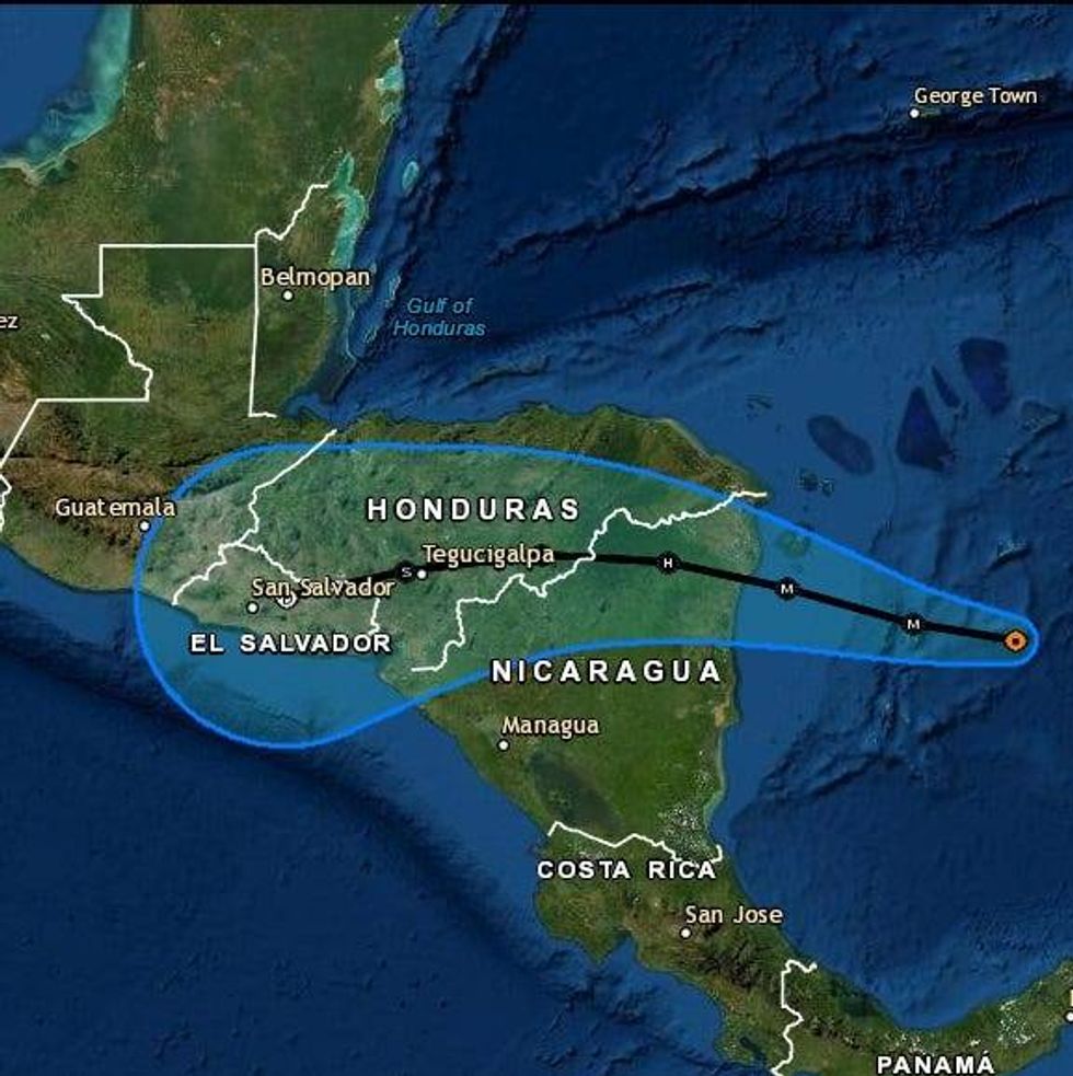
"On the forecast track, the core of Iota will pass near or over Providencia island late tonight or Monday, and make landfall within the hurricane warning area in northeastern Nicaragua and eastern Honduras Monday night."
As of Sunday night maximum sustained winds were near 105 mph with higher gusts.
"Rapid strengthening is expected during the next 24 hours, and Iota is forecast to be an extremely dangerous category 4 hurricane when it approaches Central America."
Forecasters expect Iota to get up to 140 mph winds before it makes landfall.
The Hurricane Center expects Honduras, Nicaragua, Guatemala and Belize to see widespread 8 to 16 inches of rain with isolated maximum totals of 20-30 inches.
"This rainfall would lead to significant, life-threatening flash flooding and river flooding, along with mudslides in areas of higher terrain."
As a major hurricane, the wind damage will be severe as well.
"Potentially catastrophic wind damage is expected where Iota's eyewall moves onshore within the Hurricane Warning area in Nicaragua and Honduras beginning late Monday."
A life-threatening storm surge will raise water levels by as much as 10 to 15 feet above normal.
Iota is the record 30th named storm of the 2020 hurricane season.