


The National Weather Service office for New Orleans has issued a Freeze Warning, Cold Weather Advisory, Gale Watch and Extreme Cold Watch for areas across the region.
"Our next Arctic cold front arrives tomorrow," WWL TV Meteorologist Payton Malone warned. "Friday afternoon temperatures will begin to fall and winds will pick up."
He says after getting up to around 55 degrees, the frigid front arrives.
"Saturday morning will feel brutal, with wind chills in the single digits."
He says we stay very cold throughout the day Saturday.
"Even under sunny skies, afternoon temperatures will struggle to climb much above freezing, and some spots may stay below freezing all day."
Malone advises that Saturday night parades will feel like the teens and 20s.
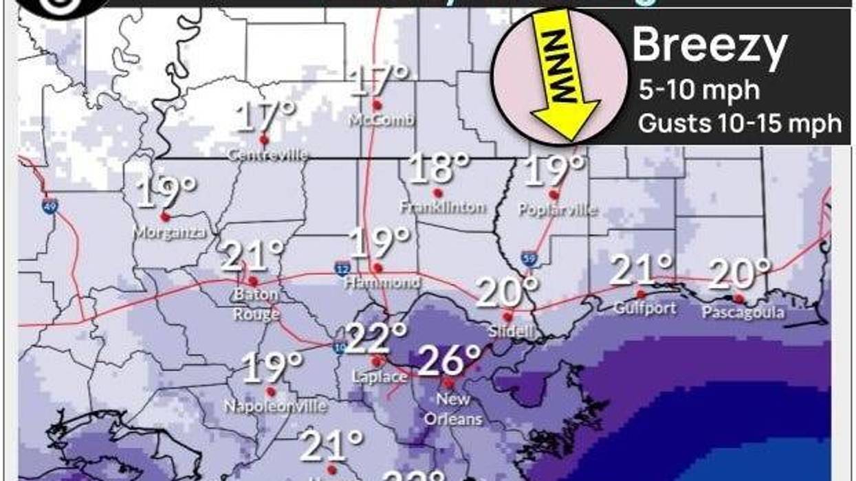
"Sunday morning looks even colder with temperatures in the teens and 20s."
Detailed Forecast...
TODAY:
Light freeze North. Milder temps. Few passing clouds. High: 60. Winds: SE/S 5-10.
FRIDAY:
All above freezing. Mostly cloudy. Chilly, breezy. Mostly dry. Low: S 45, N 38. High: 55 then temps fall.
SATURDAY:
AM wind chills single digits, low teens. Bitter cold and windy. Hard freeze. Low: S 27, N 24. High: 34.
SUNDAY:
Hard freeze. Breezy early, then diminishing. Mostly sunny. Cold! Low: S 24, N 17. High: 41.
 NWS
NWS
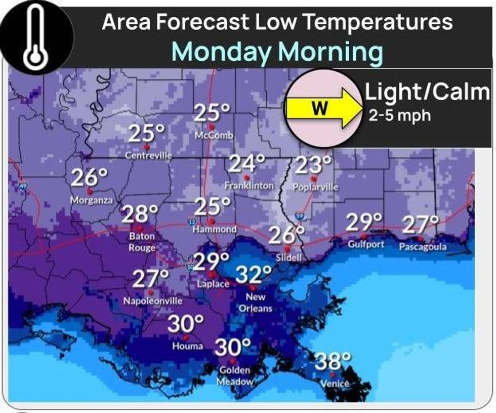
MONDAY:
Hard freeze North. Mostly sunny. Becoming breezy. Low: S 28, N 20. High: 54.
TUESDAY:
Sunny and milder. Breezy. Low: S 38, N 29. High: 62.
WEDNESDAY:
Mostly cloudy. Stray shower. Milder temps. Low: S 46, N 40. High: 64.


