


Get ready for more intense heat.
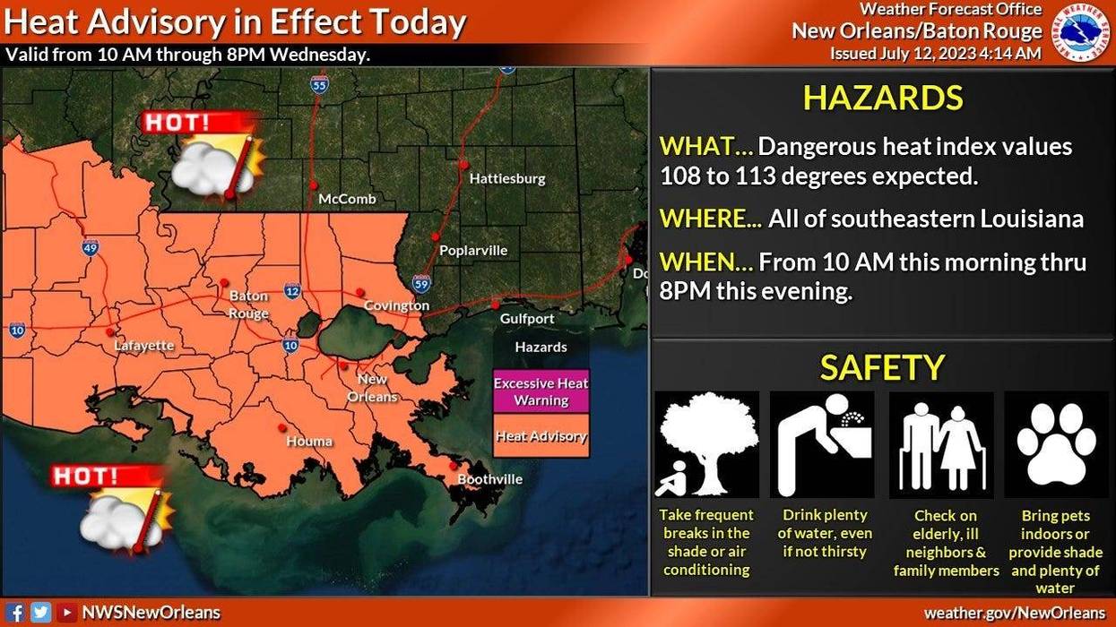
"The dreaded Heat Advisory has returned to the area as feel like temperatures could approach 110-113 degrees," WWL TV Meteorologist Payton Malone said. "Another thing to watch for are afternoon storms.'
He says areas that do get storms during the afternoon will see temperatures drop into the 80s.
"The rest of this week and weekend looks similar with hot, humid afternoons with pop up storms."
Malone says it will get even hotter next week.
"We'll see the heat ridge to our west slowly expand east and grow in intensity. That means hotter temperatures are on the way next week with slightly lower chances for rain."
Detailed Forecast...
TODAY:
40% showers and storms. Some heavy downpours possible. Still hot! High: 94. Winds: S 5-10.
THURSDAY:
40% showers and storms. Some heavy downpours possible. Hot, humid. Low: S 78, N 76. High: 94.
FRIDAY:
Partly sunny. 40% scattered storms. Hot, humid. Low: S 79, N 77. High: 95.
SATURDAY:
Partly cloudy. 40% spotty showers, storms. Hot and humid. Low: S 79, N 77. High: 95.
SUNDAY:
Partly cloudy. 50% spotty showers, storms. Hot and humid. Low: S 79, N 78. High: 95.
MONDAY:
Sun to partly cloudy. 40% isolated shower. Hot, humid. Low: S 80, N 78. High: 95.
TUESDAY:
Sun to partly cloudy. 30% isolated shower. Hot, humid. Low: S 80, N 78. High: 96.


