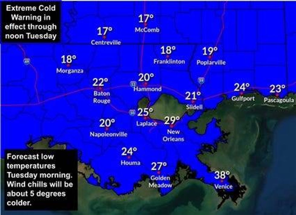
Temperatures dipped to low 20s on both sides of the lake this morning, with wind chills falling to the teens and lower.
Frost has been widespread.
 NWS
NWS
"A very cold start this morning," noted WWL TV Meteorologist Payton Malone. "If you are running water, most areas climb back above freezing by about 9 to 10 am."
He says this afternoon highs only climb to the upper 40s.
"We will need to protect pipes again Wednesday morning, mainly on the Northshore."
Malone says Thursday and Friday will not see hard freezes, but another blast of Arctic air arrives for the weekend.
"Saturday morning will be in the 20s and windy, with highs struggling to reach the mid 30s even with sunshine. Wind chills Saturday morning will be dangerous, dropping into the single digits."
He says the region will only get above freezing for a short time Saturday afternoon before plunging again for Sunday.
Detailed Forecast...
TODAY:
Hard freeze. Sunny, cold. Low: High: 48. Winds: Light.
WEDNESDAY:
Hard freeze North. Sunny & Cold. Low: S 31, N 24. High: 52.
THURSDAY:
Light freeze North. Chilly. Increasing clouds late. Low: S 36, N 28. High: 58.
FRIDAY:
All above freezing. Mostly cloudy. Stray shower. Chilly, breezy. Colder late. Low: S 42, N 36. High: 53.
SATURDAY:
Cold and windy. Hard freeze. Low: S 27, N 23. High: 36.
SUNDAY:
Hard freeze. Mostly sunny. Low: S 25, N 17. High: 43.
MONDAY:
Hard freeze. Sunny. Low: S 28, N 22. High: 45.