
As an Arctic blast bears down on much of the country, Louisiana is bracing for a sharp north-to-south divide in impacts, with northern parts of the state facing potentially dangerous conditions while southeast Louisiana prepares for cold, wet weather.
LSU Health climatologist Barry Keim says the incoming system represents a worst-case winter scenario for parts of the region, especially far north of Lake Pontchartrain.
“This is the kind of setup meteorologists don’t like to see,” Keim said. “Rain freezing on contact on roads, bridges, trees, and power lines can quickly bring travel to a standstill.”
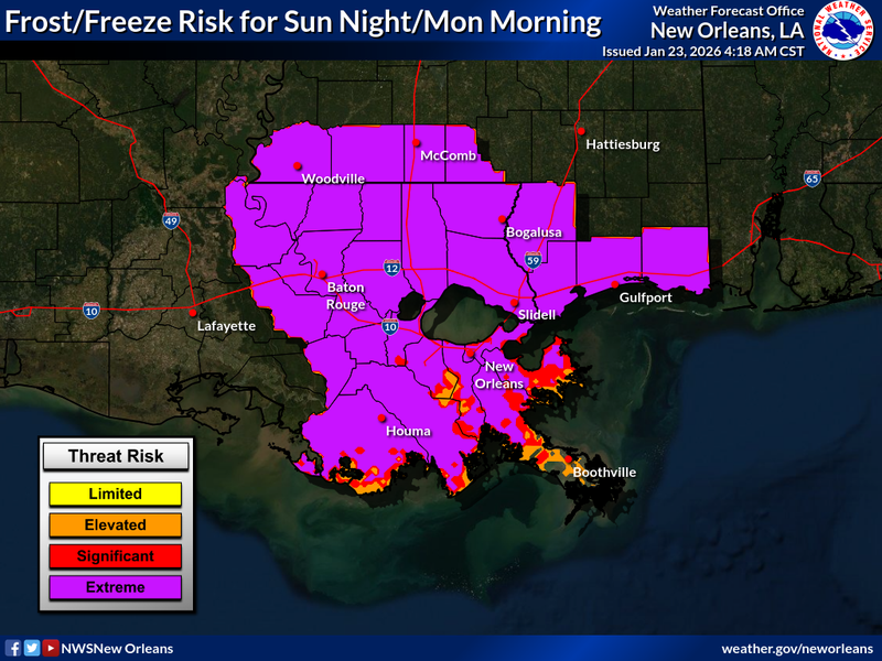
Keim says areas from Alexandria to the north and west... and communities well north of the lake are most at risk for freezing rain, which can coat surfaces with ice and create hazardous driving conditions. In those hardest-hit areas, travel could become nearly impossible.
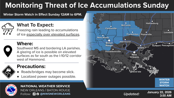
The National Weather Service has only included Northern Tangipahoa, Washington and Livingston Parish is the Winter Weather Watch for ice locally.
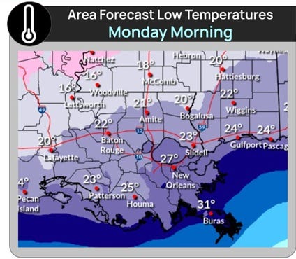
For New Orleans and most of Southeast Louisiana, the forecast looks different but still uncomfortable.
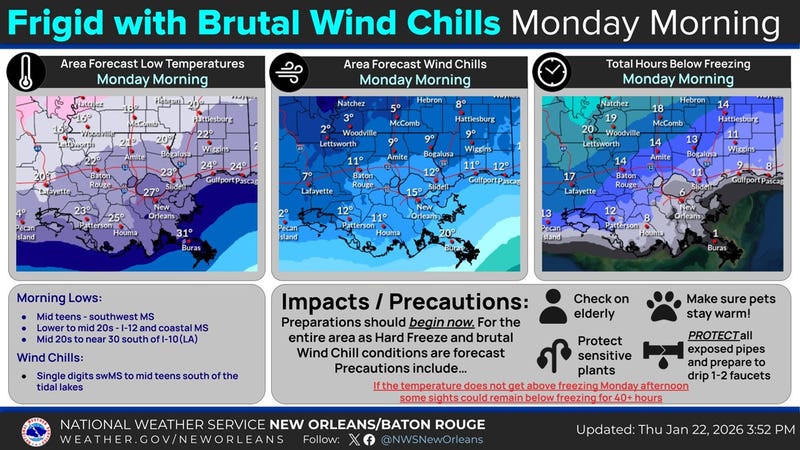
“It’s going to be cold and rainy, no doubt about it,” Keim said. “But right now, we’re steering clear of frozen precipitation in the metro area.”
Even without ice, Keim says residents should prepare for bitter cold and remain cautious, especially during early morning and overnight hours.
Travelers are also urged to keep an eye on conditions beyond Louisiana. Keim notes that major airline hubs including Dallas, Nashville, St. Louis, and later Atlanta sit directly in the storm’s path.
“With air travel, it’s not just about where you’re going,” he explained. “It’s the stops in between. A delay in the middle of the country can trigger a domino effect nationwide.”
Keim’s advice is simple: bundle up, avoid unnecessary travel, especially in northern Louisiana, and give the system time to move through.
“This is one you ride out,” he said. “Hunker down, stay warm, and wait for it to pass.”
Related
